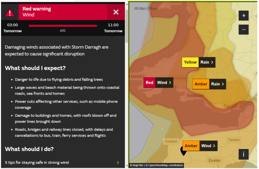
The Met Office has issued an amber warning for both wind and rain across South West England. There is also a red warning for wind across West Wales and the Bristol Channel coast of Devon and Cornwall:
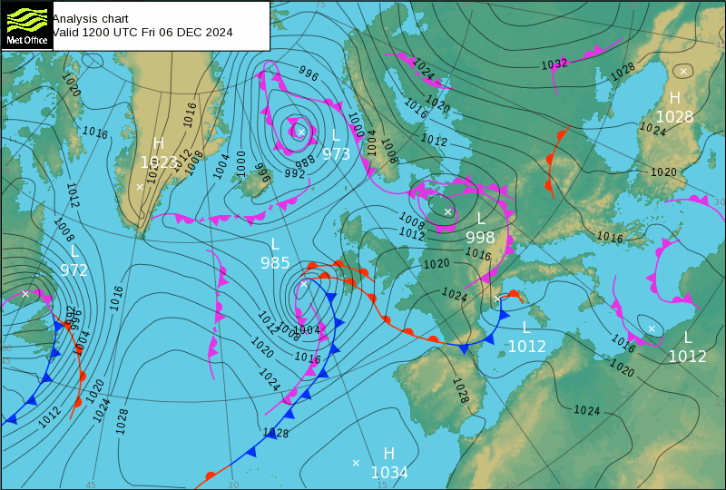
The cause of this extreme weather is the fourth named storm of the winter, Storm Darragh. Here’s the Met Office’s synoptic chart for noon today, as Storm Darragh approached Ireland:
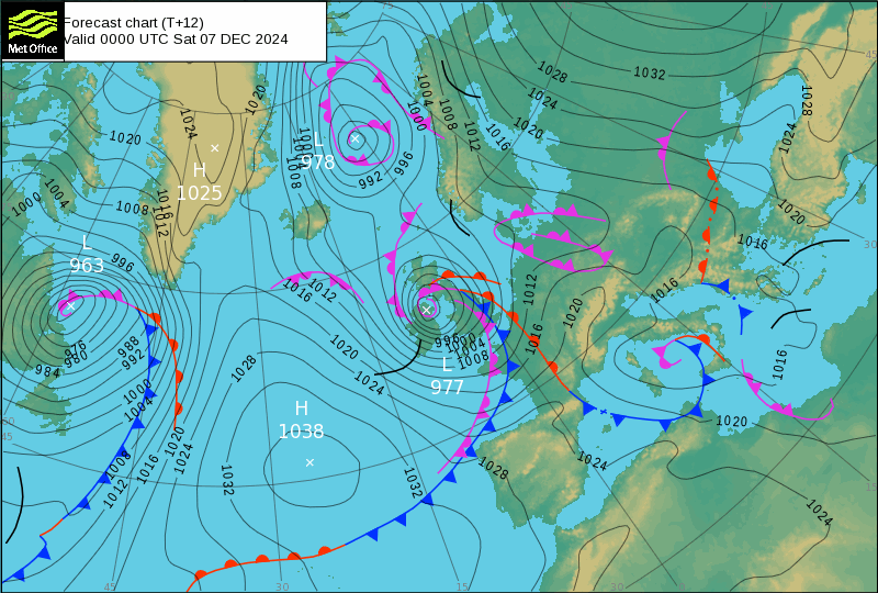
By midnight Darragh will be centred over Northern Ireland, with isobars tightly packed over Eire, Wales and South West England:
What’s more the Environment Agency has issued a flood alert for the Upper River Torridge catchment:
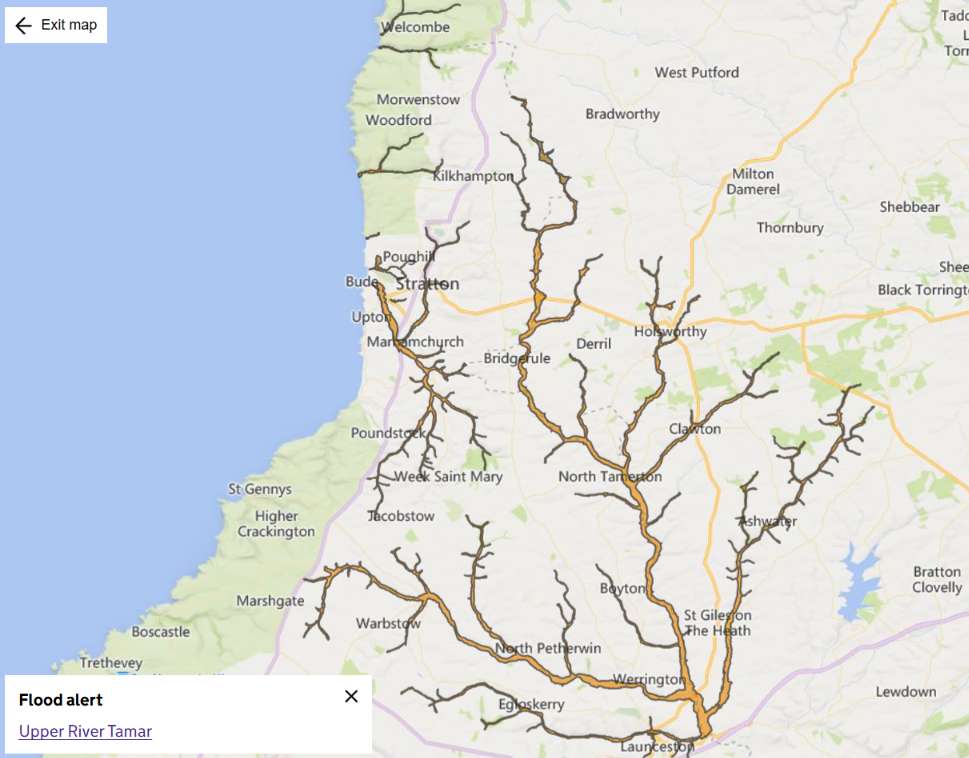
Flooding is possible on Friday evening and overnight into Saturday morning due to forecast rainfall.
River levels are high and further rain associated with Storm Darragh is likely to keep river levels elevated into Saturday morning. There may be flooding to low lying land and roads close to the river, though no flooding to properties is currently forecast.
The main band of rainfall is expected to have cleared the region by the early hours of Saturday morning. Intermittent showers, some of which may be heavy, then remain possible throughout the remainder of the weekend.
Take care near areas of concern and avoid walking or driving through floodwater. Monitor your local weather conditions and check river levels on gov.uk.
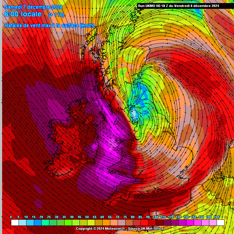
Here’s a map of forecast wind gust speed for 6 AM tomorrow morning. Hopefully it’s some consolation that the wind speeds are shown in km/h?
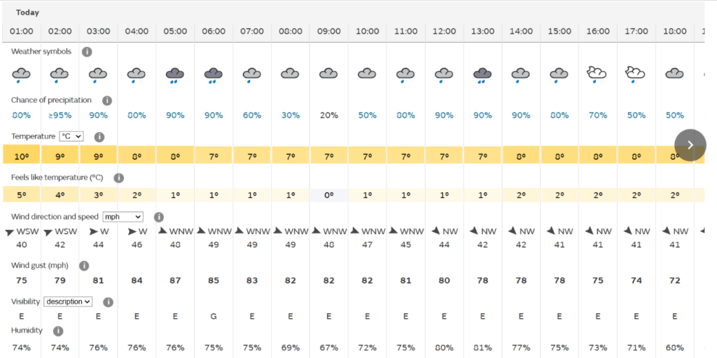
Ilfracombe is forecast to suffer wind gusts as high as 87 miles per hour:
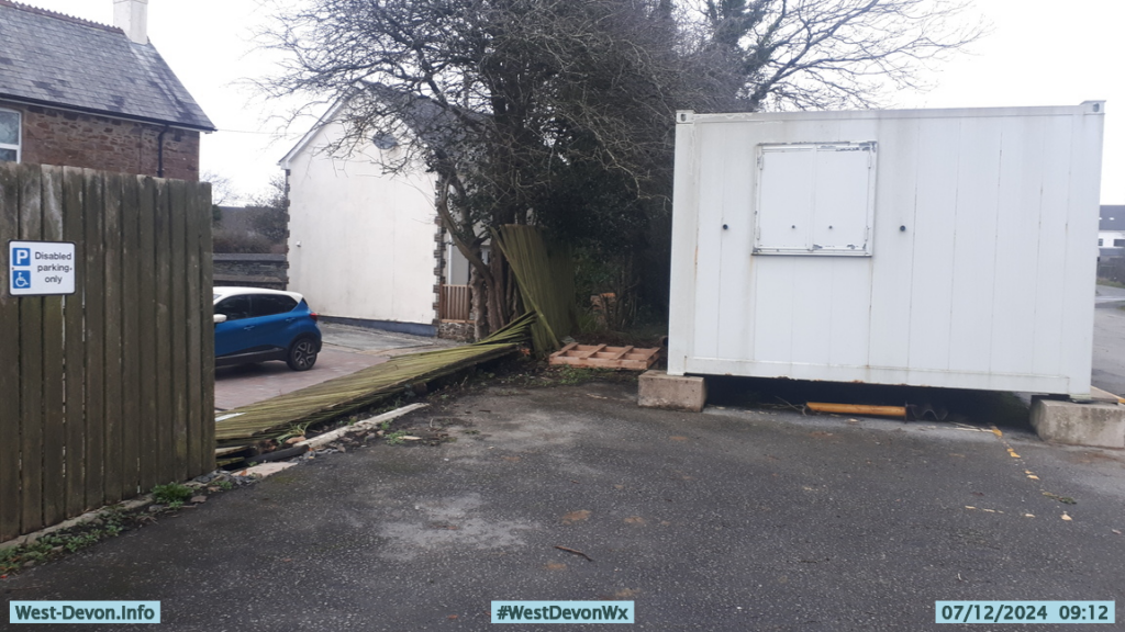
This morning we awoke to discover that overnight Storm Darragh had blown down next door’s fence:
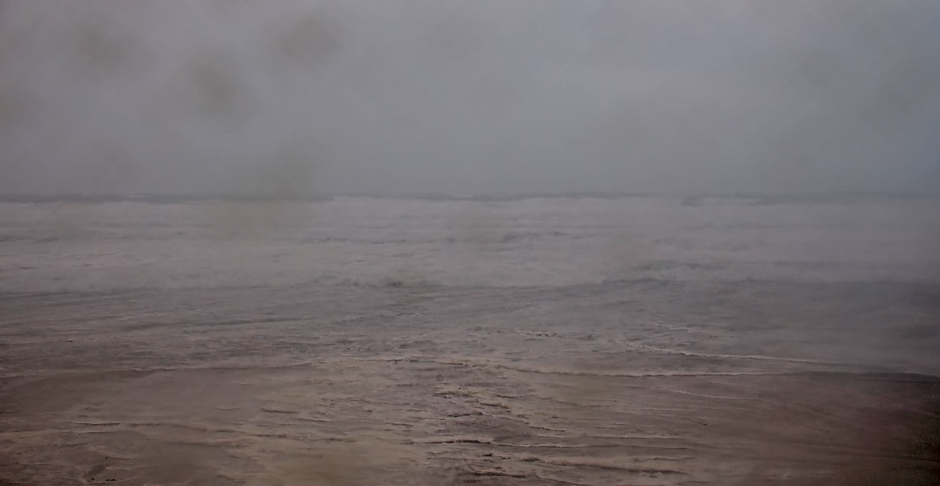
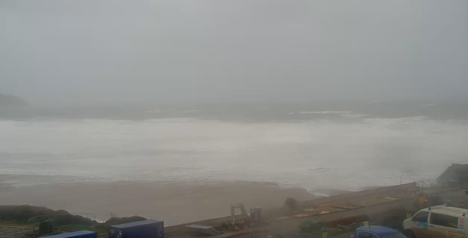
The north coast surfcams are largely obscured by rain and spray. The first snap is from Watergate Bay, where the Surfline surf forecast is for 25-30 foot high waves. The second is from Woolacombe, where the forecast is for a mere 15-20 feet:
Here is this morning’s Met Office weather forecast for Ilfracombe:
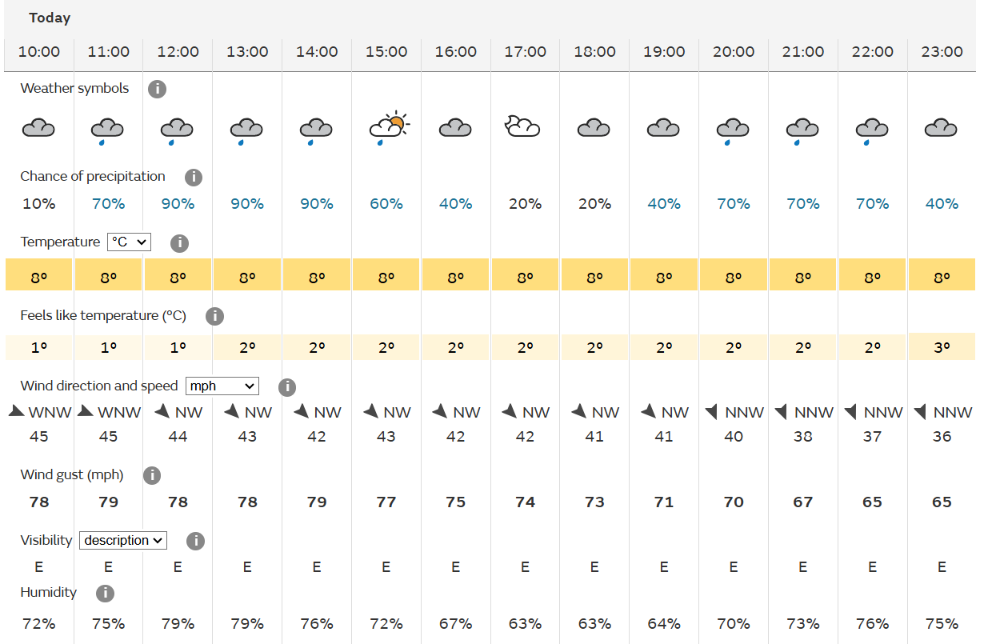
Sustained winds of 45 miles per hour, with gusts up to 79 mph.
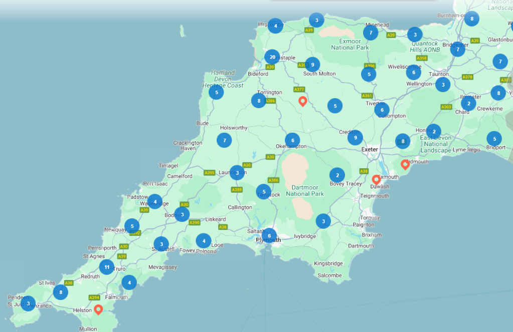
By mid afternoon National Grid Electricity Distribution’s map of power cuts across Devon and Cornwall looks like this:
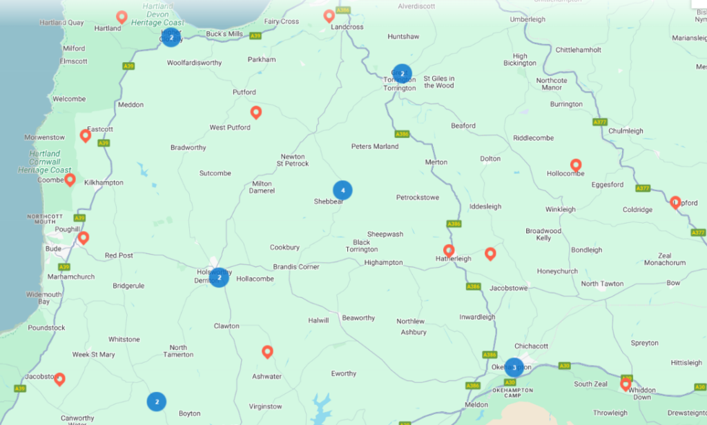
Zooming in reveals plenty of power outages in our corner of Devon:
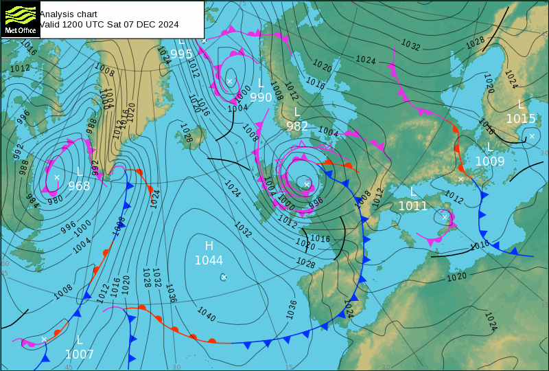
.Here’s the Met Office’s synoptic chart for noon today, as Storm Darragh heads across the North Sea towards the Netherlands:
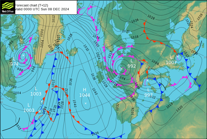
By midnight Darragh is forecast to have made landfall:
In their 7 PM update National Grid Electricity Distribution state that:
Strong winds and rain are still affecting the South West, Midlands and South Wales this evening as a result of Storm Darragh. Our teams will continue to work throughout the night to restore power supplies as quickly as possible.
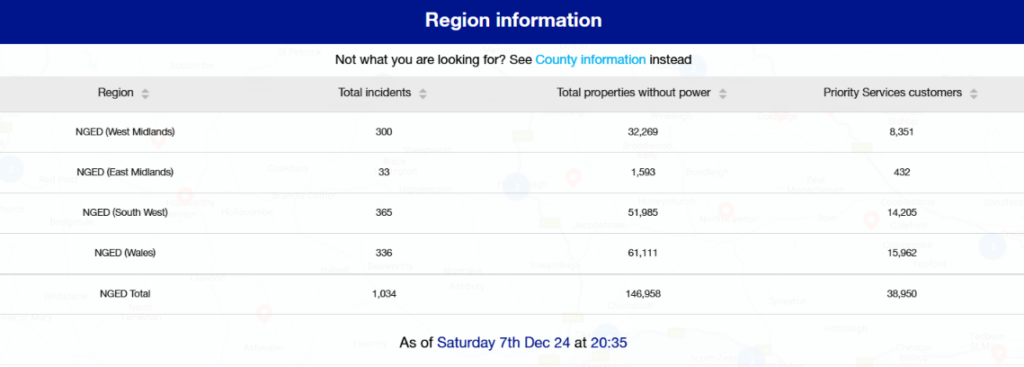
As of 7pm, 174,288 properties are without power. Since the beginning of the storm on Friday evening, we have been able to successfully and safely restore supplies to 920,053 homes and businesses.
NGED’s tabular data reveals almost 52,000 properties without power across the South West region:
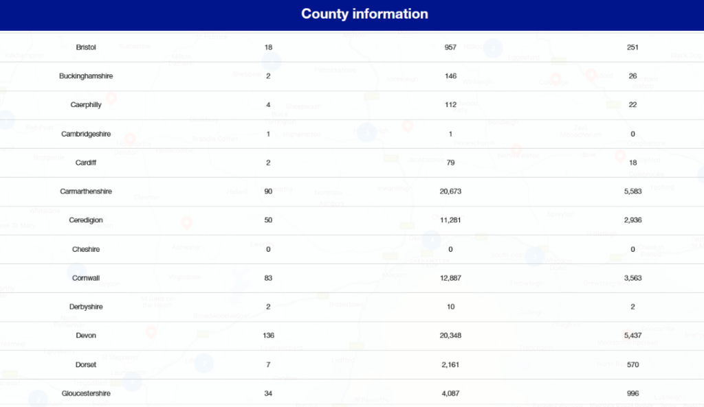
including 20,348 in Devon and 12,887 in Cornwall:
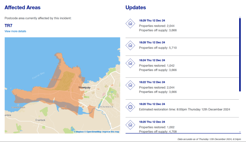
Just when we thought it was all over, there comes news that briefly 5,710 properties in Newquay suffered a power cut this evening! 3,666 remain without electricity at 18:29:
To be continued…