
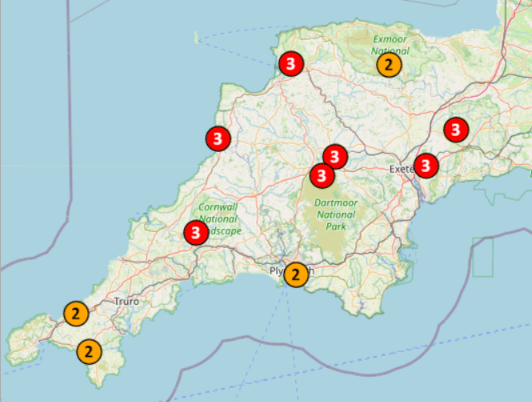
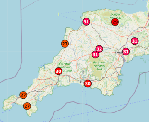
The Met Office has released a red weather warning for “extreme heat” across central and southern England from 9 AM on June 24th until 9 PM on the 25th. That is accompanied by an amber warning that covers Devon and eastern Cornwall for all of Wednesday and Thursday:
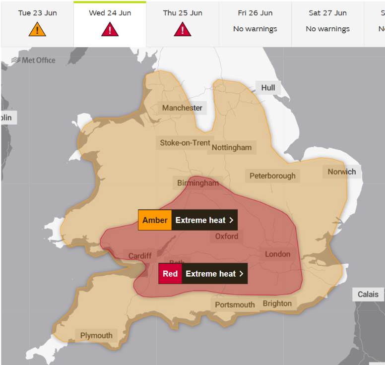
According to the Met Office warning:
Very hot weather will continue in general until at least Thursday across the highlighted region, although some variations from place to place and day by day are likely. Temperatures by day are widely expected to exceed 30 Celsius, with the hottest areas potentially peaking around 38-40 Celsius within the embedded red warning.
Overnight, temperatures are unlikely to fall much lower than high teens Celsius, and some places will not fall below low 20s Celsius. These high temperatures will also be accompanied by high humidity.
Cooler conditions may begin to become established from the west following this period, but confidence is low.
A Met Office article about the heatwave adds that:
Temperatures will quickly rise on Monday and are forecast to reach 34°C in southern parts of England. However, this brings with it the chance of thundery showers for some.
The heat will build further into Tuesday, with highs of 37°C forecast for southern England and 35°C in southeast Wales. The peak of the heatwave is now forecast for Wednesday and Thursday, when temperatures are expected to climb to at least 39°C and there remains a chance of this being exceeded in places.
By Friday conditions will be less hot, with highs of 32°C forecast across eastern areas.
Overnight temperatures will also be very high, with widespread Tropical Nights, where the temperature does not drop below 20°C, across parts of England and Wales, especially in urban areas. Humidity is also a factor, making this heatwave even more impactful with heat stress a danger to all.
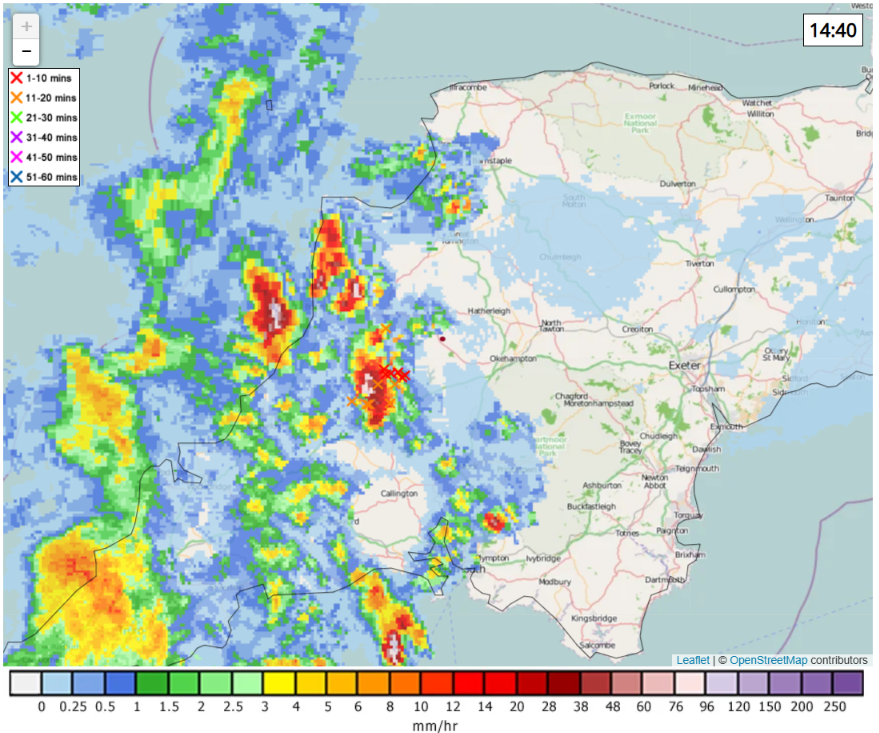
One of those thundery showers is currently approaching us, heralded by loud thunder. Here is the current Netweather.tv rain and lightning map:
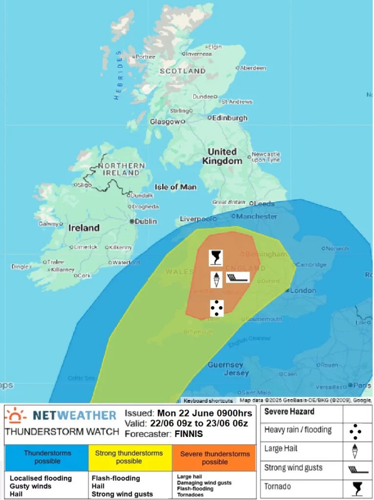
Netweather have also issued a warning for potential “severe thunderstorms” in this part of the world, so the WestDevon.info account on BlueSky will be following further developments closely!
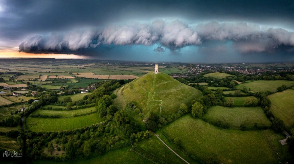
As documented in greater detail on BlueSky, yesterday’s thunderstorm grew into a huge storm as it crossed the West Country towards Bristol. Here’s a photograph of the storm approaching Glastonbury:
Amongst other things it damaged the air traffic control system at Bristol Airport and caused flash flooding across Somerset, including in Bath:

Here’s a timelapse video of flash flooding in Oakhill:
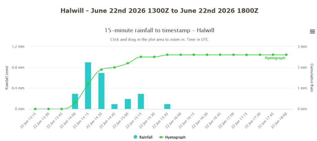
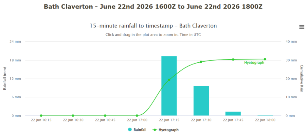
Here’s a comparison of yesterday’s rainfall in Halwill and Bath, courtesy of Starlings Roost Weather:
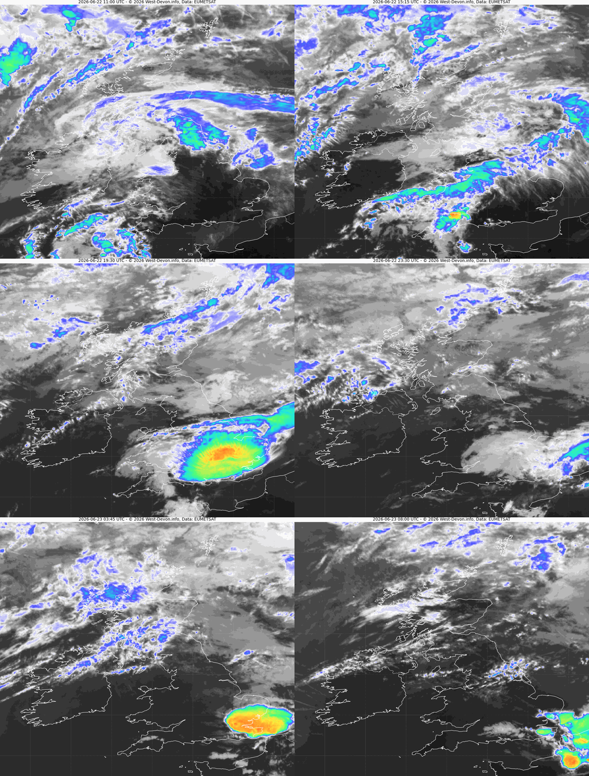
Here’s an infrared satellite image of the thunderstorm over Somerset yesterday. Click the image to see a 15 Mb animation, including the later thunderstorm over London:
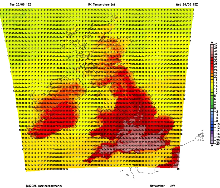
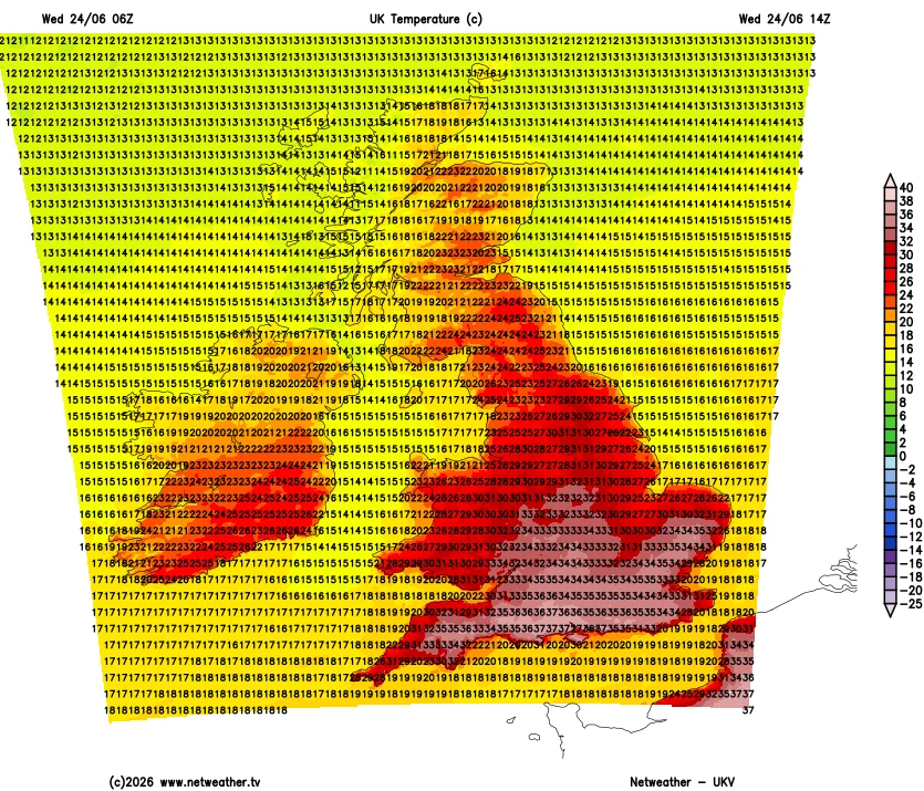
The current UKV forecast suggests that temperatures will reach 37 °C in central southern England tomorrow afternoon, and 34 °C in our neck of the woods:
P.S. This evening it has been confirmed that we are officially in a heatwave. In South West England that’s three consecutive days with maximum temperatures over 25 °C.
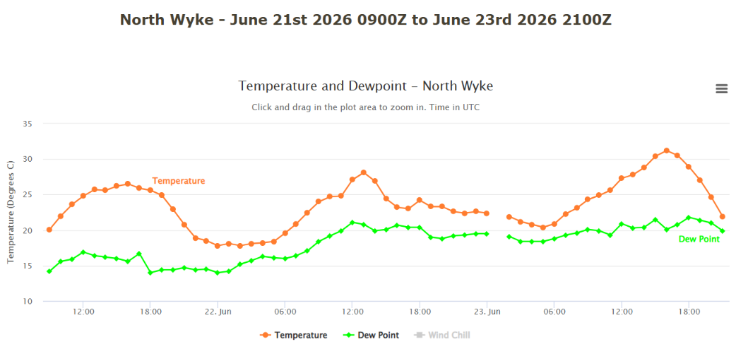
Here’s the temperature graph recorded at the nearby Rothamsted Research Farm at North Wyke:
The latest UKV forecast suggests a maximum temperature of 35 °C for West Devon today:
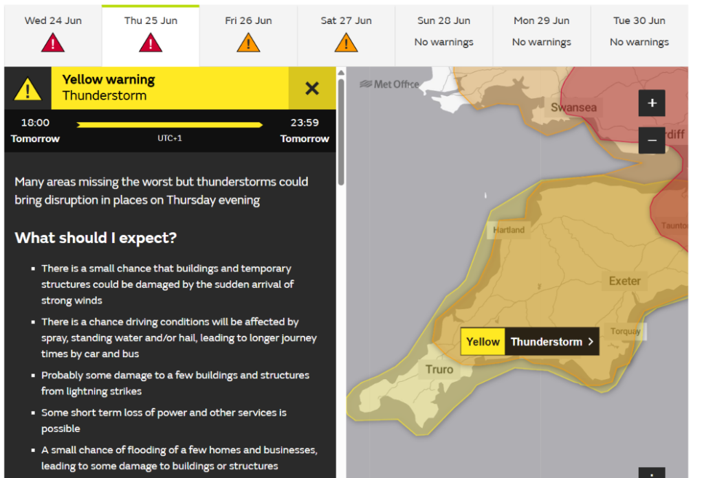
The Met Office has now issued a yellow warning for more potential thunderstorms across Devon and Cornwall on Thursday evening:
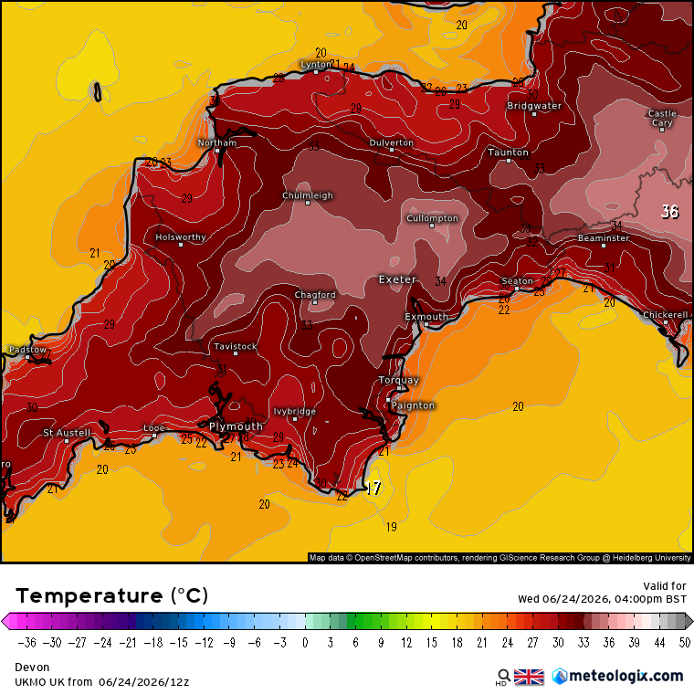
The 12Z model run suggests slightly cooler temperatures than previously forecast later this afternoon:
Yesterday evening the Met Office reported a new UK record temperature for the month of June:
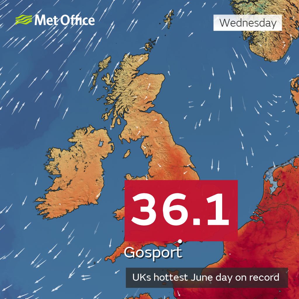
If confirmed via the verification process, the new 36.1°C figure exceeds the previous record of 35.6°C which was reached on 28 June 1976 and on 29 June 1957. It’s possible this figure will be beaten again in the coming days, with the heatwave forecast to continue on Thursday and Friday.
At the conclusion of the heatwave, the verification process will begin for any new national records. The equipment and site will undergo a rigorous validation process before a decision is made on officially inducting any new figures into the meteorological record books.
This process will include site inspections and verification checks of the equipment used to measure the temperature.
In order for a value to be treated as an official national record, the Met Office follows national and international best practice and guidance. If the figure doesn’t meet the required standards, it will be rejected as an official national record.
In our neck of the woods temperatures were a few degrees cooler. Here’s the latest air temperature graph from North Wyke, which reached a high of 33.4 °C. Note that the graph shows hourly readings rather than min/max values:
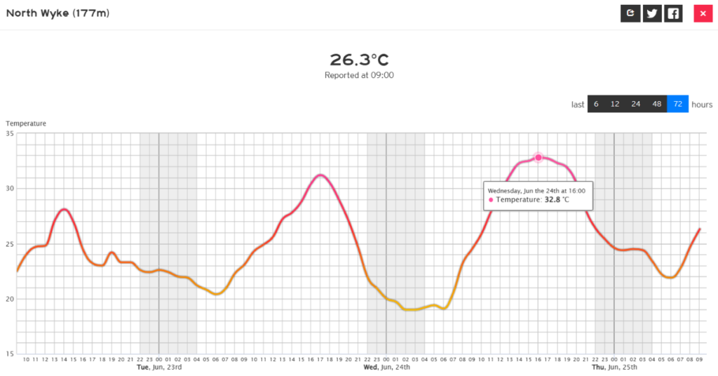
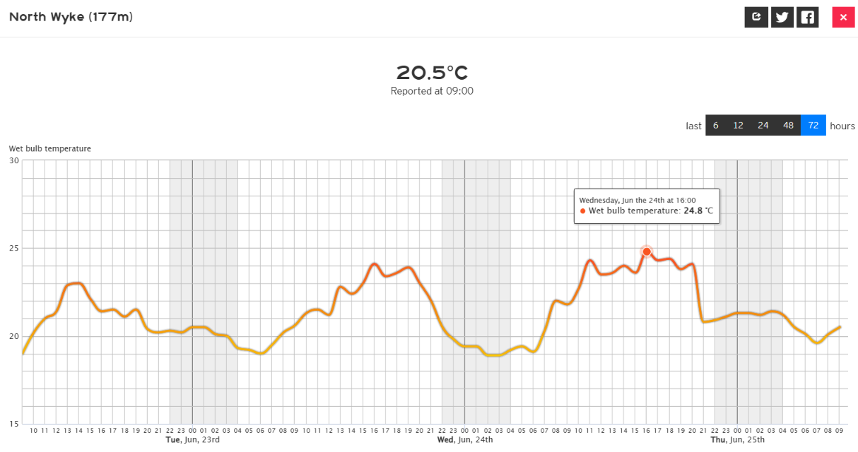
Note also that the minimum temperature overnight was 21.7 °C, and that the wet bulb temperature reached a high of approximately 24.8 °C yesterday:
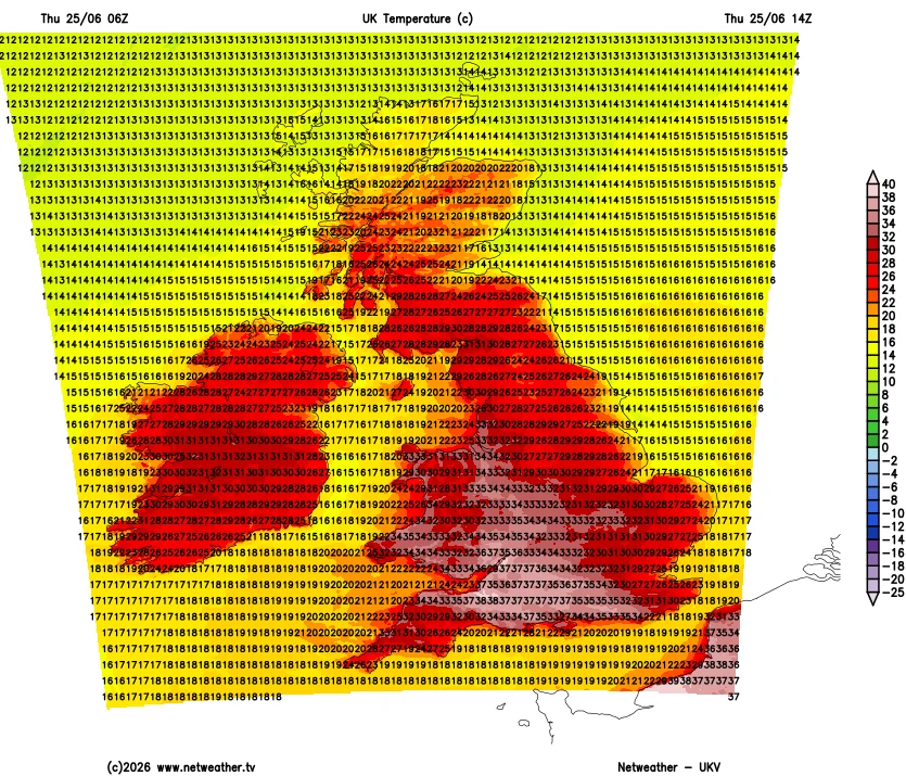
This morning’s UKV model run suggests that temperatures here will be slightly cooler today, but that the new record might be broken across the border in Somerset:
The official Met Office all time record high temperature for South West England is 36 °C, set in Bude during the long hot summer of 2022. That record may well be broken later today, albeit inland rather than on the coast:
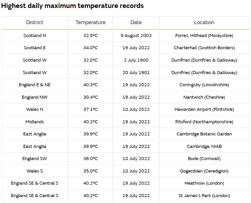
Perhaps some other regional records will fall too?
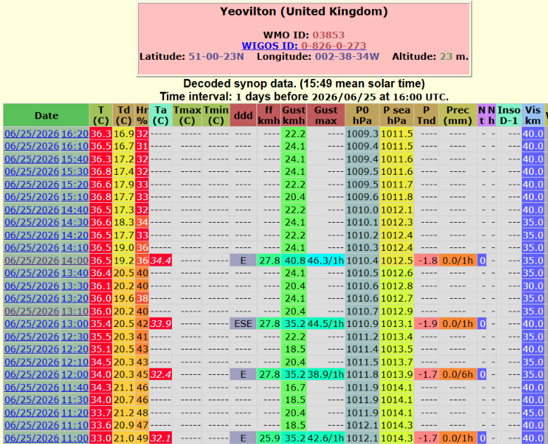
P.S. The pan UK June and all time SW England maximum temperature records have duly (if provisionally!) fallen at Yeovilton in Somerset:
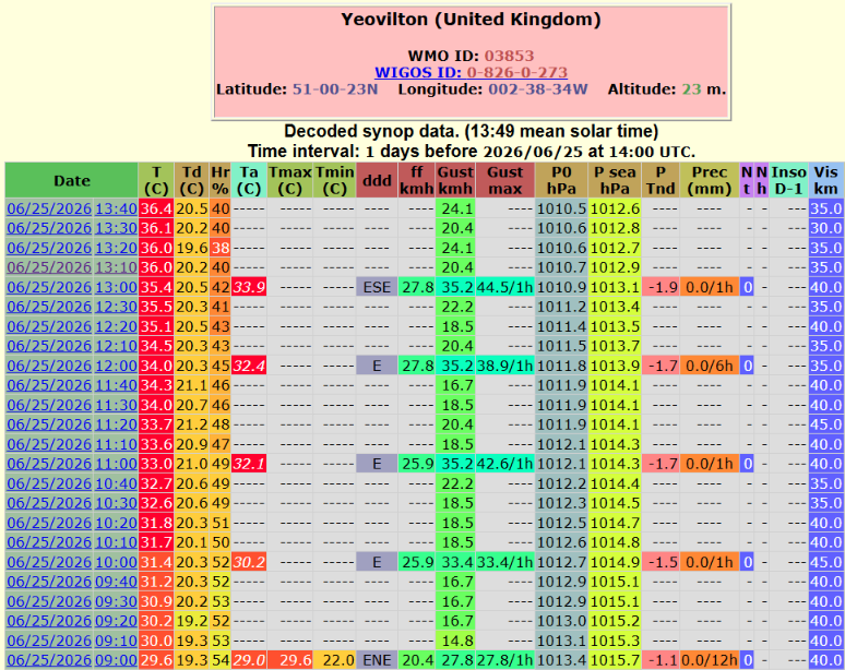
P.P.S The maximum temperature at Yeovilton subsequently reached at least 36.8 °C:
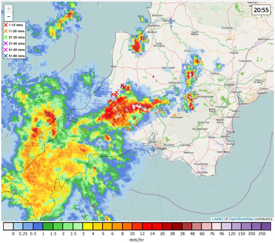
There have been a few more peals of thunder here this evening, albeit in the distance. East Cornwall has seen plenty of lightning, and the coast of North Cornwall will be under it shortly. Sadly we’ve only been able to view it from afar:
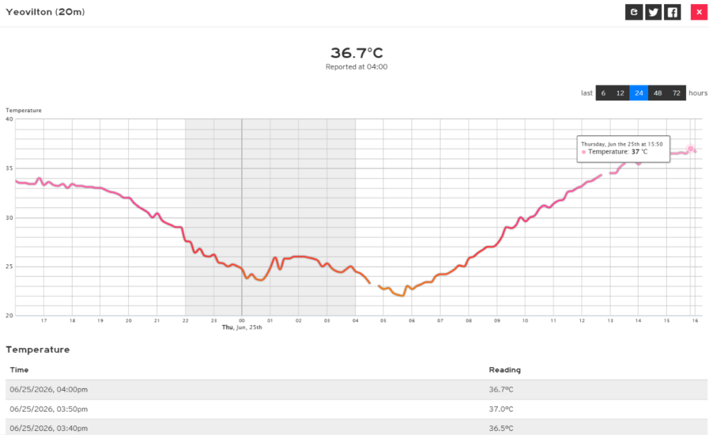
I’ve discovered this morning that Meteologix has reported the 15:50 UTC reading missing from the OGIMET record for Yeovilton:
In view of the above data I am wondering why the Met Office released this graphic on (anti)social media yesterday:
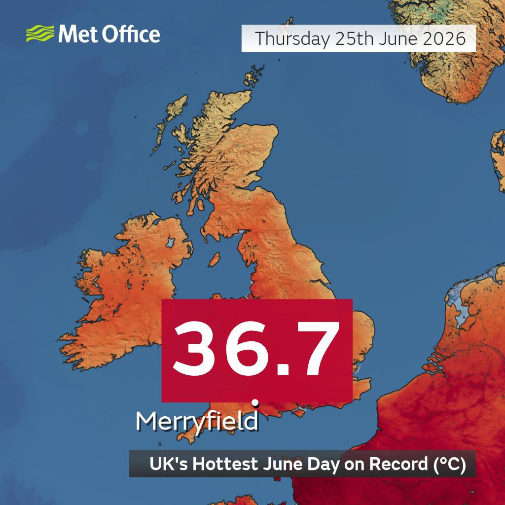
They also issued a press release yesterday evening stating that:
The UK has provisionally set a new maximum temperature record for June for the second consecutive day, with 36.7°C reached at Merryfield, Somerset, on 25 June.
I called the Met Office to ask for a comment. They have yet to get back to me, but I will pass on what they have to say in due course.
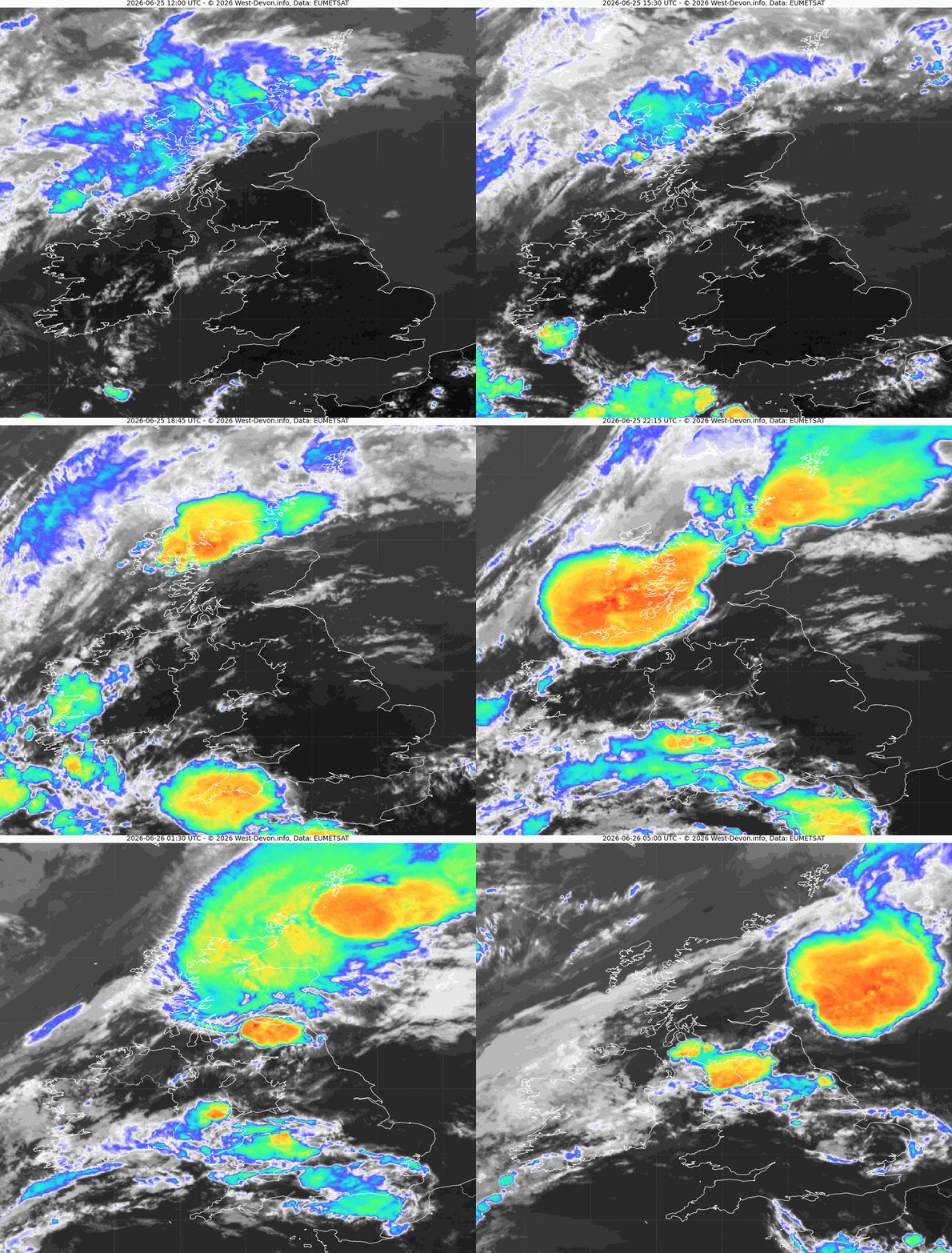
Here’s how yesterday’s thunderstorms looked in infrared from on high at 9 PM. Click the image to see a 15 Mb loop of all last night’s action:
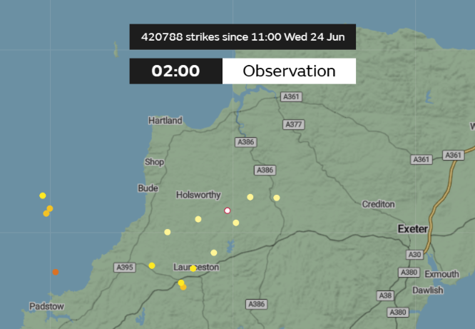
This morning a neighbour assured me she had been woken by thunder and lightning in the small hours of the morning. I slept through it, but the Met Office web site confirms there was a flash very close by at 2 AM:
It’s cooler today here in West Devon, and the new South West England all time high temperature record seems safe for a while at least, pending verification of course:
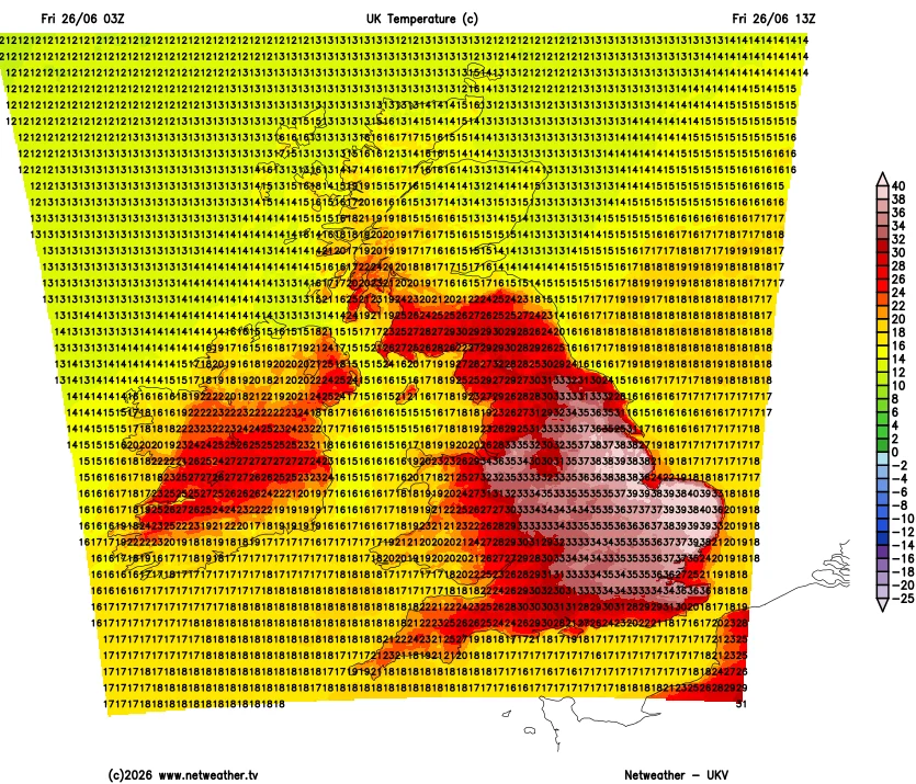
However the 06Z UKV run suggests that the pan UK record for June may well be broken in East Anglia later today:
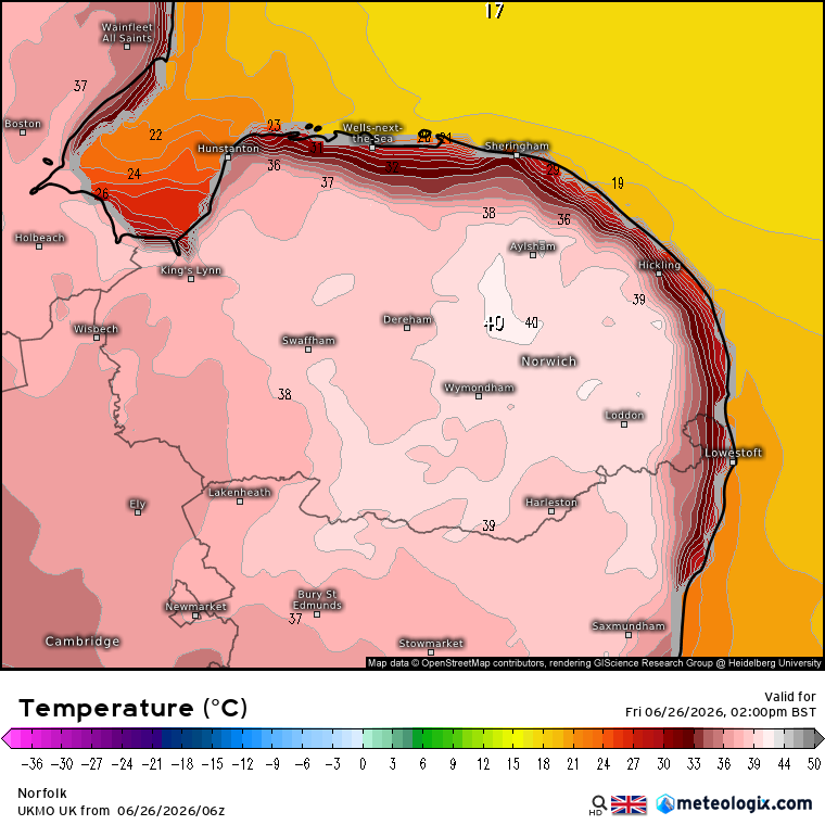
P.S. Moving over to East Anglia temporarily, here are three more conflicting items of information:
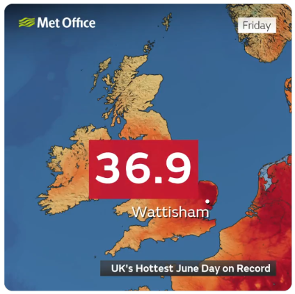
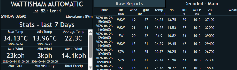
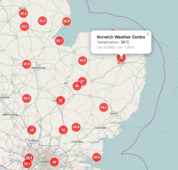
P.P.S. According the latest press release from the Met Office:
[Update – June 27th]The UK has provisionally seen a new maximum temperature record for June for the third consecutive day, with 37.3°C reached at Santon Downham in Suffolk on 26 June.
This exceeds the figures reported on 24 and 25 June and, if confirmed via the verification process, would become the new daily maximum air temperature record for the month of June.
It has been confirmed that we have now been suffering from an official heatwave for 6 days, going by the nearby official weather station at North Wyke:
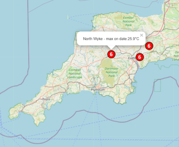
However, the current UKV forecast suggests that it will be touch and go whether another day will be added to the sequence:
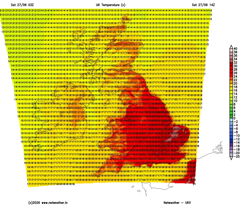
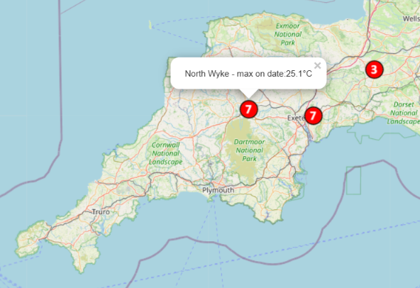
North Wyke just crept over the 25.0 °C threshold yesterday, so our heatwave has been extended to 7 days:
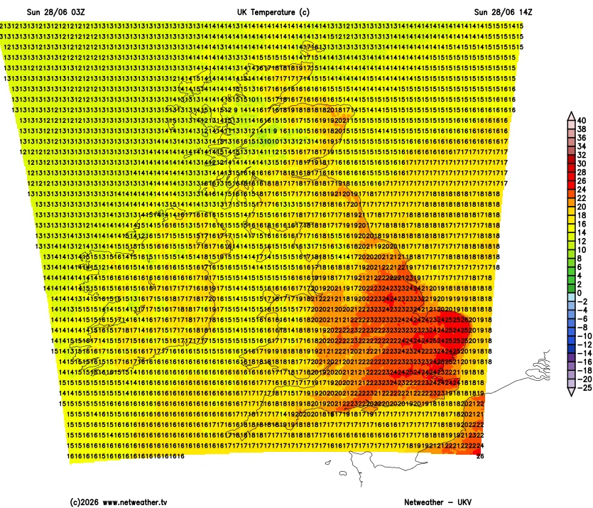
This morning’s UKV temperature forecast makes it clear that the long run will not be extended today. Which means amongst other things that at long last we are planning a long (by our standards) walk on Dartmoor.
To be continued…

The rain, thunder and lightning have arrived in Halwill Junction. A flash of the latter also caused a brief power cut here:
We’ve also had a second brief power cut. It seems highly likely that our problems are related to this longer power outage in nearby Ashwater:
The nearby power cut has been repaired: