The June Heatwave in West Devon
The Met Office has released a red weather warning for “extreme heat” across central and southern England from 9 AM on June 24th until 9 PM on the 25th. That is accompanied by an amber warning that covers Devon and eastern Cornwall for all of Wednesday and Thursday:
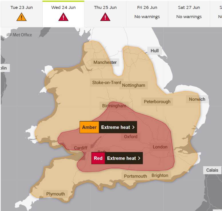
According to the Met Office warning:
Very hot weather will continue in general until at least Thursday across the highlighted region, although some variations from place to place and day by day are likely. Temperatures by day are widely expected to exceed 30 Celsius, with the hottest areas potentially peaking around 38-40 Celsius within the embedded red warning.
Overnight, temperatures are unlikely to fall much lower than high teens Celsius, and some places will not fall below low 20s Celsius. These high temperatures will also be accompanied by high humidity.
Cooler conditions may begin to become established from the west following this period, but confidence is low.
A Met Office article about the heatwave adds that:
Temperatures will quickly rise on Monday and are forecast to reach 34°C in southern parts of England. However, this brings with it the chance of thundery showers for some.
The heat will build further into Tuesday, with highs of 37°C forecast for southern England and 35°C in southeast Wales. The peak of the heatwave is now forecast for Wednesday and Thursday, when temperatures are expected to climb to at least 39°C and there remains a chance of this being exceeded in places.
By Friday conditions will be less hot, with highs of 32°C forecast across eastern areas.
Overnight temperatures will also be very high, with widespread Tropical Nights, where the temperature does not drop below 20°C, across parts of England and Wales, especially in urban areas. Humidity is also a factor, making this heatwave even more impactful with heat stress a danger to all.
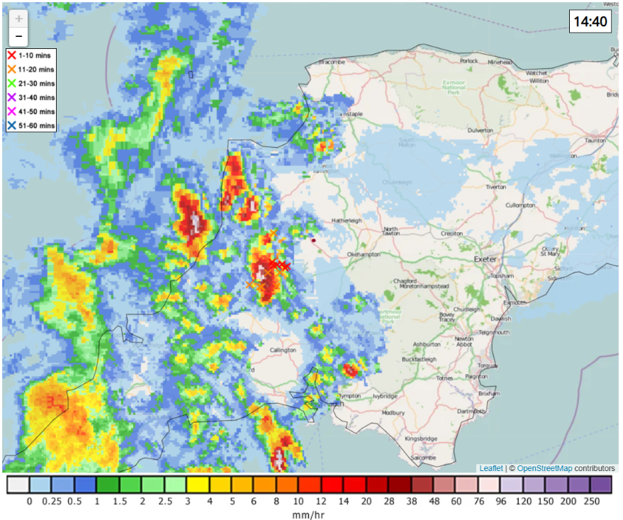
One of those thundery showers is currently approaching us, heralded by loud thunder. Here is the current Netweather.tv rain and lightning map: