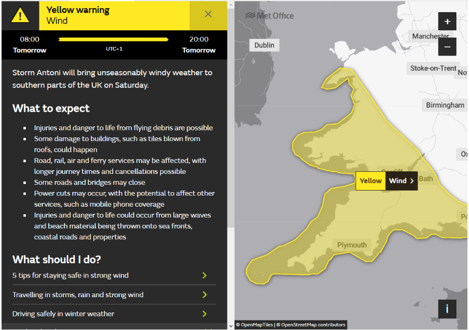
The Met Office in Exeter have issued a high wind warning for tomorrow:
Not only that, but also the high winds will be caused by the first named storm of the 2023/24 winter season, in early August!
Storm Antoni has been named by the Met Office with a low-pressure system set to bring strong winds and rain for many on Saturday.
From late Friday night and into Saturday, Storm Antoni will bring strong winds and a spell of heavy rain which has resulted in the issuing of weather warnings.
Northern Ireland will be the first to see the influence of this low-pressure system, with a warning for rain in force from the early hours of Saturday morning.
A further warning for wind has also been issued for southern and western parts of Wales, the southwest of England, as well as a large stretch of the south coast of England.
Met Office Chief Meteorologist Steve Willington said: “Storm Antoni will bring some potentially disruptive weather on Saturday as it moves from west to east. Northern Ireland is likely to see some of the highest rainfall totals, with 40-60mm falling in some spots, but 20-30mm more widely. Away from the warning area many will still see a very wet day, especially in north Wales and north England.
“Storm Antoni will also bring strong winds to a swathe of Wales, southwest England and southern coastal areas of England. The strongest winds will affect parts southwest England and southwest Wales where exposed coasts and high ground could see gusts in excess of 60mph. In these areas, gusts inland could reach 50-55mph for a time. These windy conditions will likely coincide with high tides which will present an additional challenge for coastal areas.
Here are some visualisations of the Met Office’s model wind and rain forecast for tomorrow. Firstly average sustained wind speeds tomorrow morning:
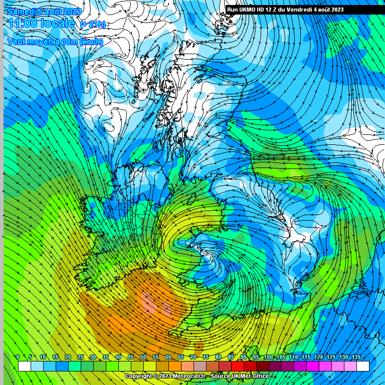
Perhaps it is of some comfort to learn that the scale is in km/h? Next here is the maximum wind gust speed during the day up to 7 PM:
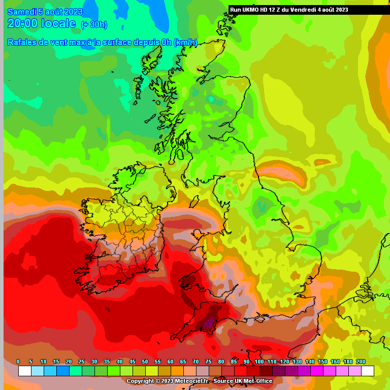
Dartmoor looks a bit blowy, with gusts up to 120 km/h forecast! Finally, for the moment at least, here’s the total rainfall during the day up until 7 PM:
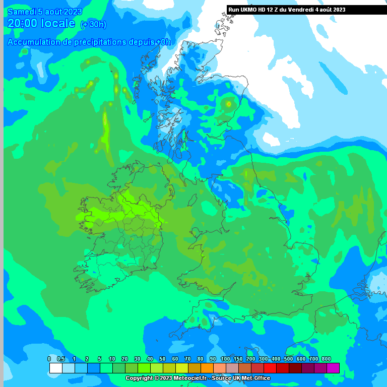
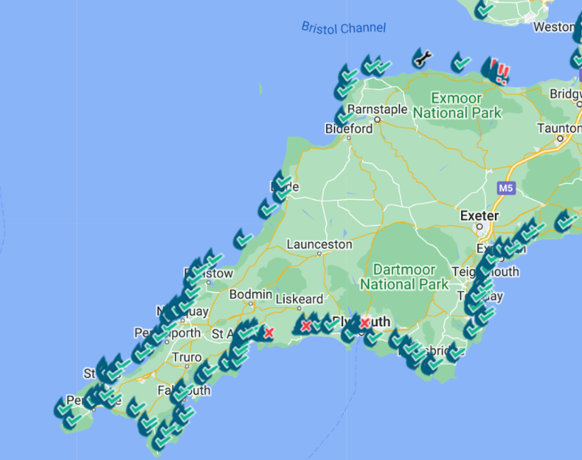
That shows up to 20 mm of rain on the high ground in South West England. I wonder how the coastal sewage pollution maps will look by then? Here’s the north coast’s calm before Storm Antoni according to Surfers Against Sewage:
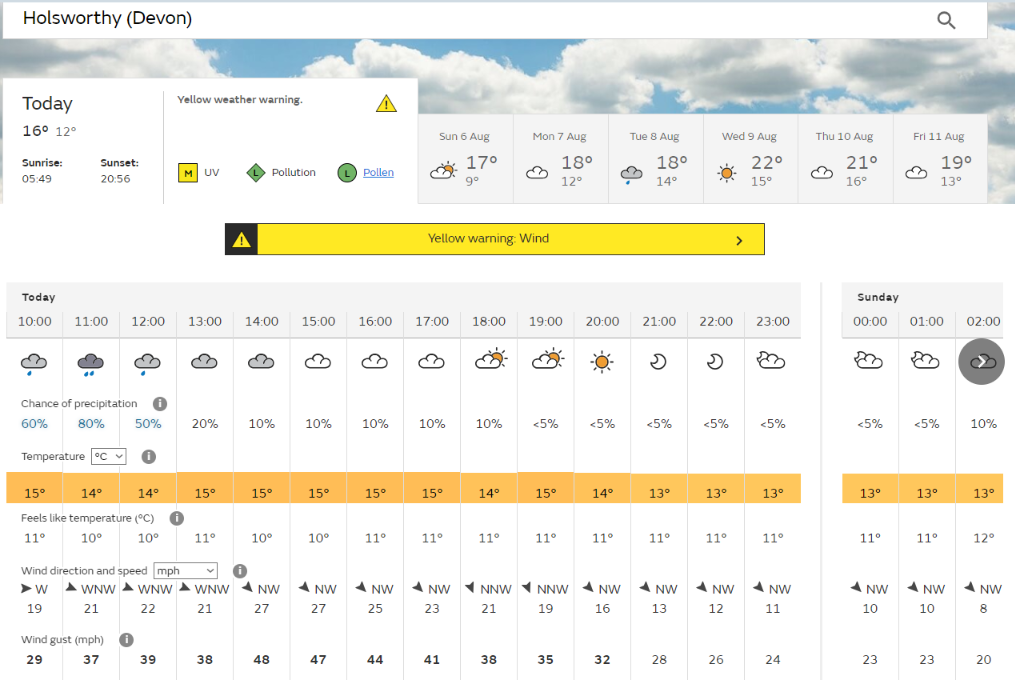
Here’s this morning’s Met Office weather forecast for our neck of the woods, as Storm Antoni passes by later today:
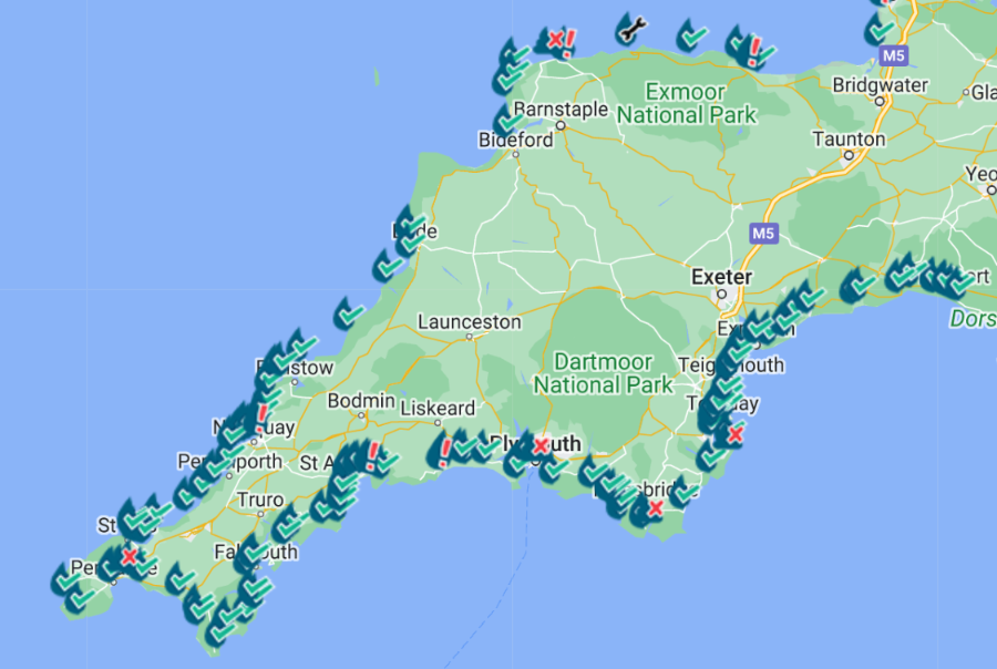
Here too is this morning’s SAS sewage pollution map:
Long Rock in West Cornwall and Ilfracombe Hele in North Devon are already the proud possessors of new “red flags”.
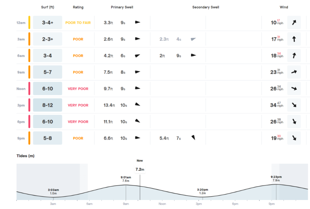
Finally, for the moment at least, here’s the Surfline surf forecast for Widemouth Bay:
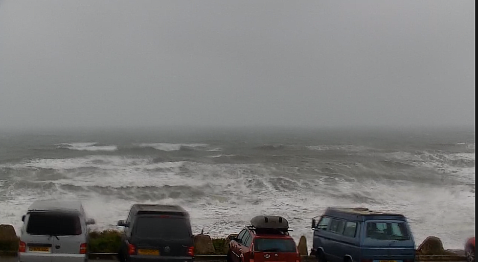
and a view of the actual surf shortly after this morning’s high tide:
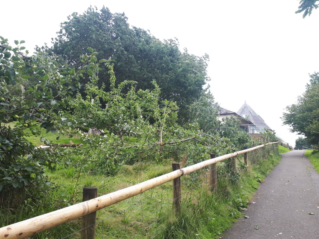
We took a chance and drove to Roadford Lake at lunchtime. There was plenty of evidence of the unfortunate side effects of Storm Antoni, but we had an enjoyable stroll nevertheless:


We even managed to record a video, but the sound track leaves a lot to be desired!
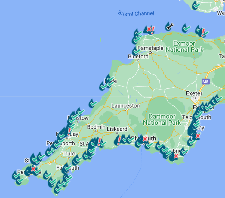
Thankfully this evening there have been no additional sewage pollution incidents:
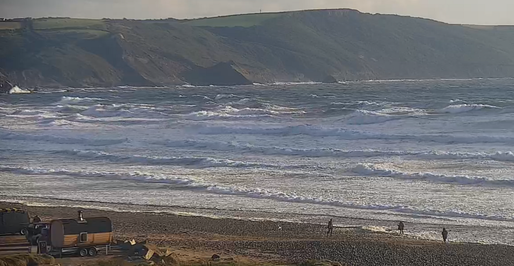
The sun has even emerged from behind the storm clouds, and here is the view near the evening high tide at Widemouth Bay:
While we were out and about earlier this afternoon, BBC Weather published this video explaining how an unusual kink in the jetstream over the British Isles led to the fallen trees we saw:
Storm Antoni lashes parts of the UK.
— BBC Weather (@bbcweather) August 5, 2023
Ben Rich has the latest forecast pic.twitter.com/6c5yPq06p1
To be continued…