There has been no let up in the wet weather and consequent sewage pollution since Storm Chandra hit South West England a week ago.
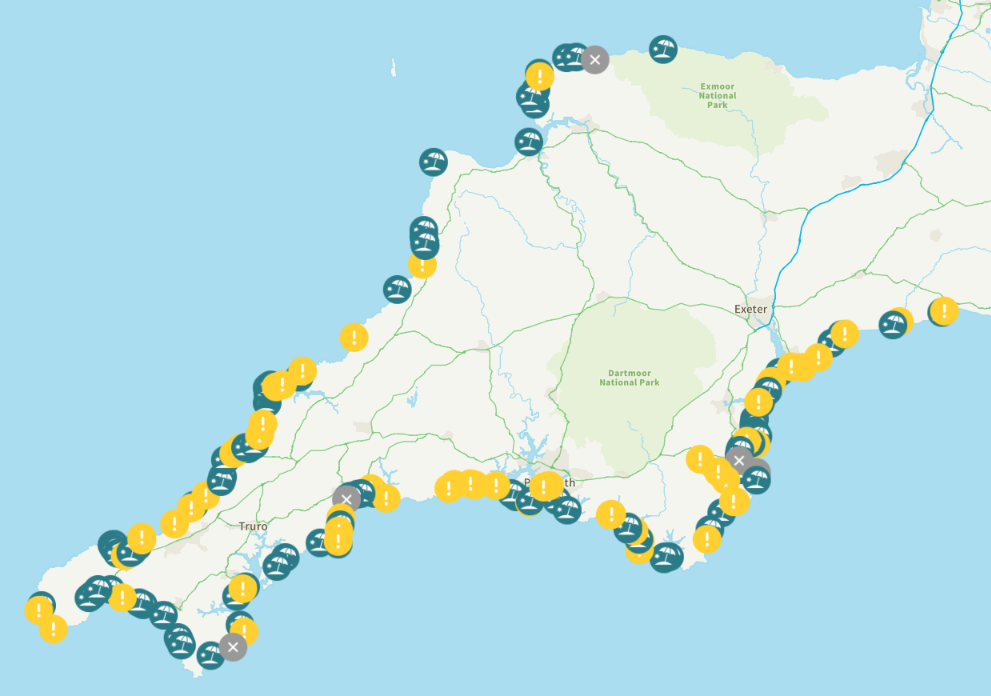
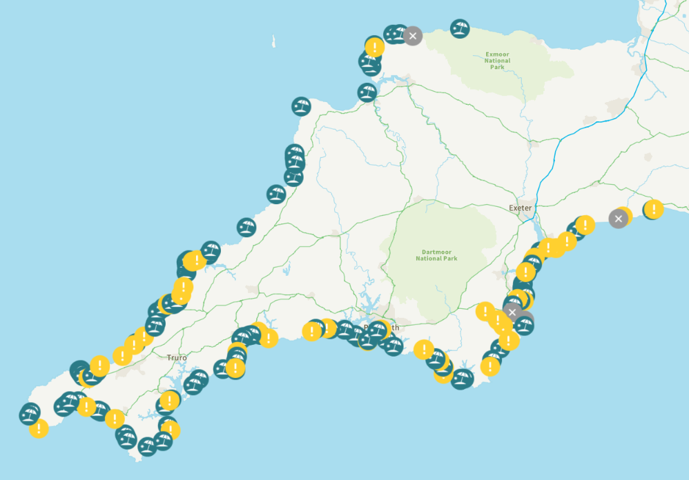
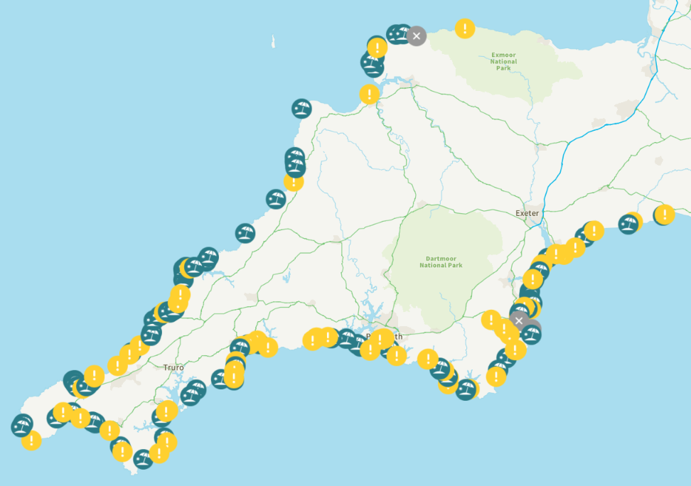
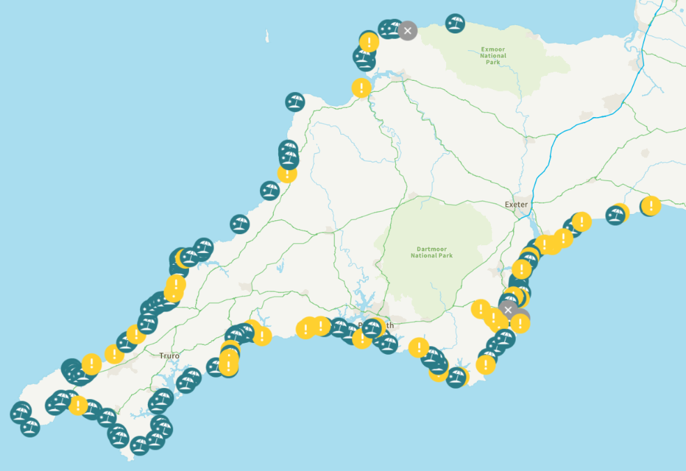
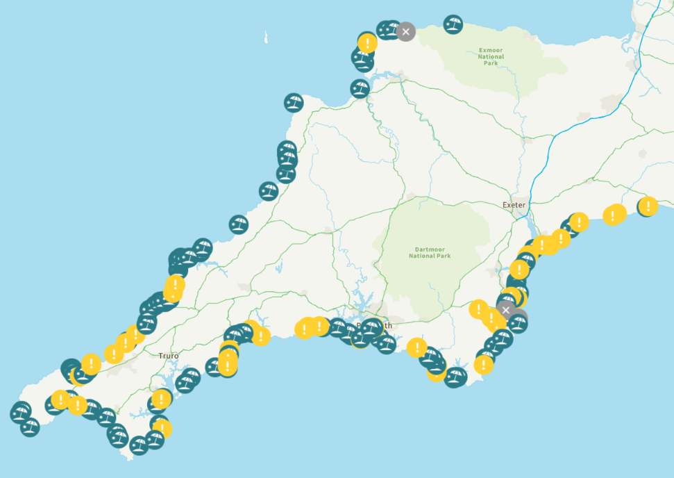
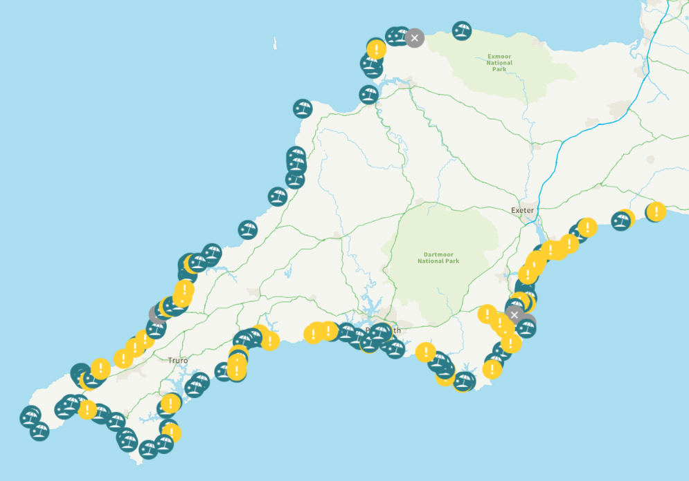
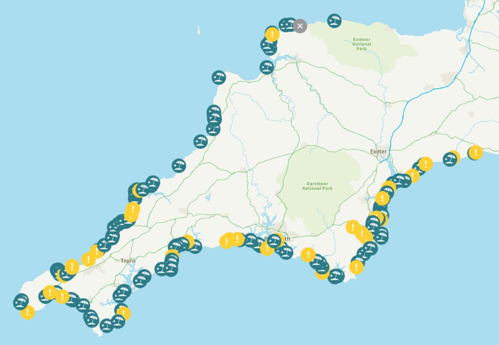
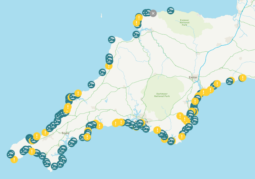
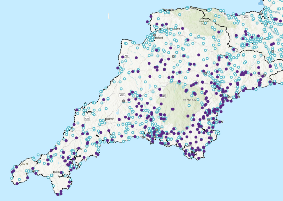
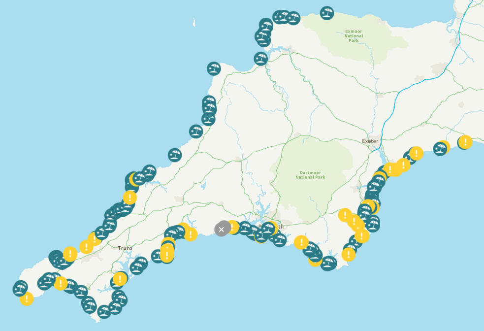
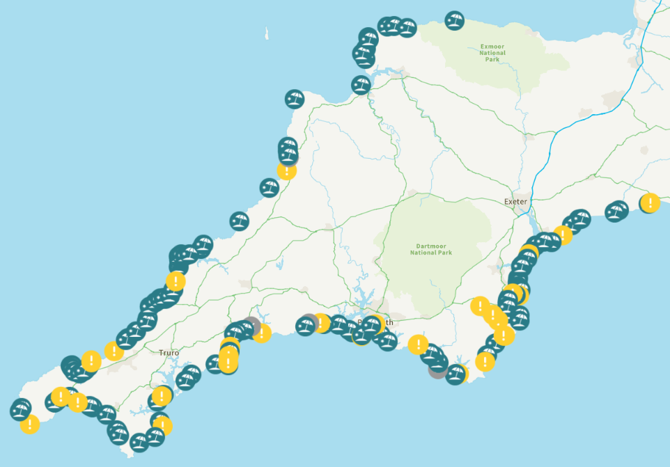
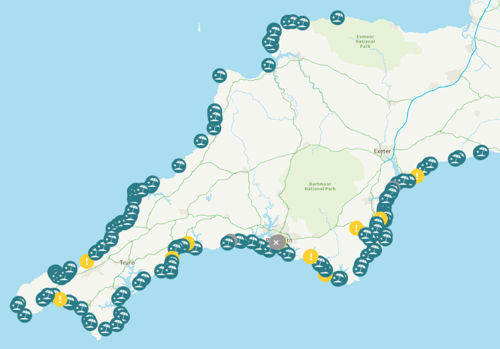
Here’s South West Water’s current map of potential coastal pollution on their WaterFit Live web site:
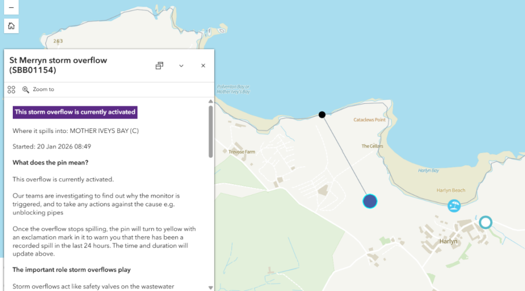
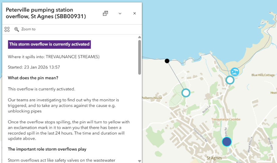
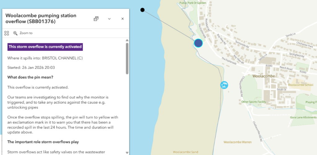
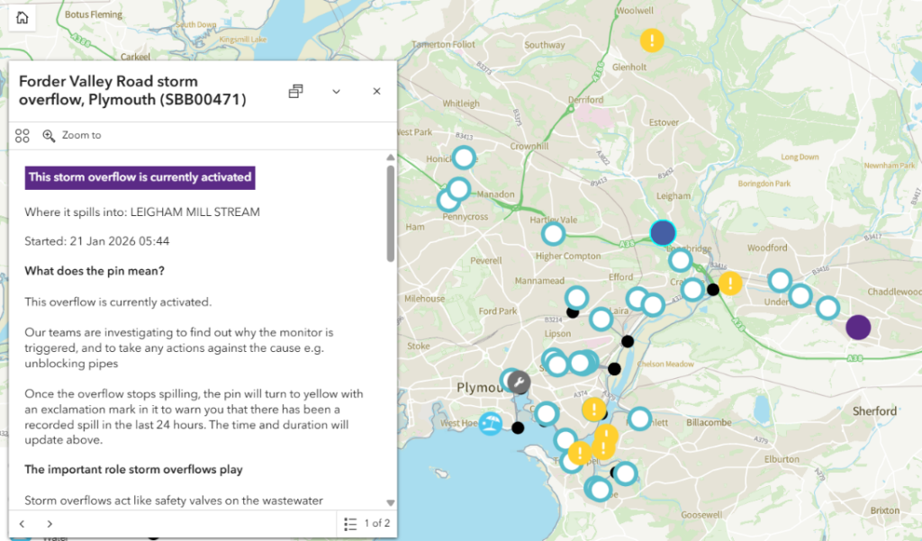
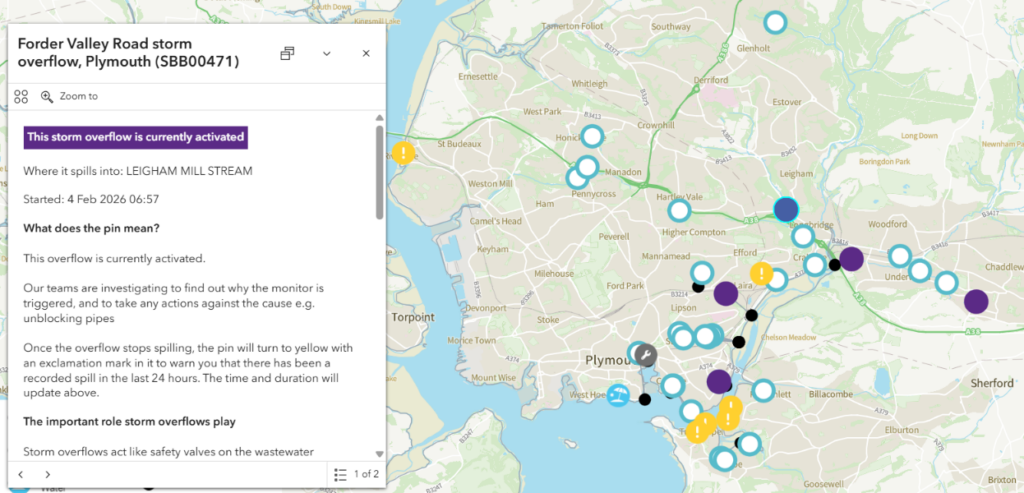
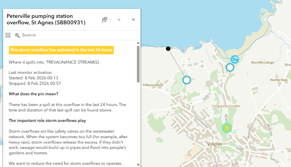
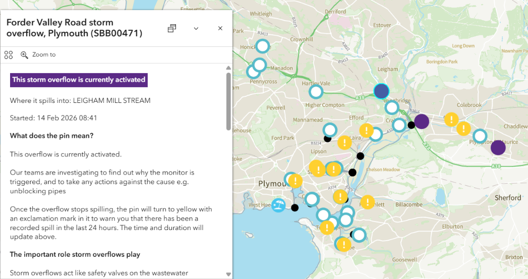
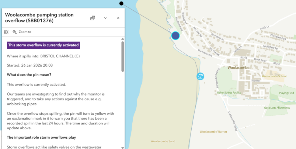
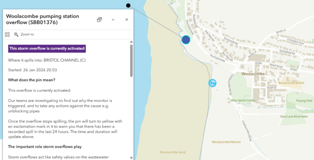
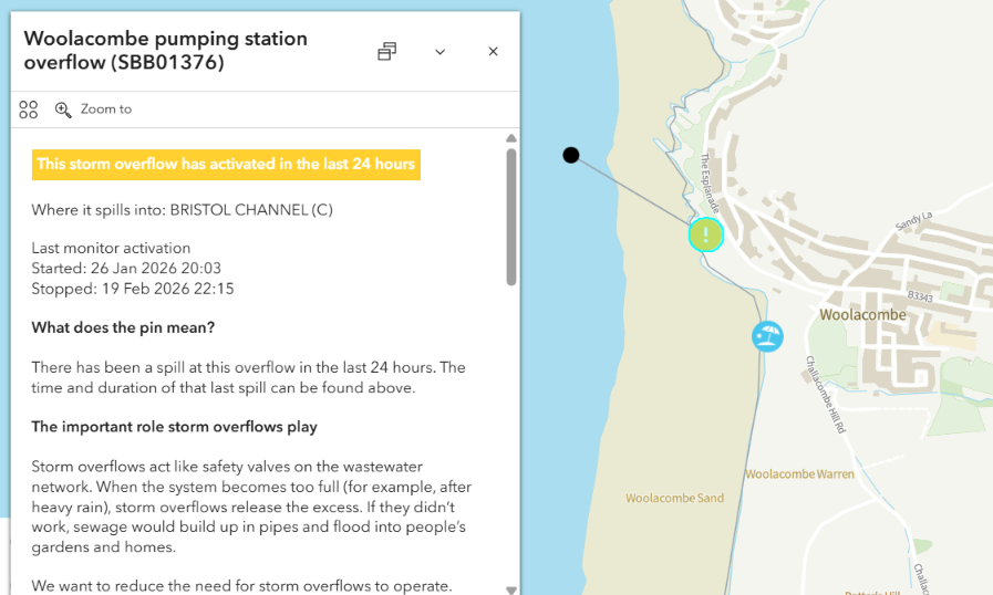
The multi-day pollution incident at Harlyn Bay started on January 20th. The Forder Valley Road combined sewer overflow in Plymouth activated on January 21st. A CSO in St.Agnes affecting Trevaunance Cove has been spilling sewage into the ocean since January 23rd. The Woolacombe “poo pipe” went into action on January 26th:
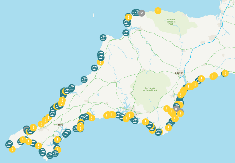
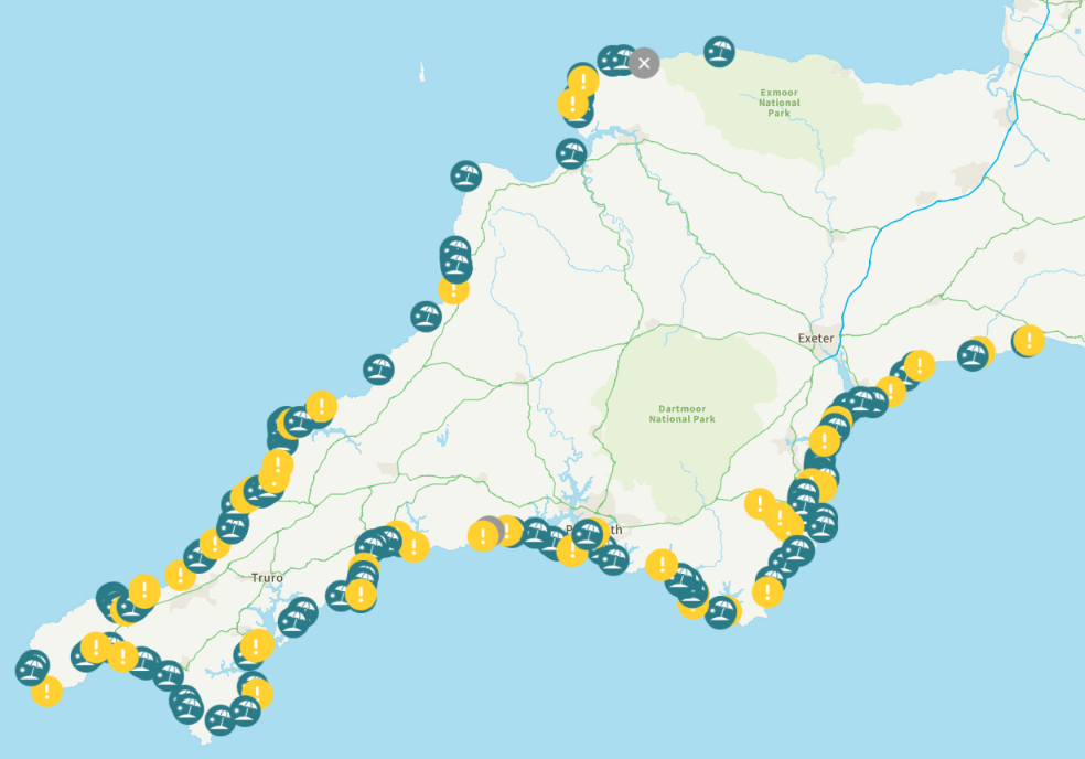
The number of recently active overflows shown in yellow on the WaterFit Live map has reduced slightly this morning:
The four multi-day sewage “spills” mentioned above have all clocked up another day, and Exmouth and Mawgan Porth are also highlighted on the overview map. Let’s take a look at them too:
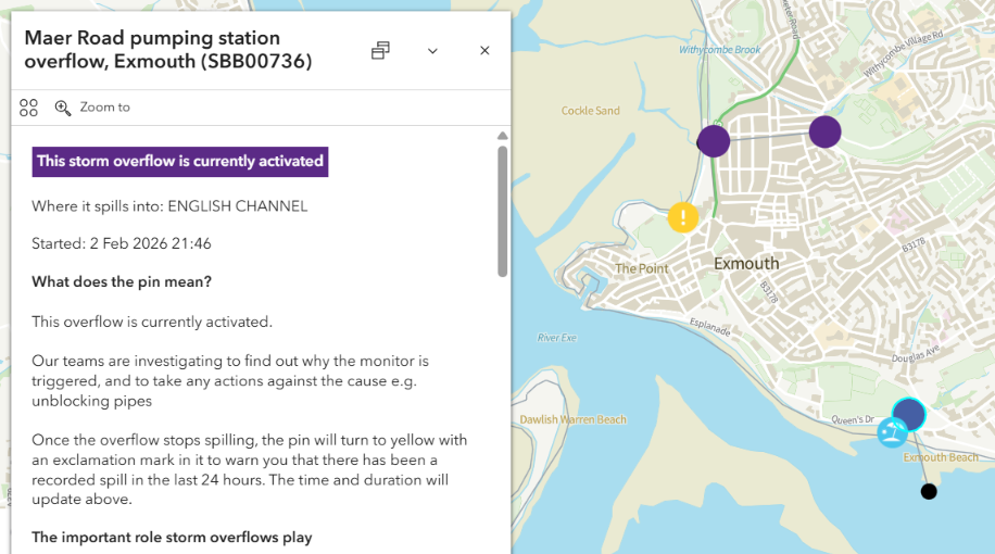
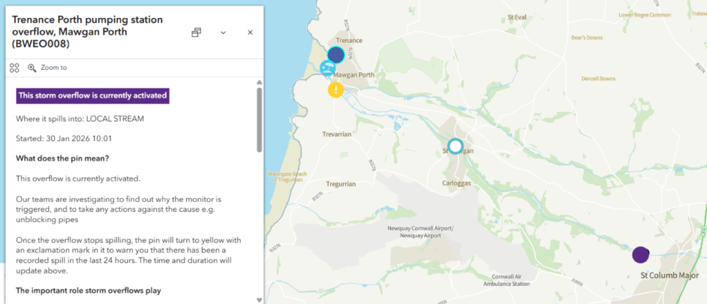
The Maer Road CSO in Exmouth reactivated last night. The St Columb CSO has also reactivated after a brief pause, but the Trenance Porth pumping station overflow near the beach at Mawgan Porth has been overflowing since January 30th.
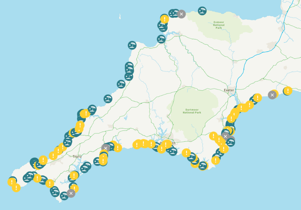
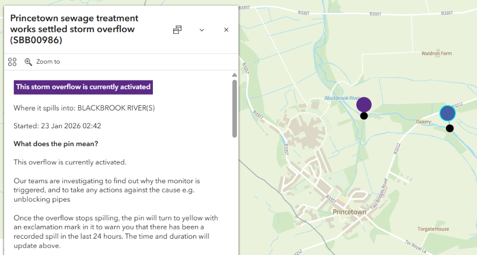
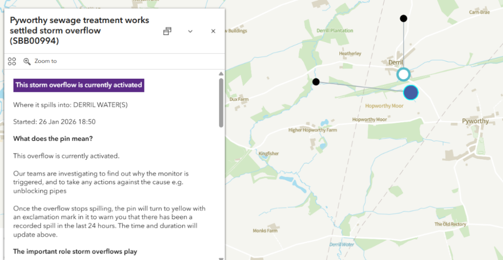
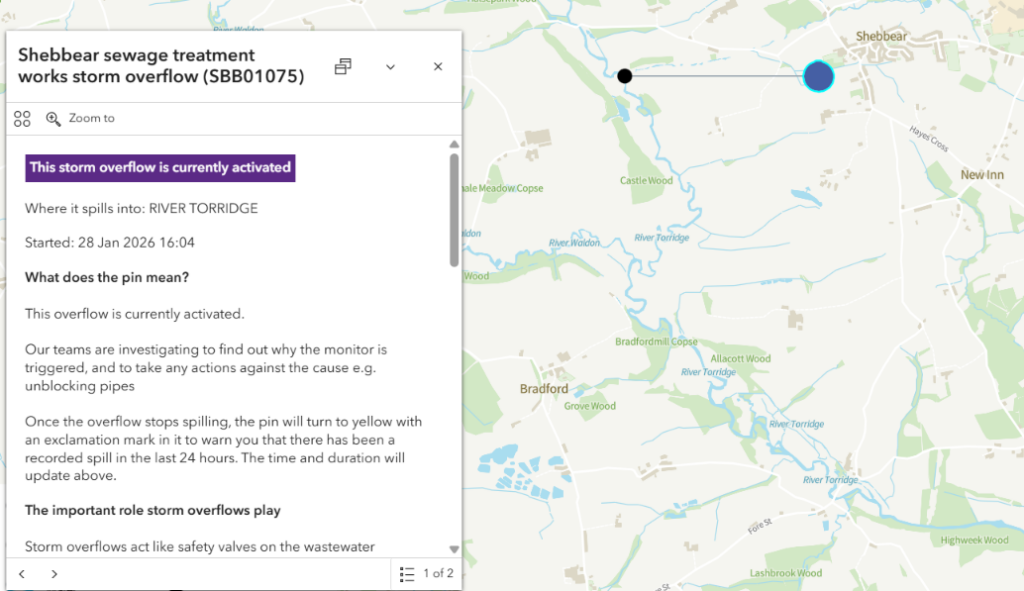
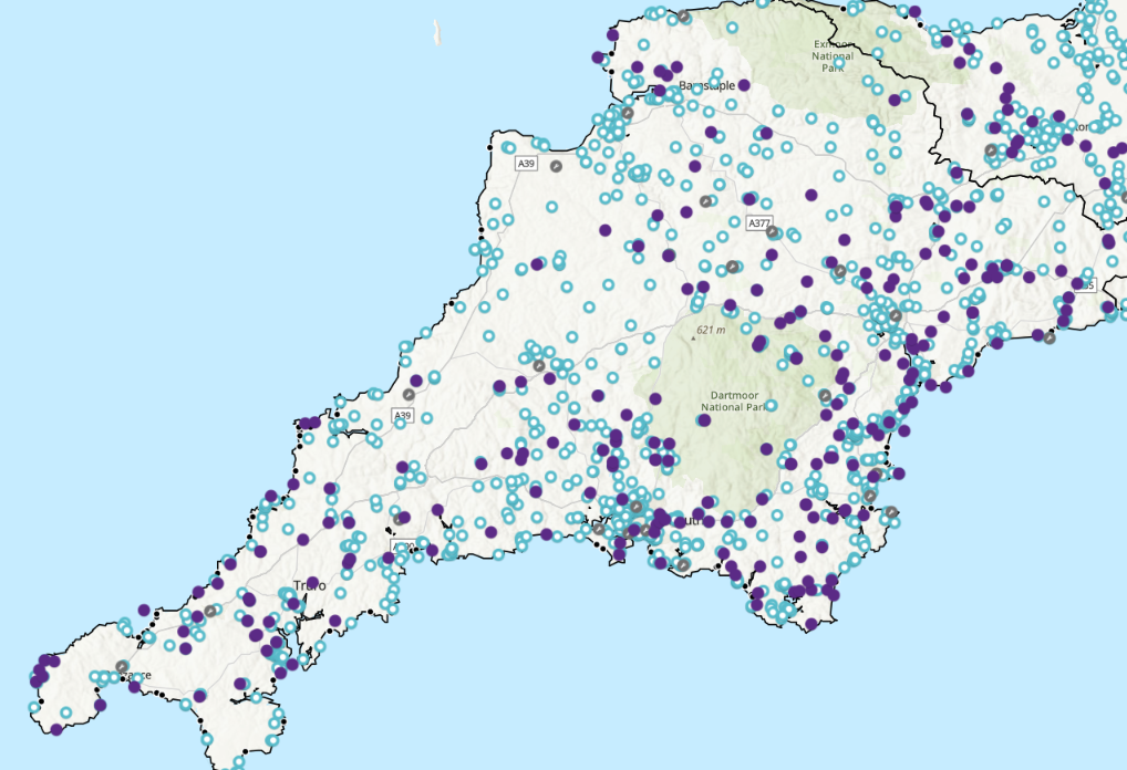
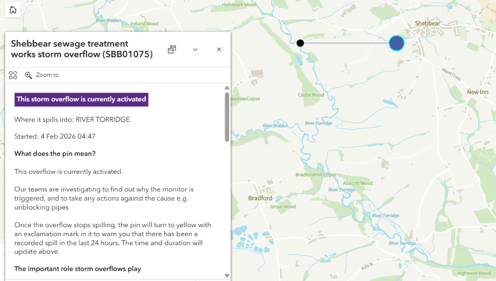
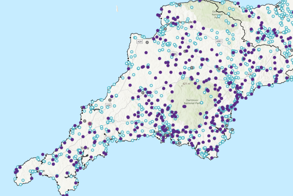
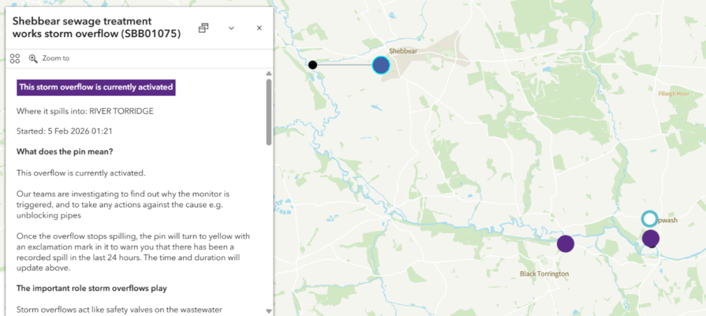
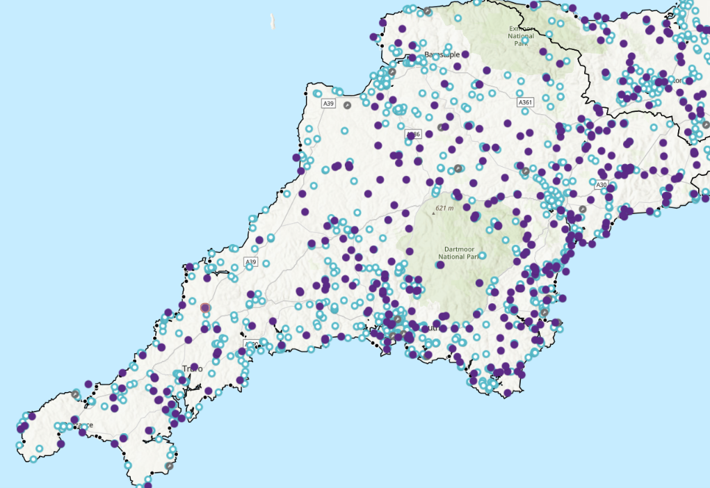
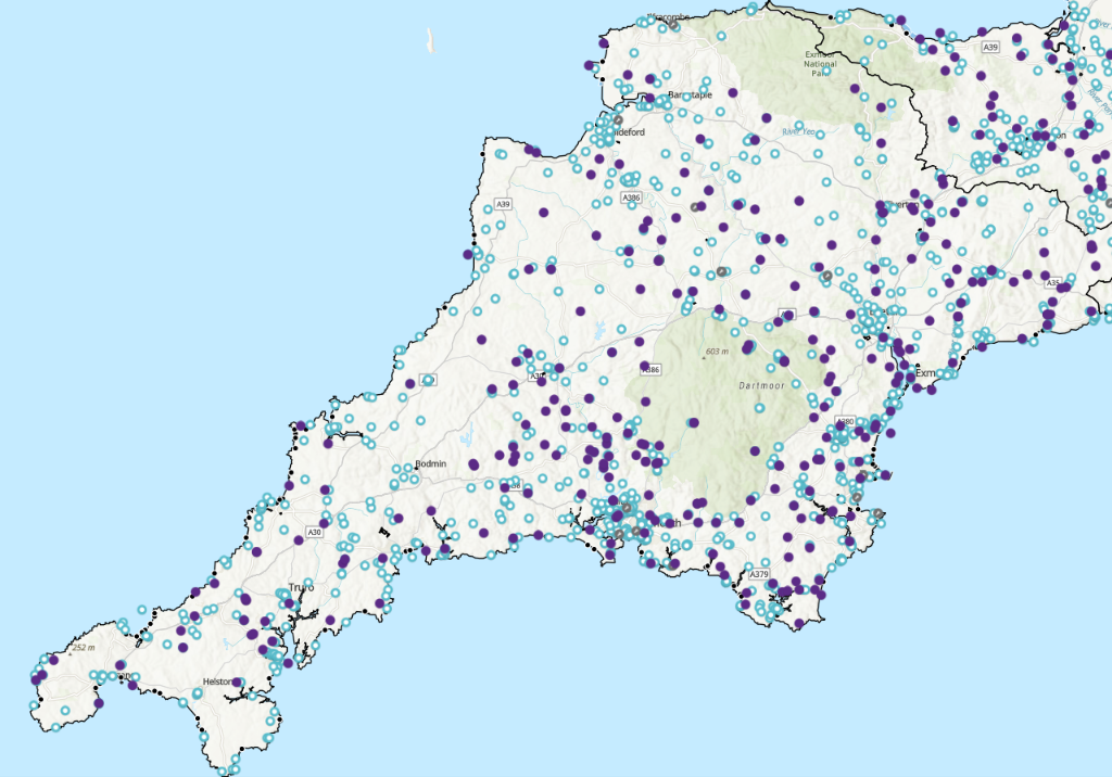
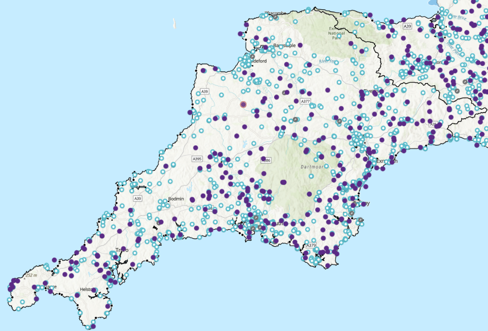
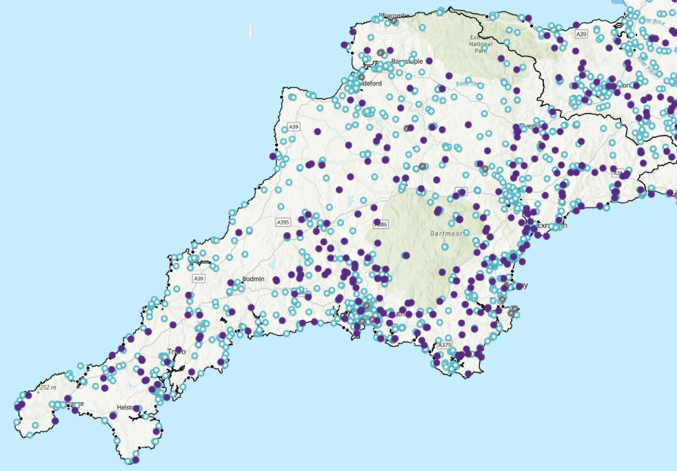
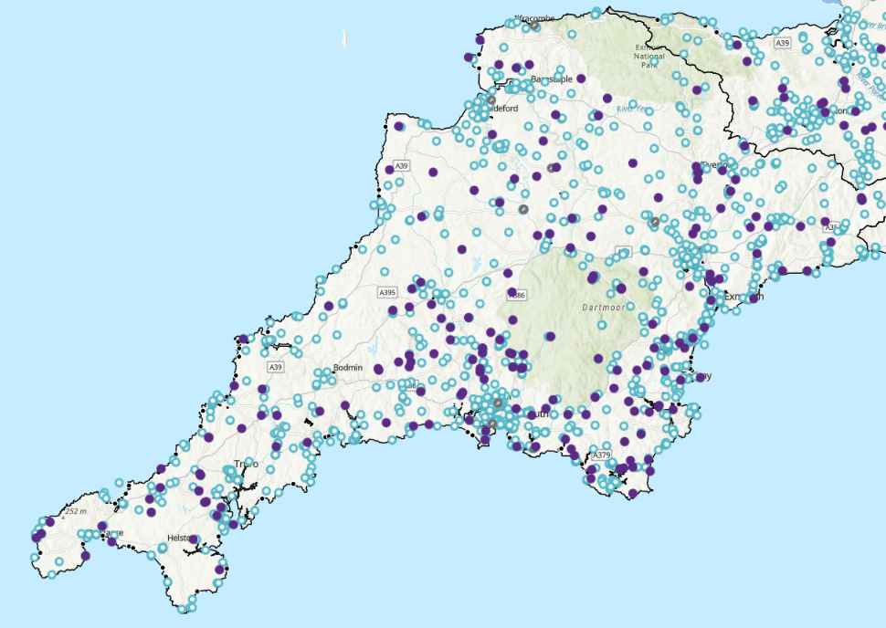
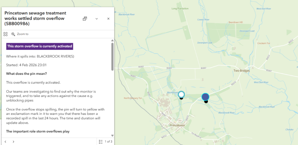
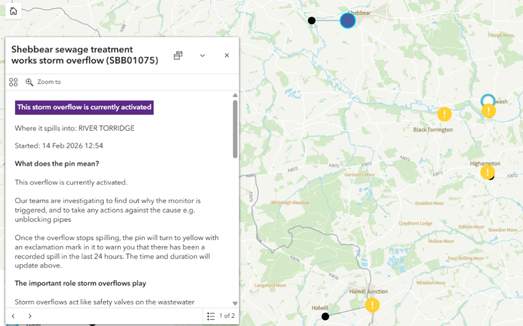
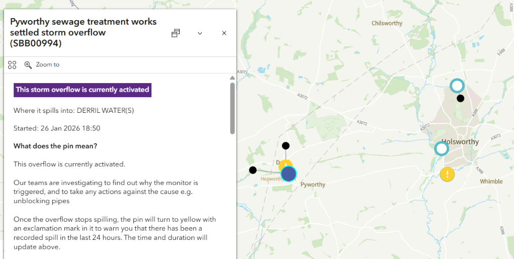
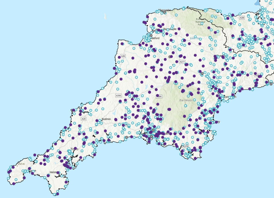
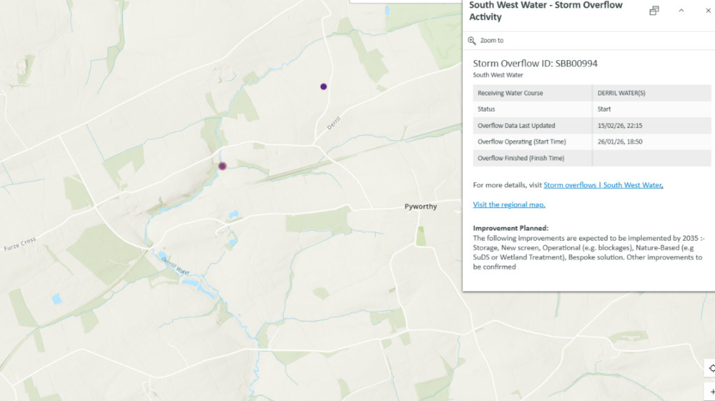
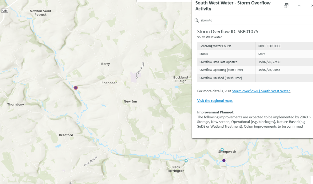
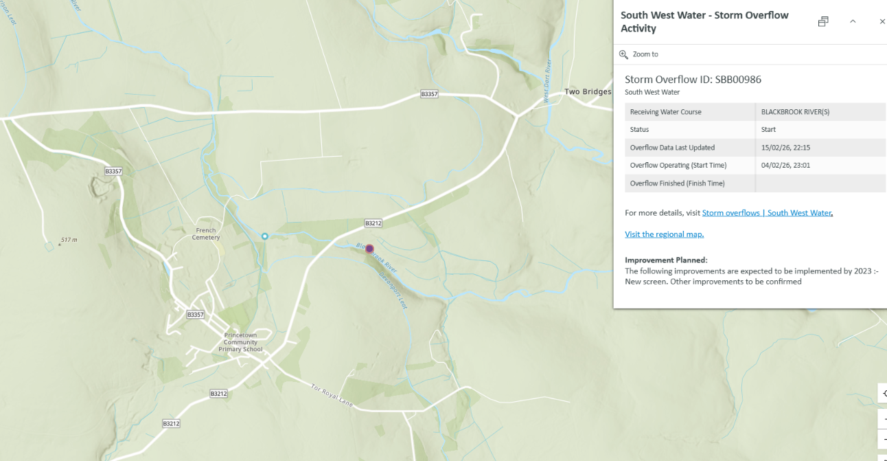
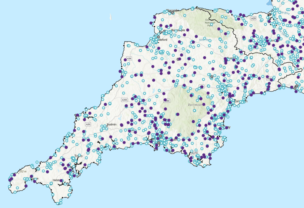
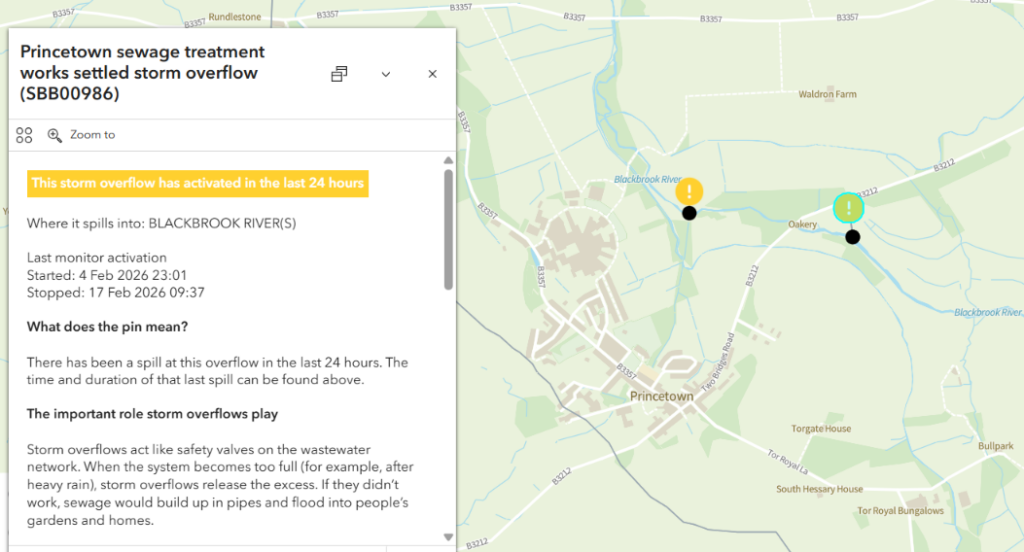
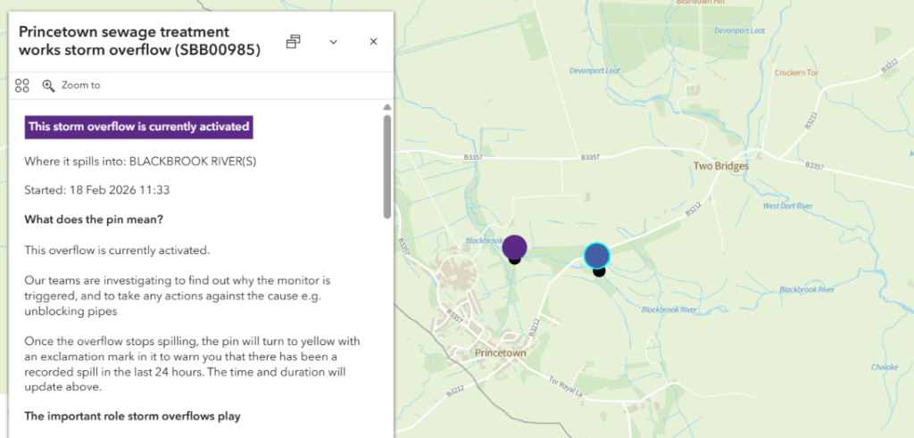
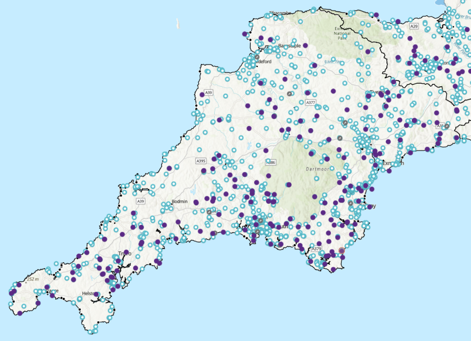
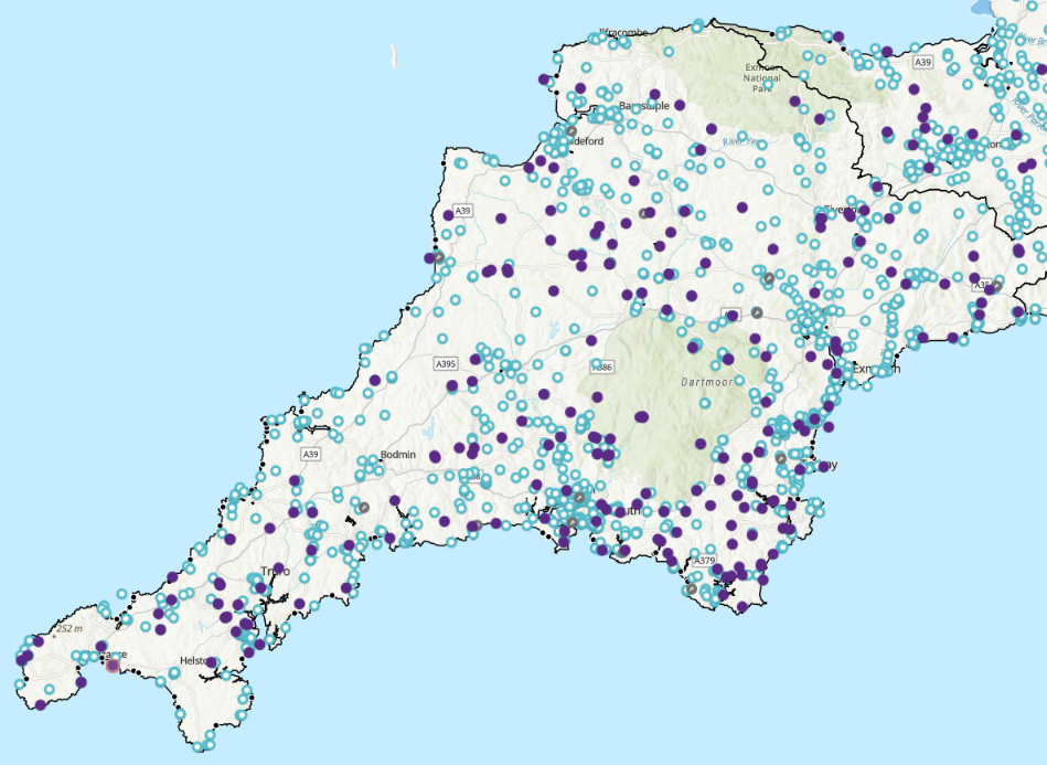
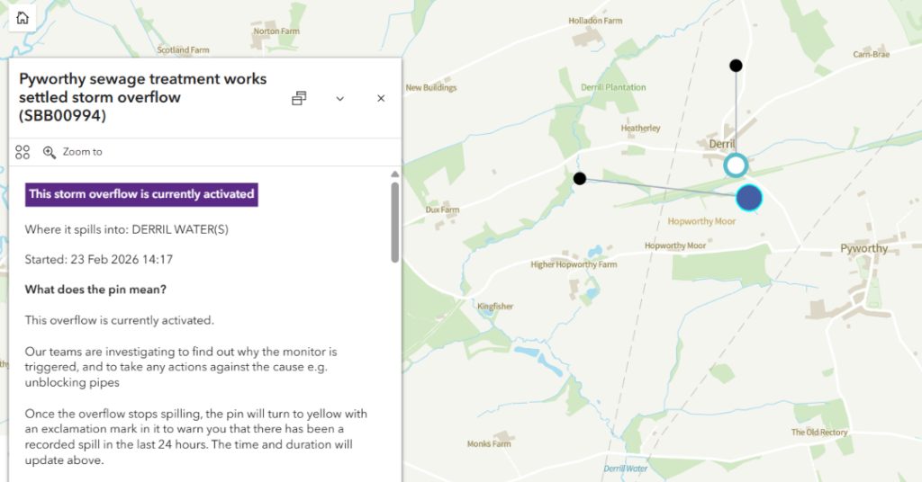
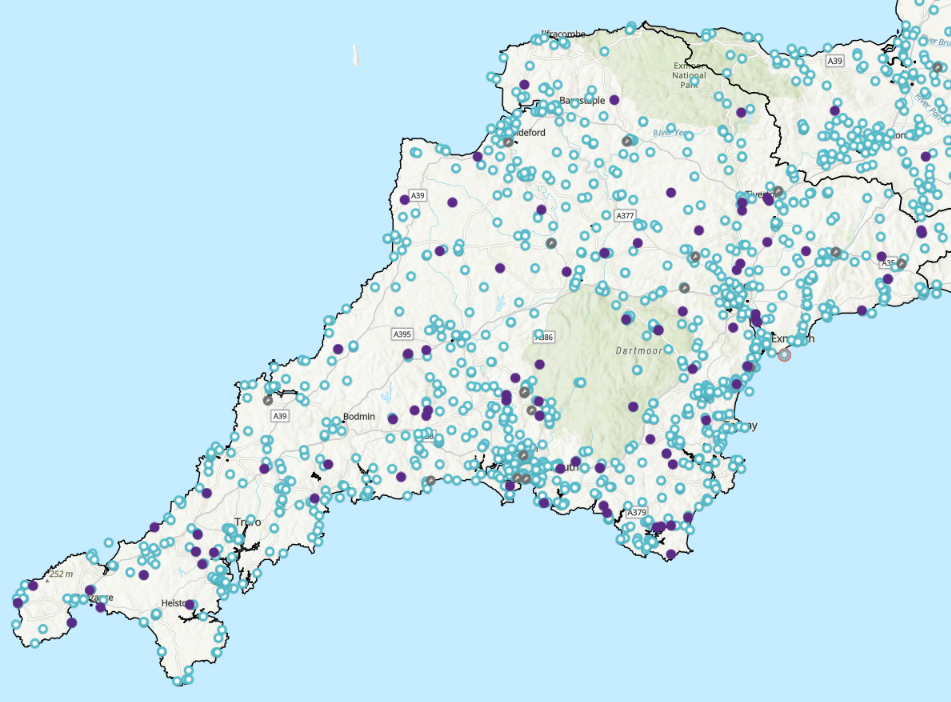
Heading inland next, here is the Water UK map of active combined sewer overflows across Devon and Cornwall, plus a few individual examples not too far from here. Up on Dartmoor the Princetown sewage treatment works has been overflowing into the Blackbrook River and thence the River Dart since January 23rd. Meanwhile at a lower level the Pyworthy sewage treatment works started “spilling” into Derrill Water and thence the River Tamar on January 26th. In addition the Shebbear sewage treatment works has been discharging into the River Torridge since January 28th:
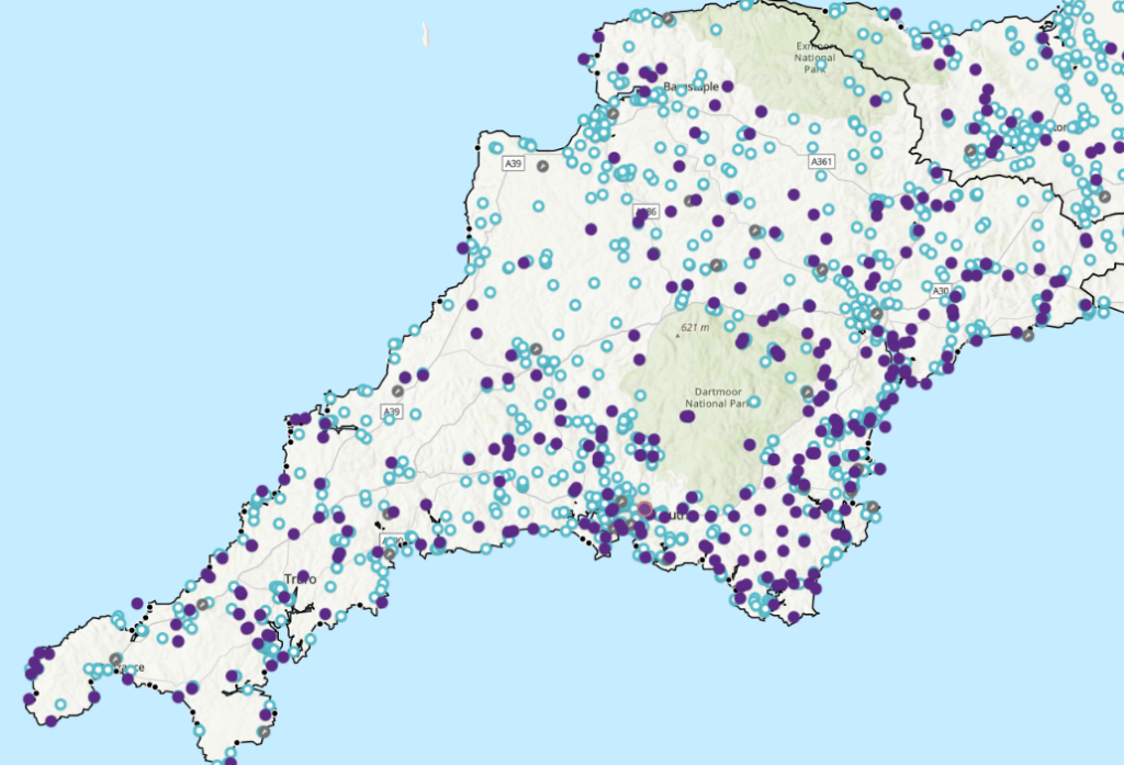
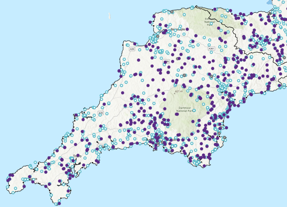
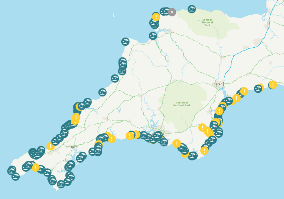
Here are today’s overview maps of active combined sewer overflows. Some improvement over yesterday can be seen:
The multi-day coastal pollution incidents at Harlyn Bay, St. Agnes and Woolacombe continue, as do the inland overflows at Princetown and Pyworthy. However, there have been all too brief respites from the overflows at Forder Valley Road in Plymouth and near Shebbear into the River Torridge:
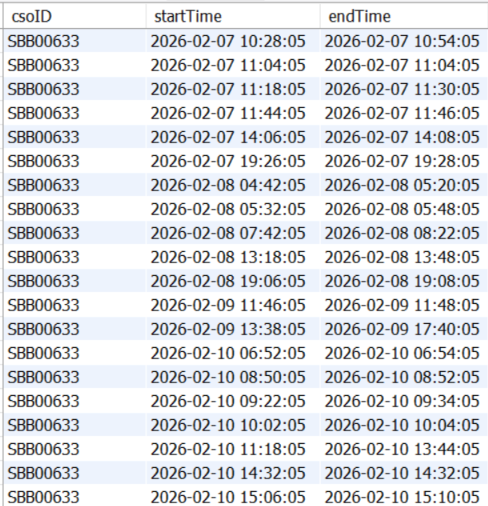
As always, South West Water’s maps only reveal the most recent sewage “spill”, and hide the fact that there has been a short hiatus in a multi-day pollution event.
[Update – February 5th]There’s been plenty more rain overnight and this morning, so the South West Water and Water UK overview maps show plenty more active sewage overflows this afternoon:
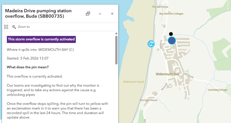
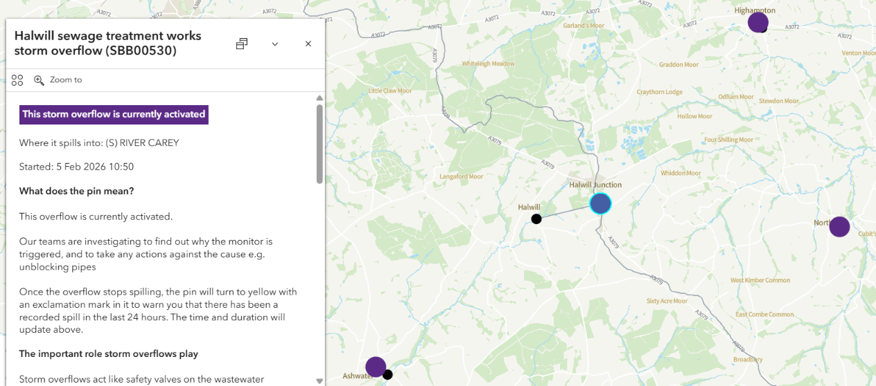
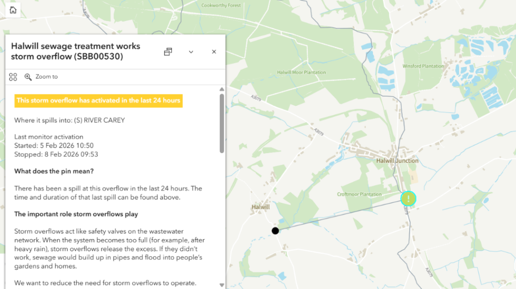
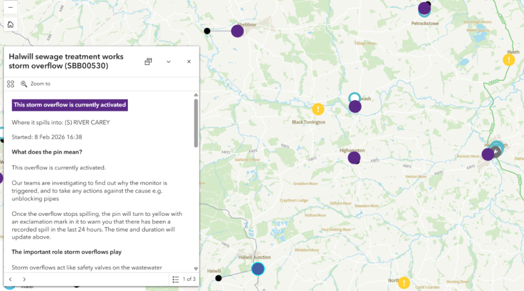
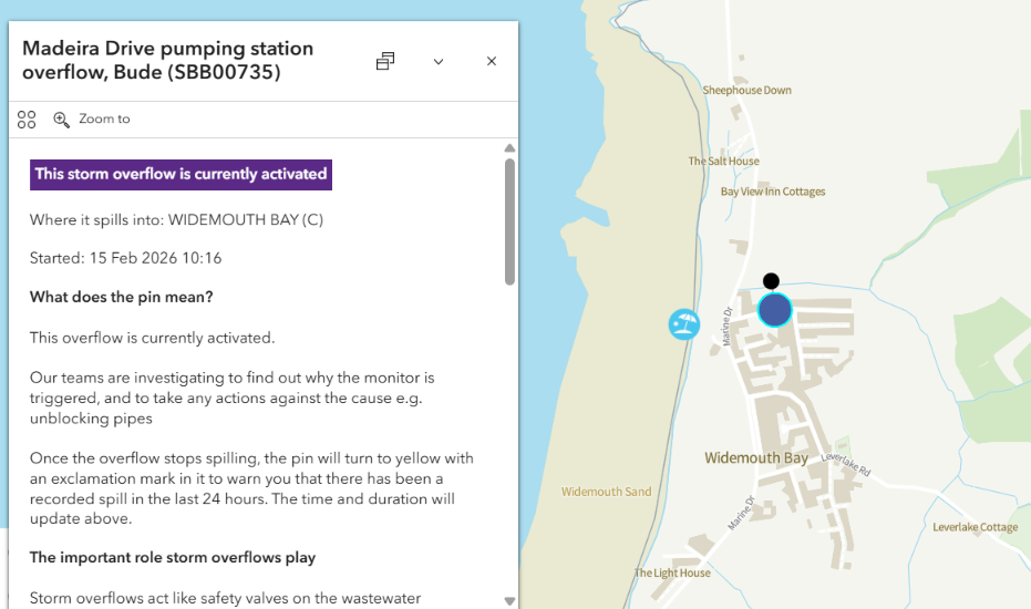
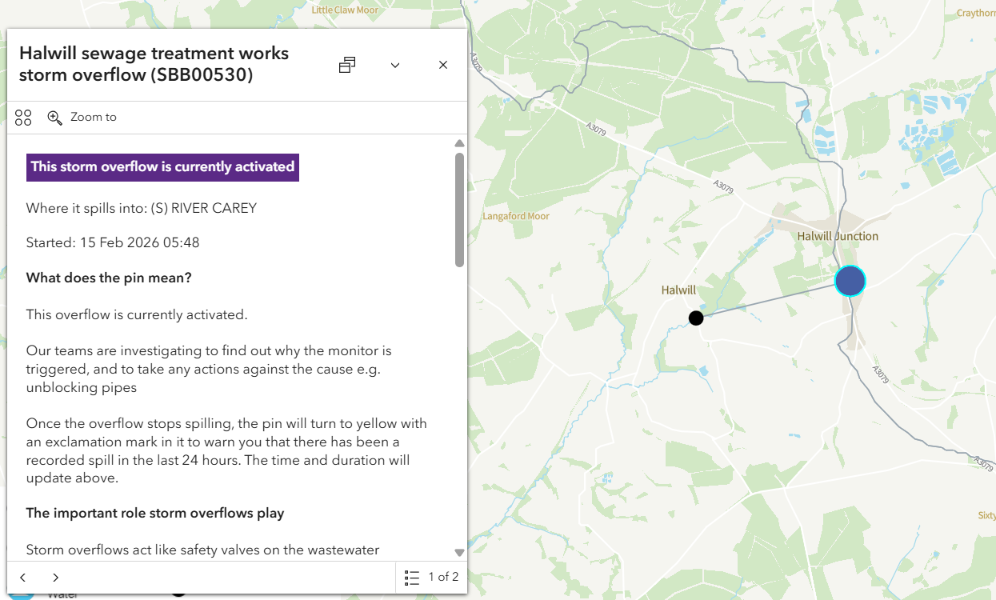
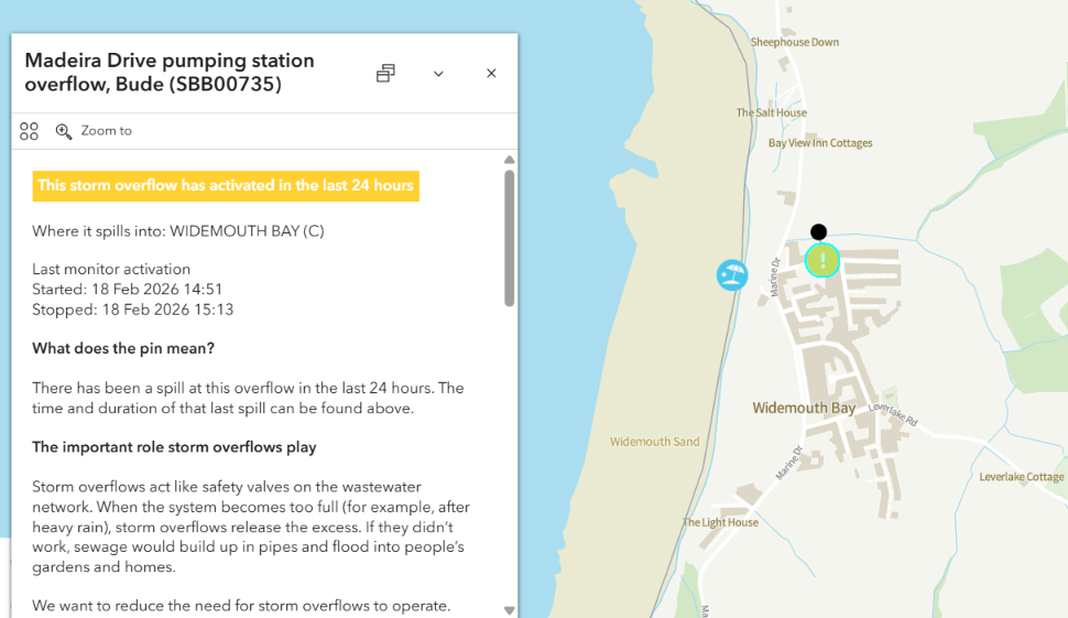
The CSO’s are currently overflowing at our local surfing beach at Widemouth Bay, and at our local sewage treatment works at Halwill discharging into the River Carey which ultimately joins the River Tamar near Launceston. The same is true of the CSO at the nearby Shebbear STW, which discharges into the River Torridge:
The South West Water and Water UK overview maps look broadly similar to yesterday:
All the assorted multi-day overflows we’ve been following are continuing today.
[Update – February 7th]Once again, it’s hard to spot a significant difference between today’s overflow maps and yesterday’s

At long last there is some reduction in the number of yellow exclamation marks on the WaterFit Live map, and purple spots on the Water UK map:
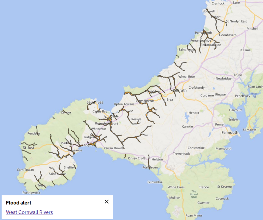
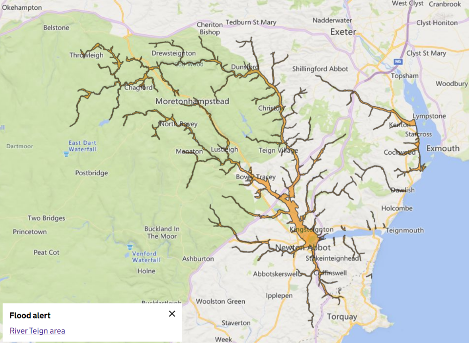
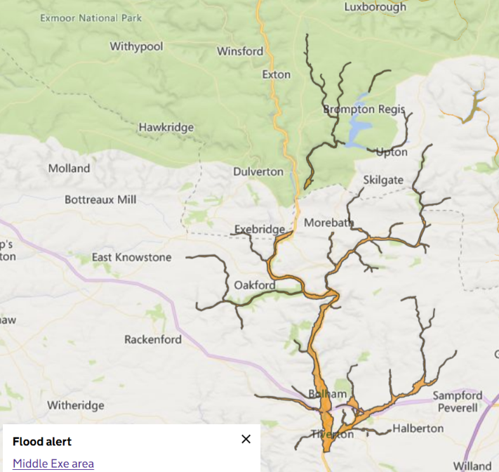
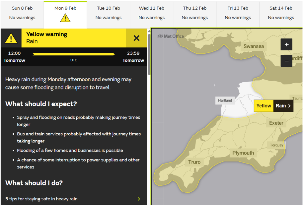
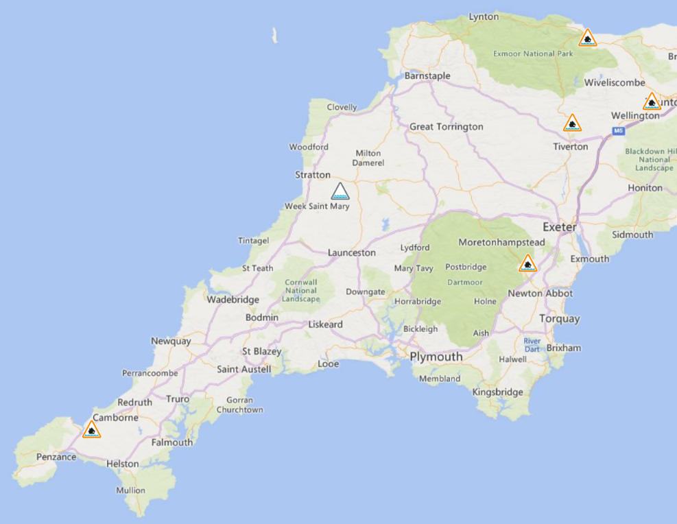
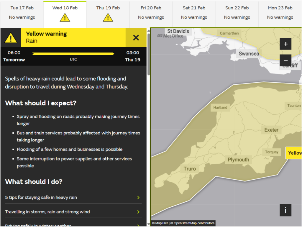
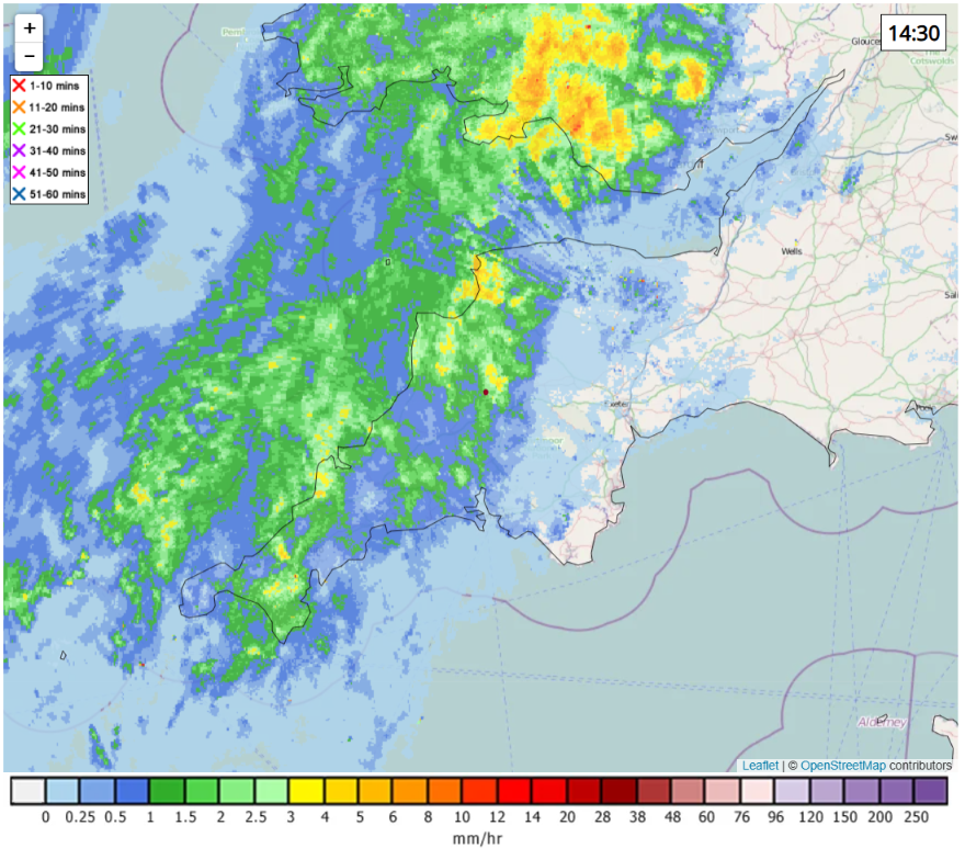
However there is a literal and metaphorical black cloud on the horizon. The Met Office has issued yet another warning for heavy rain tomorrow afternoon and evening. There are plenty of flood warnings further east, but currently the only flood alerts across Devon & Kernow are for West Cornwall rivers, the River Teign and the Middle Exe:
The multi-day overflows at Halwill STW, Widemouth Bay and St. Agnes have finished at long last:

At 10 AM this morning there was a modest improvement in the number of active sewage overflows across Devon and Cornwall:
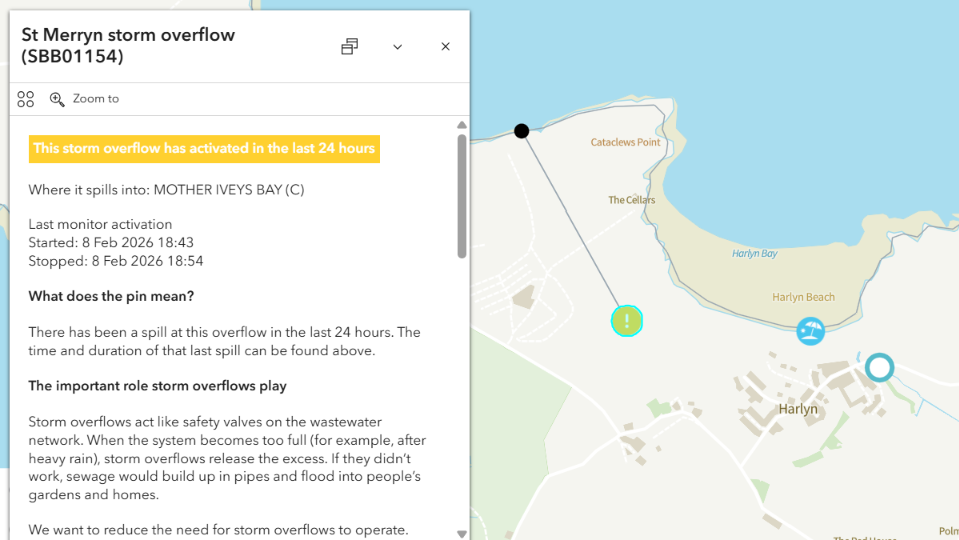
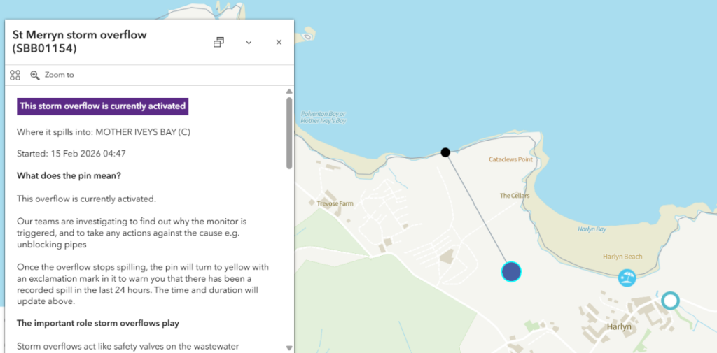
The multi-day “spill” from the St. Merryn CSO at Harlyn has finally finished. However that fact is invisible on South West Water’s web site because there has been a short activation of the overflow more recently. On the other side of the balance sheet the Halwill STW overflow is now discharging into the River Carey once again:
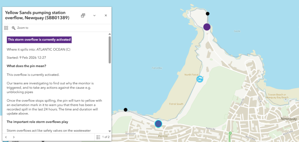
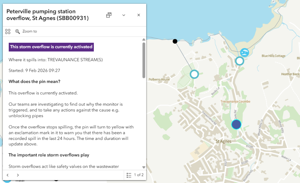
At lunchtime the forecast heavy rain has arrived, with the unfortunate side effect that the surfing beaches at Fistral in Newquay and Trevaunance Cove at St. Agnes are once again suffering from sewage pollution:
Some marginal improvements can be seen in South West Water’s coastal map and Water UK’s inland map this morning
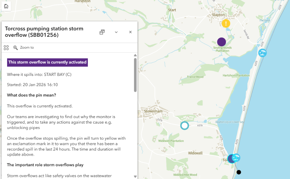
In other news the MP for South Devon, Caroline Voaden, has started a petition which “urges the government to support coastal communities affected by coastal erosion in Start Bay, including the villages of Torcross, Beesands and Hallsands, in the short and long term.”. Yesterday BBC News reported on the “coastal erosion” at Torcross as follows:
People living near a scenic coastal road that broke up and washed into the sea during stormy weather say its loss is “catastrophic”.
Parts of the A379 between Torcross and Slapton, Devon, broke apart last week after sea defences were damaged in recent storms.
The road, which has been described by local residents as “vital”, could remain shut until 2027, it emerged last week, with calls for government funding to rebuild it.
Having virtually signed Caroline’s petition I decided to take a closer look at sewage pollution along that stretch of the south coast of Devon. Here is what I discovered:

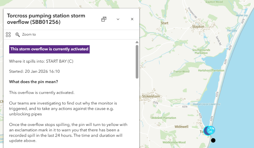
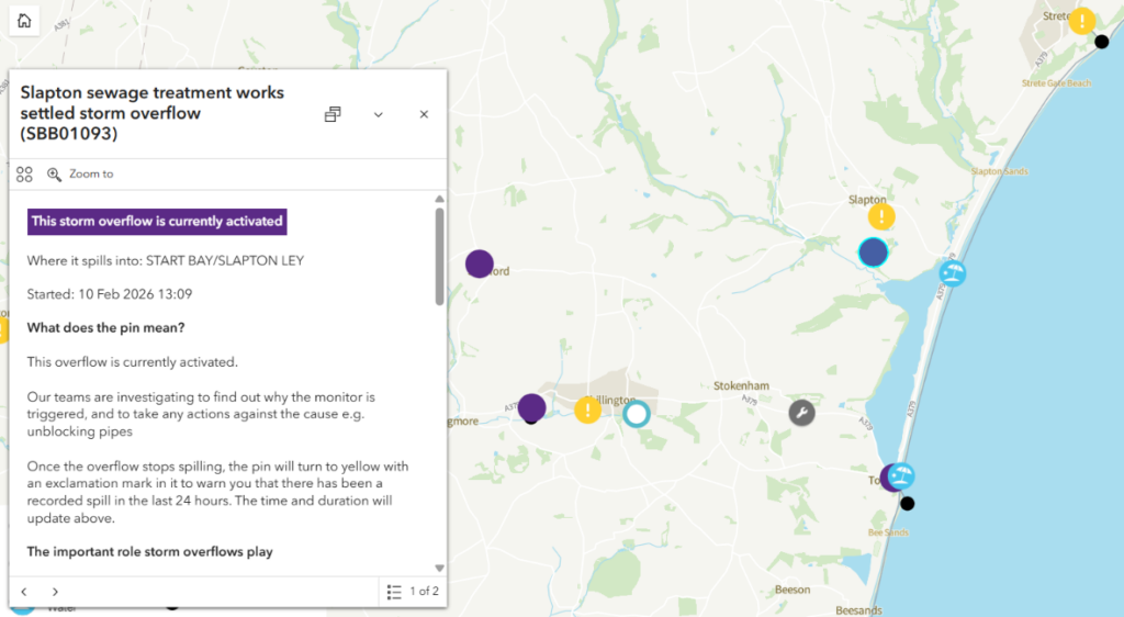
The Torcross CSO has been continuously overflowing into Start Bay since January 20th. Even more concerning is the fact that the two CSO’s in Slapton have been overflowing continuously, if intermittently, into Slapton Ley for many days. Note that according to the web site of the Field Studies Council:
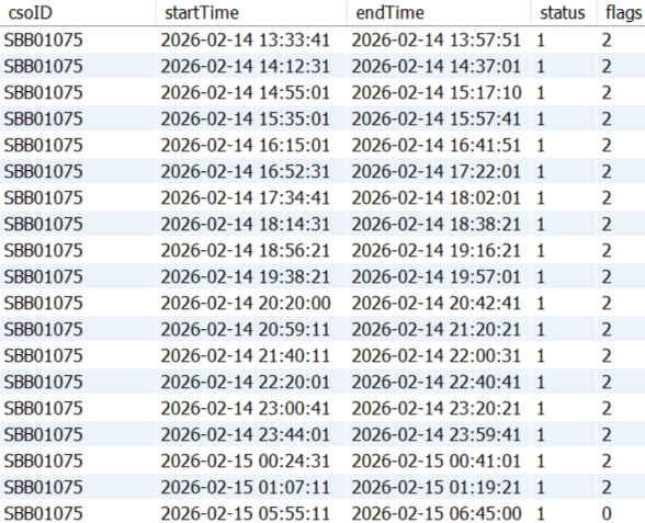
[Update – February 14th]Slapton Ley is the largest natural lake in south-west England. Although it is only separated from the sea by a narrow shingle bar, it is entirely freshwater. The lake is surrounded by reedbeds, marshes and woodland habitats.
It is a Site of Special Scientific Interest (SSSI) and was declared a National Nature Reserve (NNR) in 1993. The nature reserve is open daily and there are no entrance fees.
Shock news! This morning the sky is blue and we have a clear, if slightly hazy, view of Dartmoor for the first time in a long time!

There are also signs of some improvement on the South West Water and Water UK combined sewer overflow maps:
However the multi-day “spills” at Woolacombe, Torcross and Plymouth are continuing. So are the ones inland at Princetown, Shebbear and Pyworthy:
This morning the sky is grey rather than blue. There’s been plenty of rain overnight, with more forecast this afternoon. Consequently yesterday’s all too brief improvement in the number of active overflows has vanished:
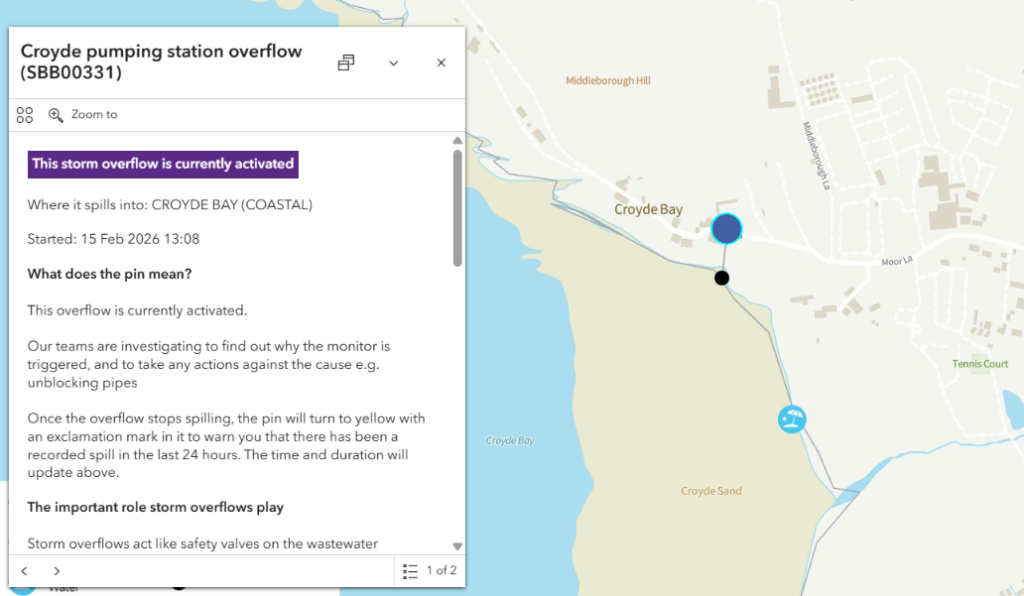
The long running overflow at Woolacombe has been joined by one just around the corner at Croyde Bay, and our local surf beach at Widemouth is suffering from pollution once again:
The sewage is also flowing into the North Atlantic at Harlyn, Mawgan Porth and St. Agnes once again, as well as at numerous other beaches.
Moving inland, Water UK’s map shows that the Pyworthy sewage treatment works has been overflowing into Derrill Water and thence the River Tamar since January 26th. Princetown sewage treatment works has been spilling into the Blackbrook River and thence the River Dart since February 4th. Further north in Torridge, the Shebbear sewage treatment works CSO activated this morning according to the Water UK map. Which hides the fact that the CSO has been overflowing into the River Torridge intermittently for several days.
This morning there is a modest reduction in the number of active overflows:
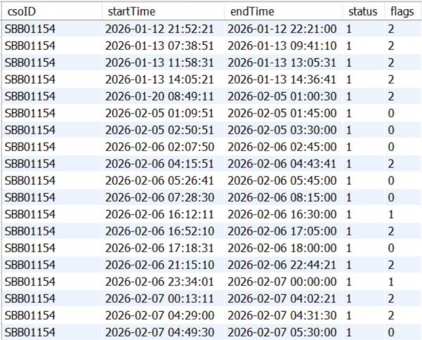
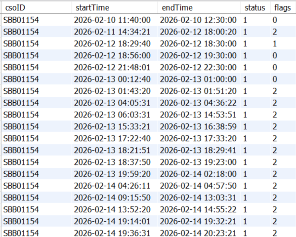
The multi-week overflows at Woolacombe, Plymouth and Torcross are continuing, and according to the maps the St. Merryn storm overflow at Harlyn has now been in operation for a day and a bit. However, our combined sewer overflow database reveals that with numerous brief gaps since February 5th the CSO has been overflowing almost continuously since January 20th:

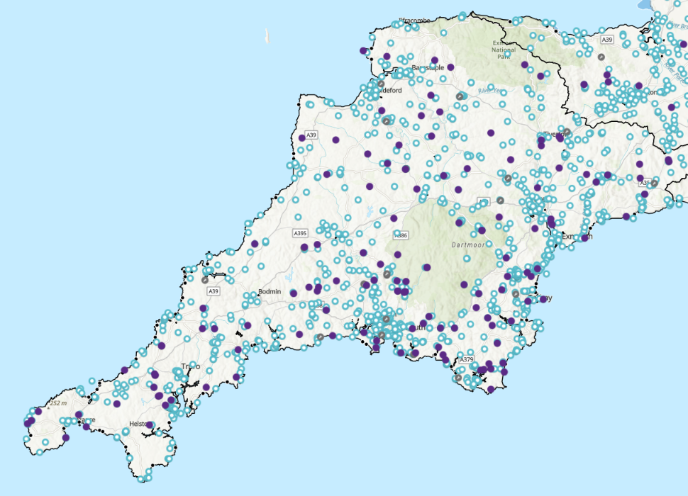
The number of active combined sewer overflows across Devon and Cornwall is gradually reducing:
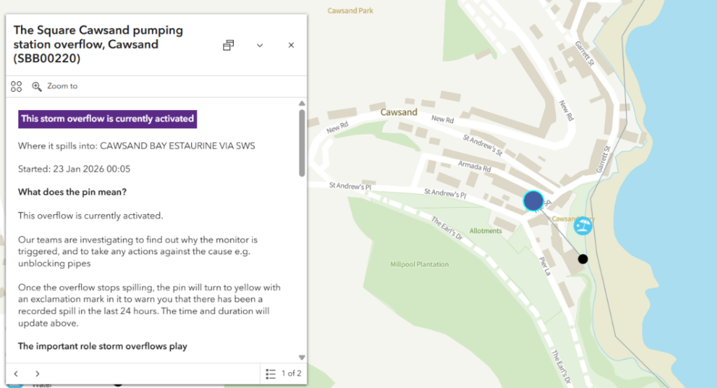
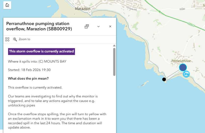
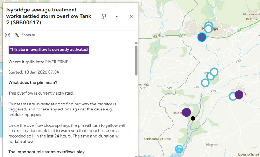
However, the multi-week sewage “spills” affecting the “bathing beaches” at Woolacombe, Torcross, Plymouth and Coastguards beach on the Erme estuary continue. Crossing the River Tamar into Cornwall, there are also ongoing multi-week active combined sewer overflows at Cawsand which started on January 23rd, Pentewan from January 10th and Perranuthnoe near Marazion from February 9th:

One bit of good news from inland is that the overflow from the Princetown STW that began on February 4th ended earlier this morning. However the long running “spill” at Pyworthy continues, as do the local multi-day CSO activations at Shebbear and Halwill:

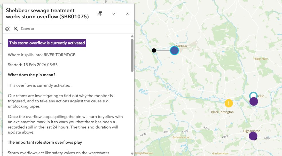

Needless to say the West Devon Free Press combined sewer overflow database reveals that with brief gaps the latter two have also been operating continuously for several weeks.
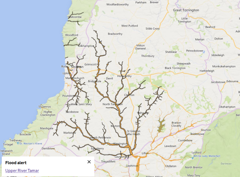
The Met Office have issued a weather warning for more rain tomorrow, and the Environment Agency have issued a flood alert for the Upper River Tamar, but not yet for the River Torridge:
The forecast rain has arrived, and as a consequence the active CSO count has increased once again:

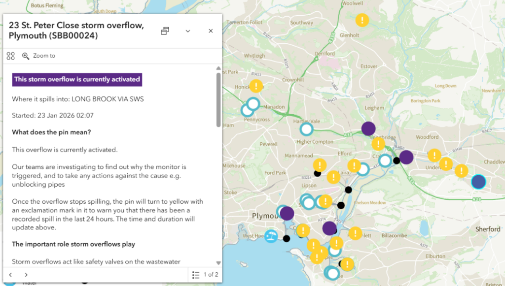
All the multi-week overflows mentioned above have continued for another day. Widemouth Bay has experienced numerous combined sewer overflow activations overnight and this morning. Princetown STW is active once again, and the majority of the CSOs in Plymouth have been busy today as well:

The blue flagged beaches of North Devon and North Cornwall are finally free of ongoing sewage pollution for the first time in a very long time. The same does not apply further west and along the south coast!
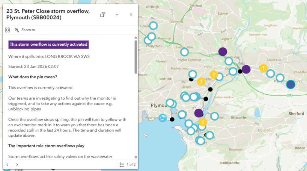
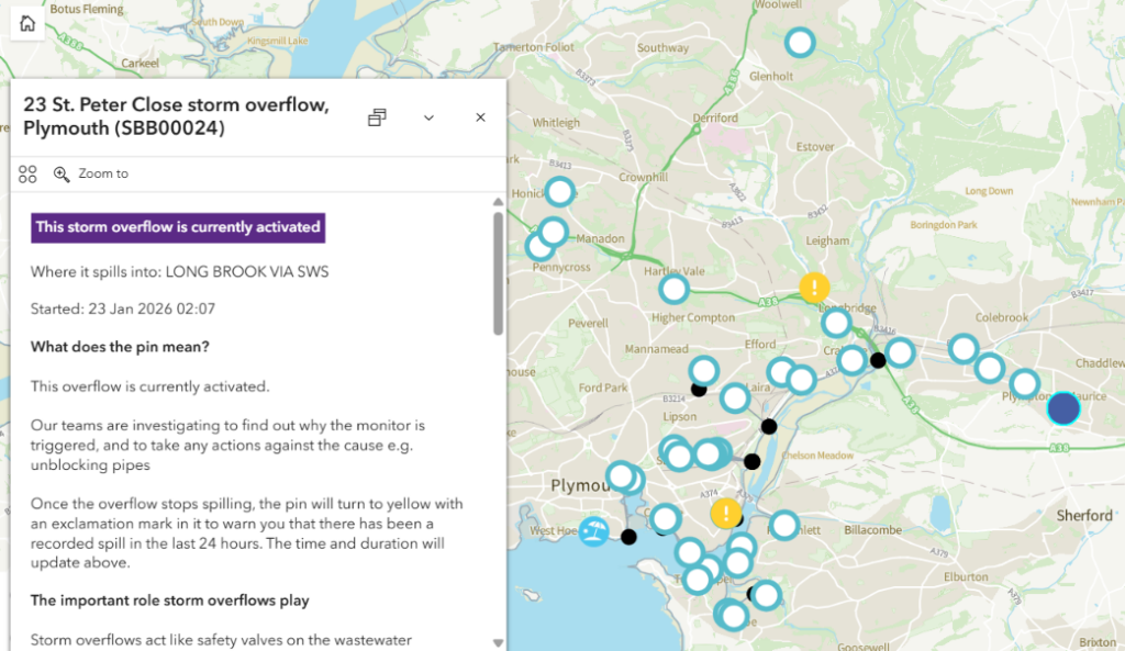
The multi-week overflow at Woolacombe finally came to an end yesterday evening. The “spill” at Mounts Bay was interrupted briefly on February 18th, but has since restarted. The pollution of the River Plym continues, although the number of recently active CSOs across Plymouth is much reduced:
There has been a modest reduction in the number of active overflows over the last 2 days:
However, Widemouth Bay is back on the map once again with a sequence of activations today. The multi-week sewage “spills” into the St. Austell River, the River Erme and the River Plym continue:

The number of active combined sewer overflows across Devon and Cornwall is gradually reducing:

Along the coast the multi-week “spills” at St. Austell, Perranuthnoe and Plymouth continue. Inland the long running CSO activation at Pyworthy paused briefly yesterday, but it is operating again today:

The SWW and Water UK maps show further reductions in the number of active CSOs. However, another band of heavy rain is currently crossing the West Country:
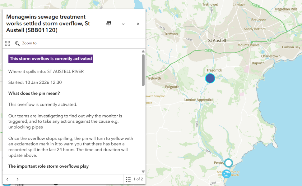
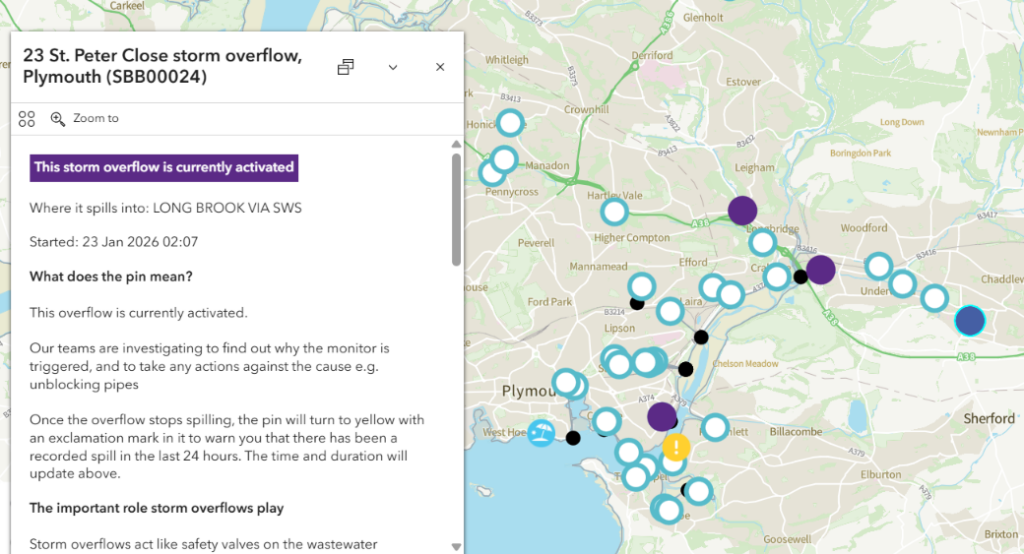
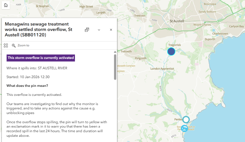
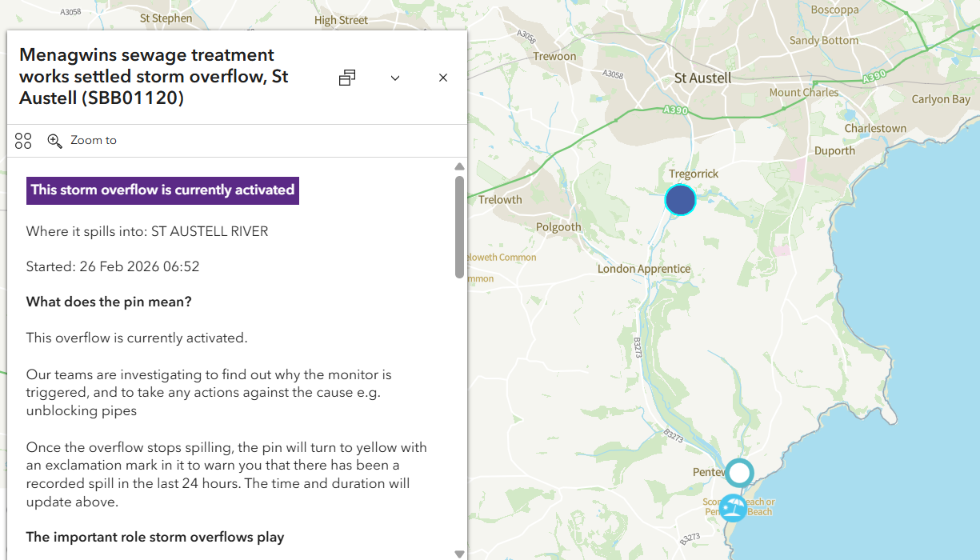
This morning’s WaterFit Live map suggests that the Menagwins sewage treatment works in St. Austell has been overflowing into the St. Austell river for only a few hours. However, the West Devon Free Press combined sewer overflow database reveals that with two brief gaps it has actually been operating continuously since January 10th:

The multi-week CSO activations at Mounts Bay and Plymouth continue.
To be continued…