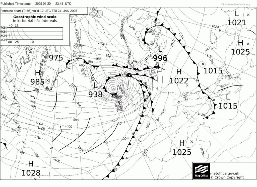
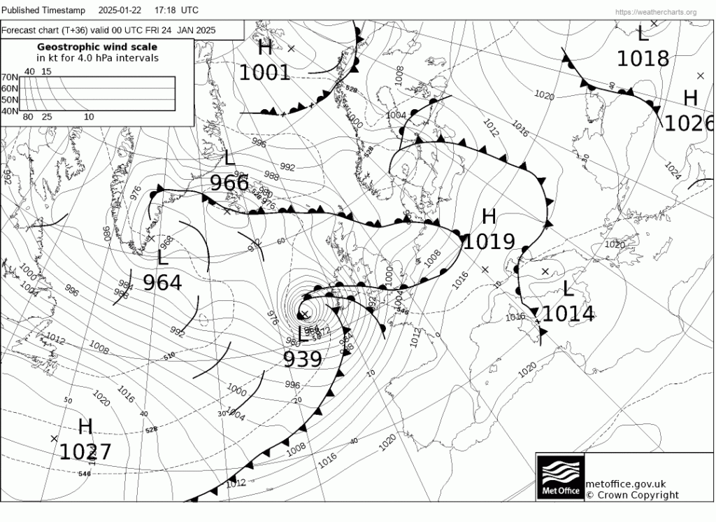
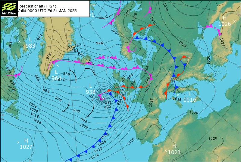
I’ve been looking at the UK Met Office’s forecast charts for the coming weekend, and this one issued at noon yesterday shows a very strong storm arriving north of Ireland on Friday morning:
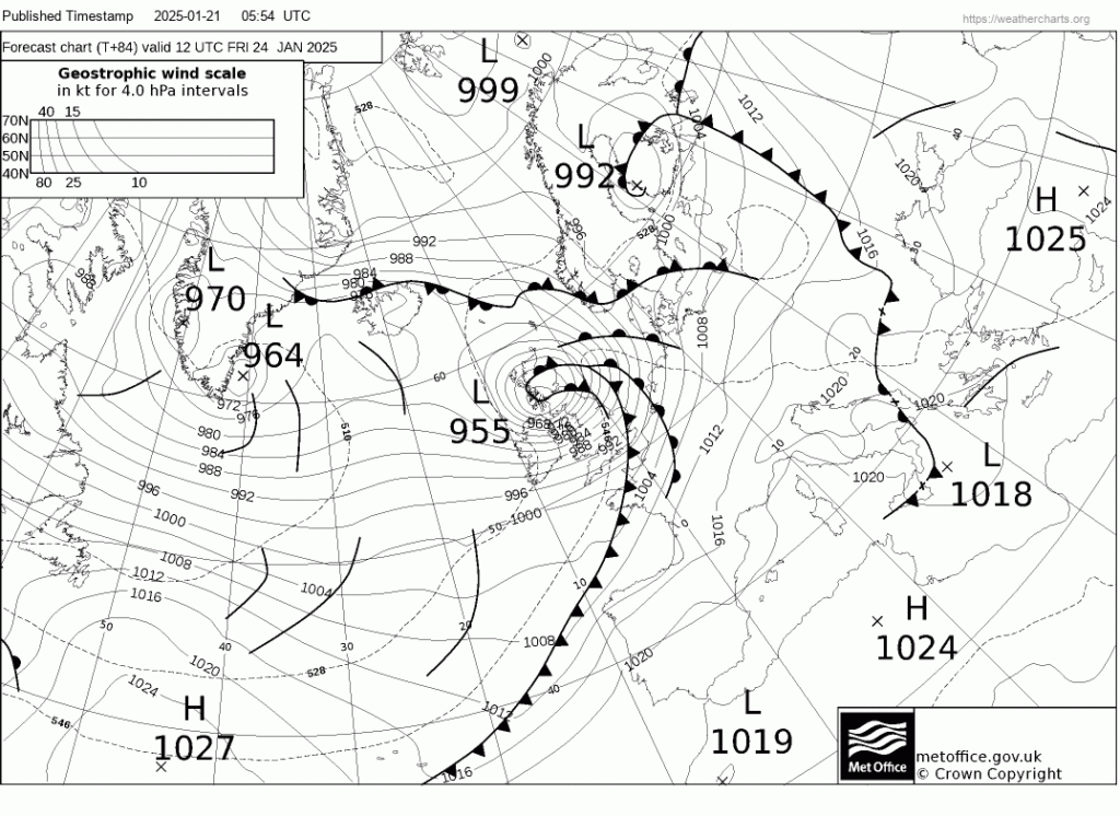
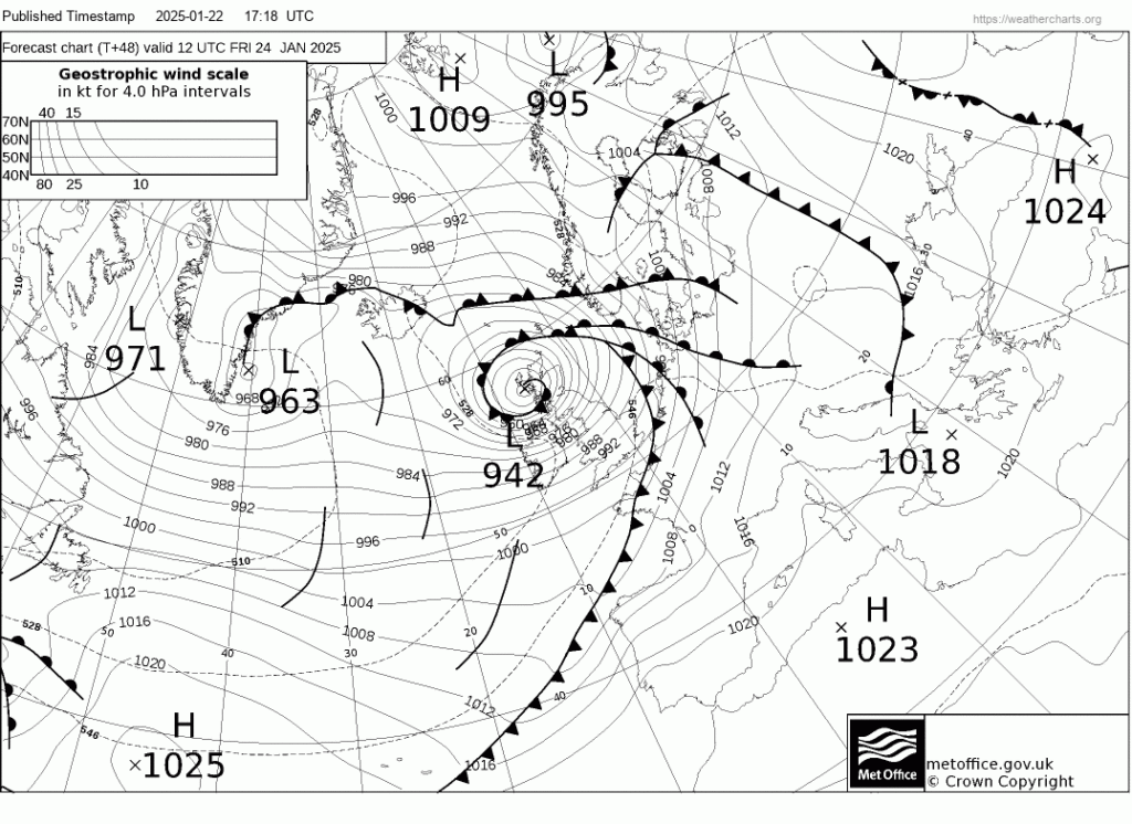
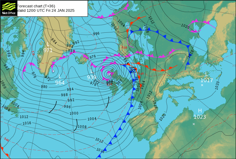
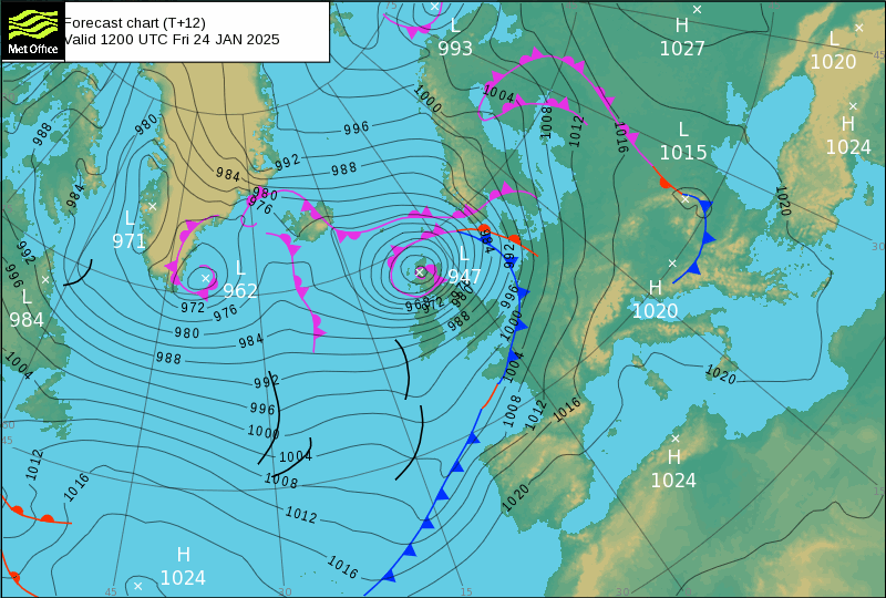
Twelve hours later the Met Office’s model concluded that the storm will have reached Scotland by noon on Friday, albeit with a less extreme central pressure:
Expect further changes by the time the storm arrives on this side of the North Atlantic. Currently the weather here is calm, misty and frosty. However, that is not going to last for long!

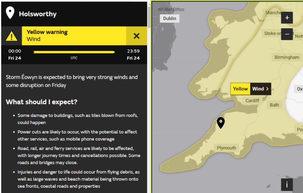
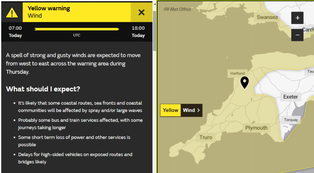
P.S. Storm Éowyn has now been officially named, and the Met Office has issued a yellow warning for strong winds across Devon and Cornwall starting at midnight on Thursday:
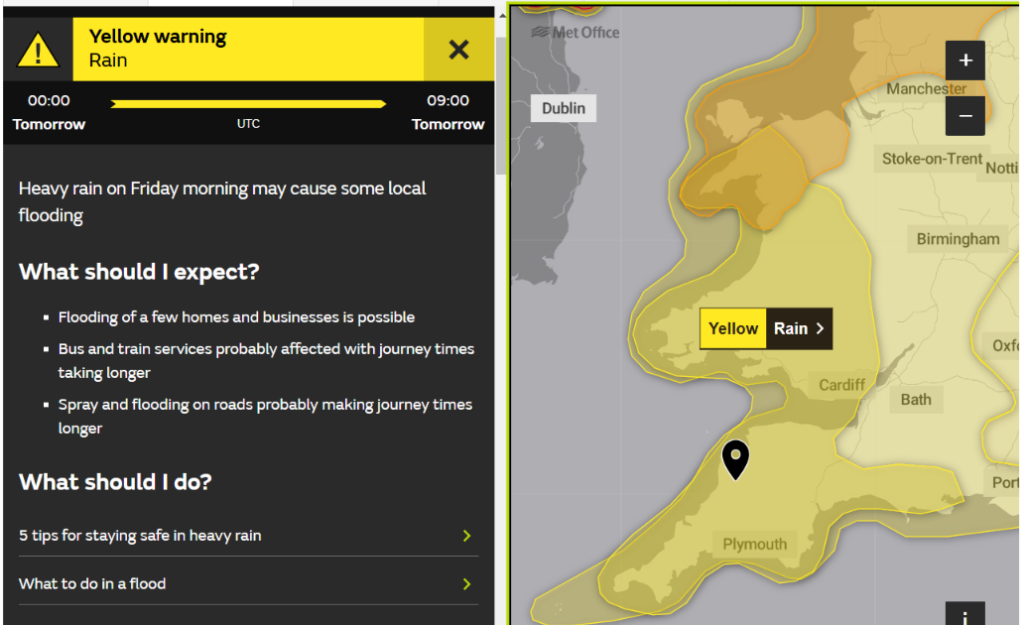
A yellow warning for heavy rain early on Friday from the weather fronts associated with Storm Éowyn has been added to the previous warning for high winds:
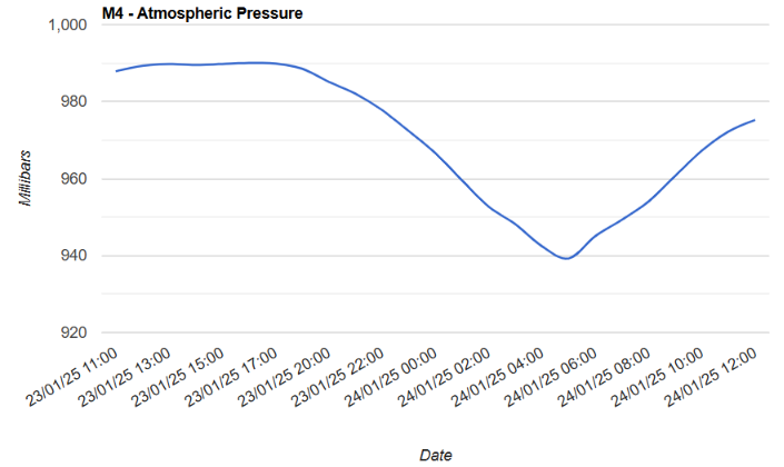
The latest Met Office surface pressure forecast charts show Éowyn’s central pressure dropping below 940 hPa on Friday:
Storm Éowyn is still out in the North Atlantic, but the Met Office has issued a warning for high winds across Cornwall and much of Devon today.
The latest Met Office surface pressure forecast charts still show Éowyn’s central pressure dropping below 940 hPa tomorrow:
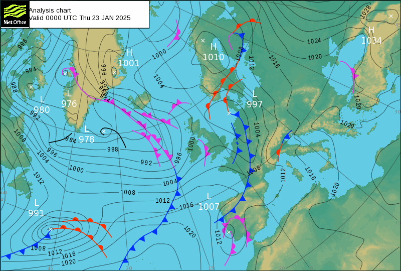
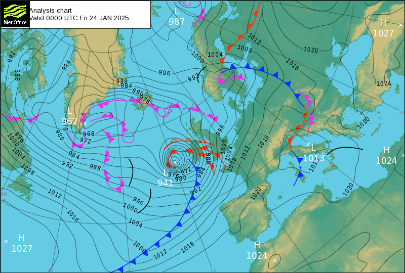
The surface pressure charts on the main Met Office web site show Storm Éowyn’s central pressure dropping to 941 hPa at midnight last night and increasing by noon:
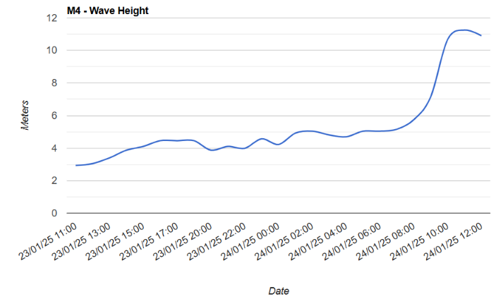
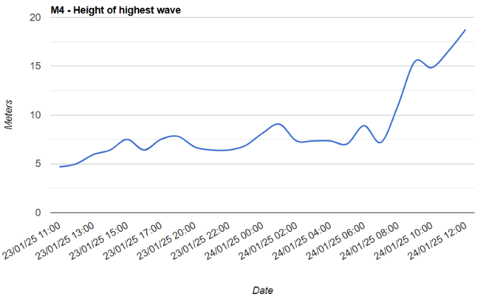
However, the M4 wave buoy anchored off the north-west coast of Ireland recorded surface pressure below 940 hPa at 5AM, as well as some very large waves!
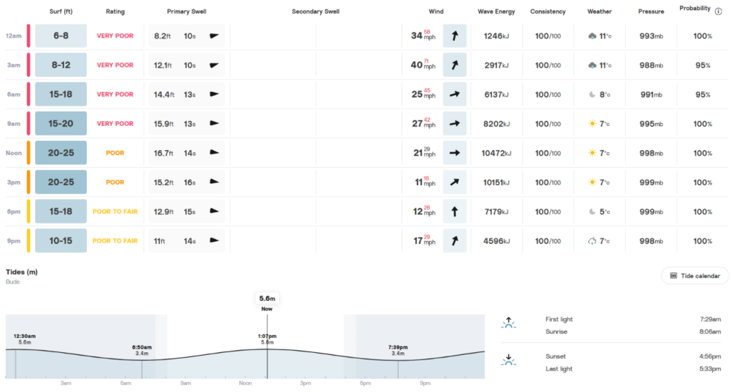
There have also been some large waves arriving on the north coast of Cornwall. This is today’s surf forecast for Widemouth Bay:
The strongest wind gusts recorded in the West Country during the passage of Storm Éowyn last night were 76 mph on the Isles of Scilly, followed by 69 mph in Plymouth:
National Grid Electricity Distribution have reported this morning that:
[Update – January 26th]As of 10am, 2,543 homes and businesses are without electricity across our South Wales and South West regions due to Storm Éowyn.
The Environment Agency has issued a red flood warning for the lower River Torridge from Dolton to Bideford, plus amber alerts for other rivers in the region:
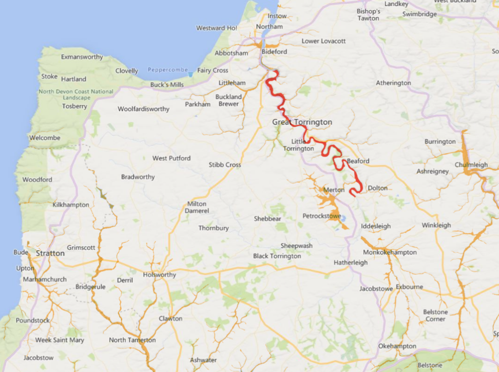
Over the last 24 hours we have seen heavy rainfall in the North Devon area. This is now causing the River Torridge to rise and the river is forecast to continue rising through the day.
Properties and low lying areas in Taddiport (properties around Taddiport Bridge, Sewage Treatment Works and B3227) and Weare Giffard (riverside properties and roads), will start to flood first from around 5:00pm on Sunday. River levels will be at their highest between 5pm and 9pm.
The level of the River Torridge at Dolton rose above 2.8 metres at 16:30. According to the EA:
Property flooding is possible above this level.

To be continued…