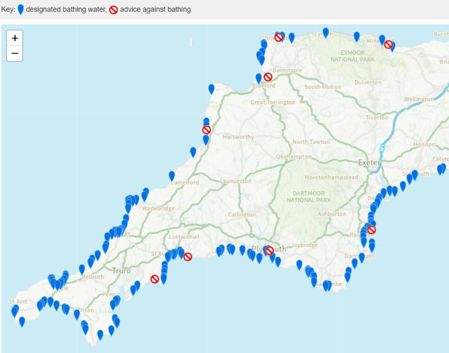
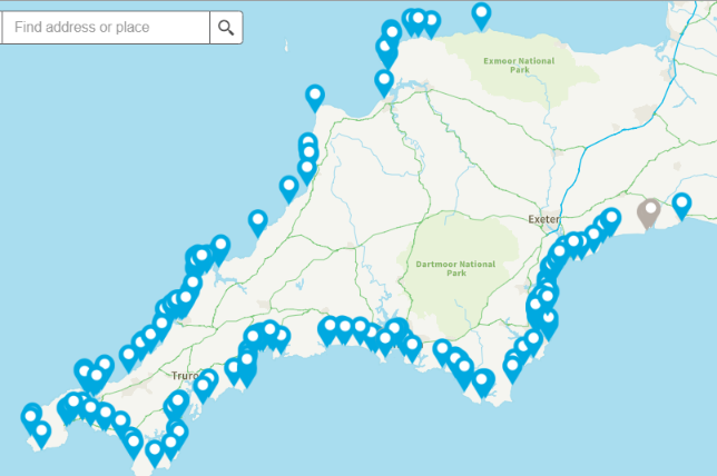
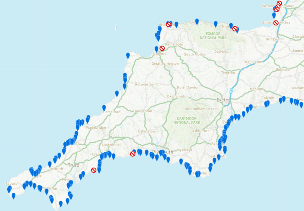
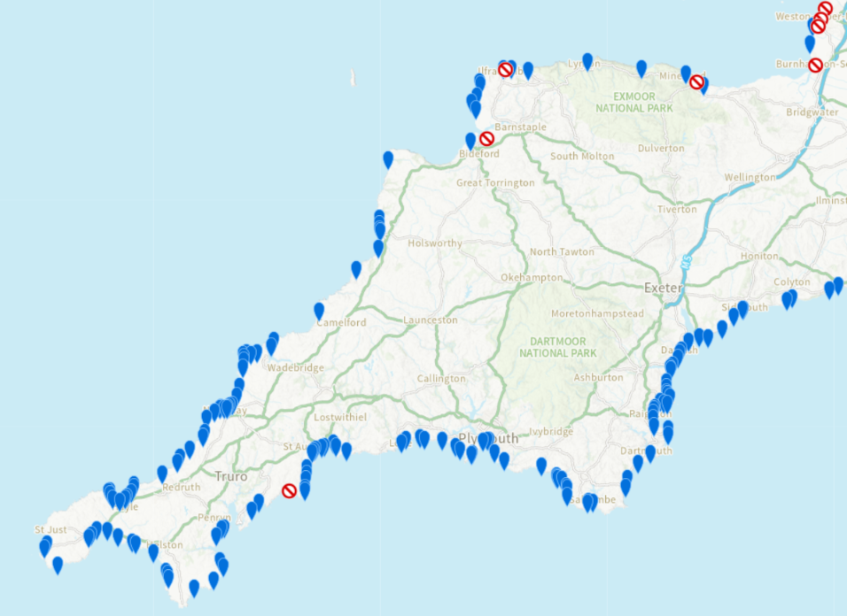
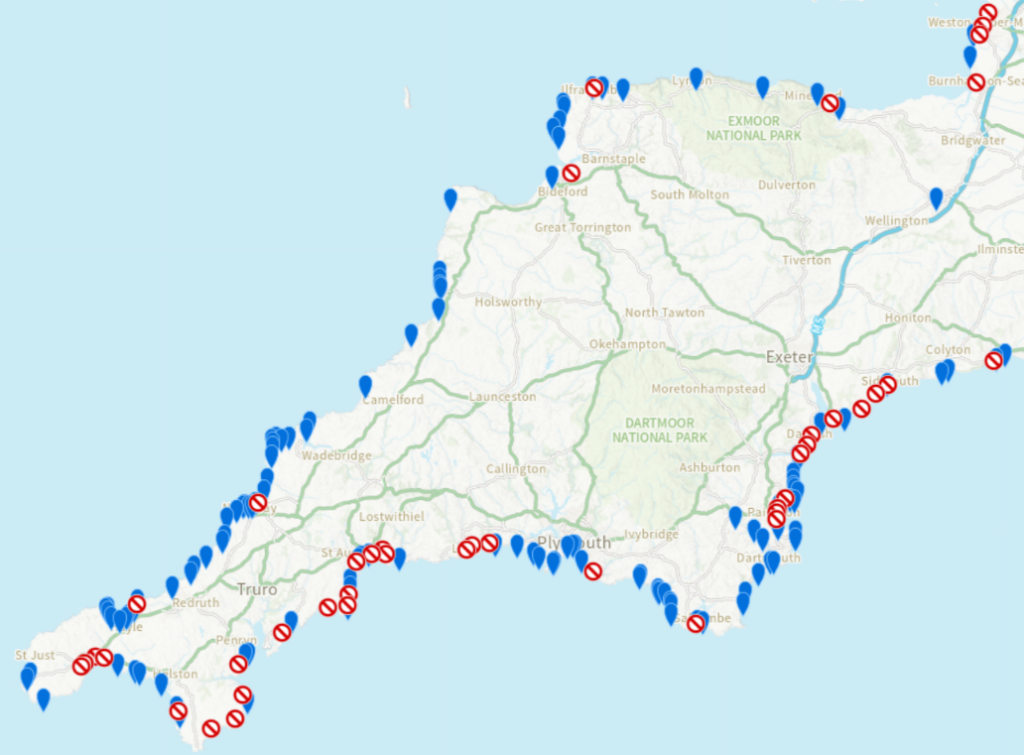
The May bank holiday is rapidly approaching, RNLI lifeguards are now patrolling the beaches of Devon and Cornwall and the Environment Agency has started issuing pollution risk warnings for designated bathing beaches. Here’s how their map looks today:
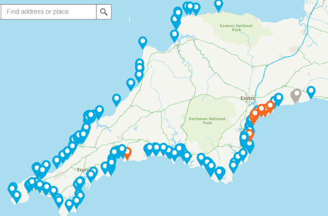
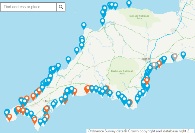
Here too is today’s WaterFit Live map from South West Water:

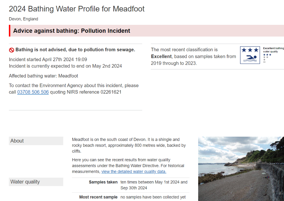
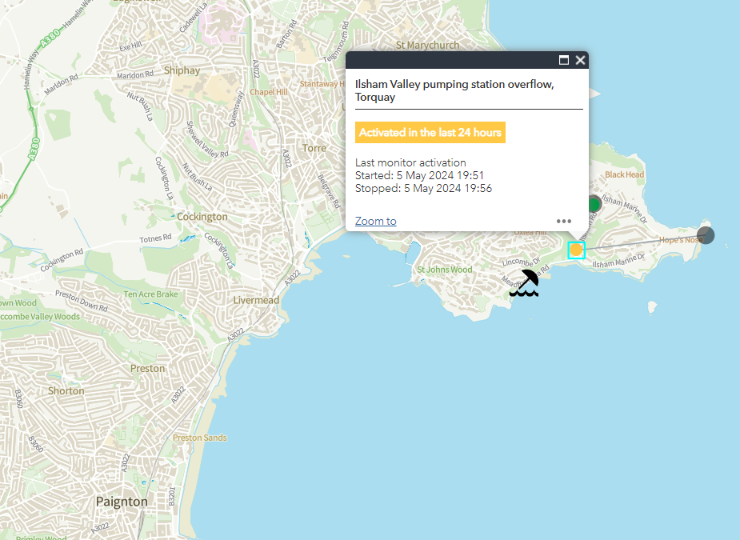
Meadfoot beach in Torbay isn’t “red flagged” on SWW’s map, but according to the Environment Agency there has been a sewage pollution incident affecting the beach today:
Here is this morning’s WaterFit Live map:
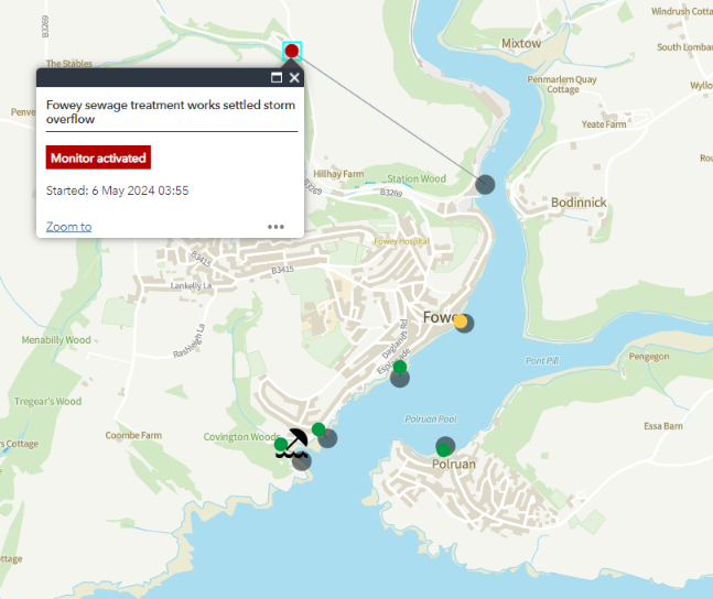
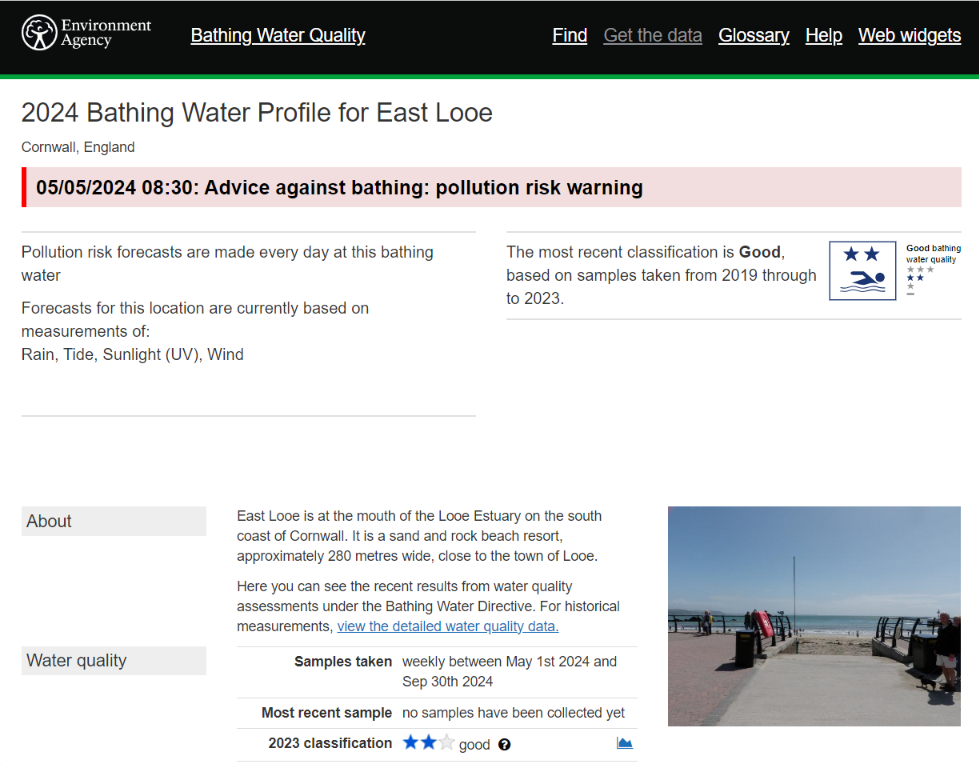
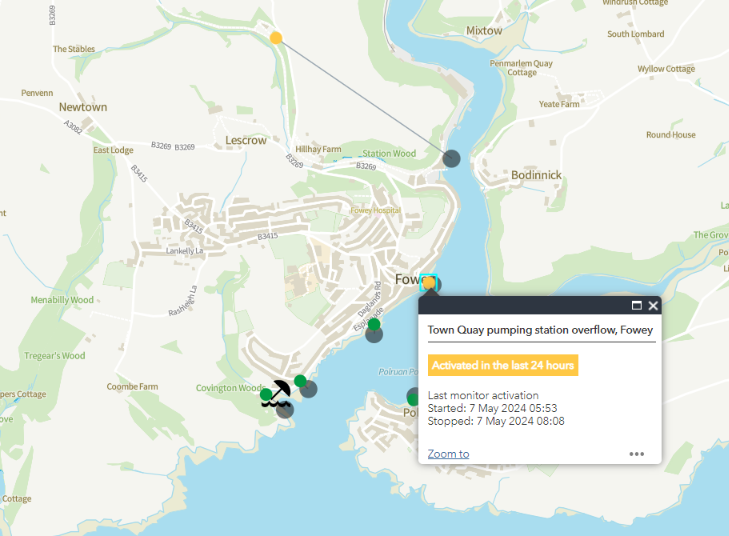
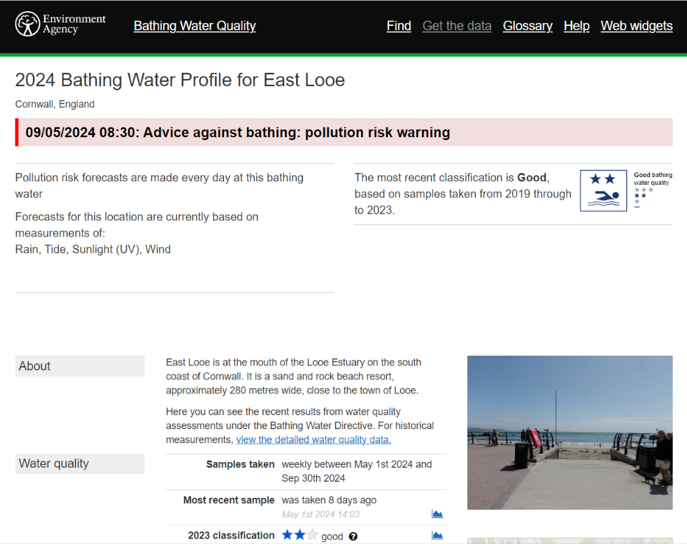
Currently there is an ongoing sewage pollution incident at Fowey, and a pollution risk warning for East Looe:
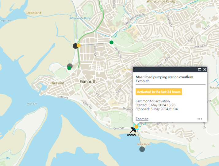
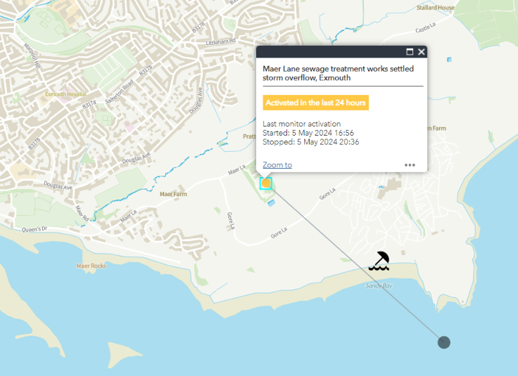
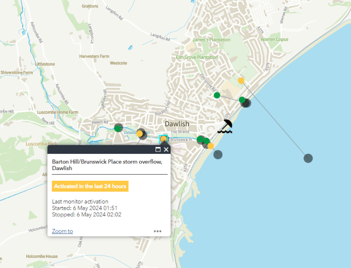
Sewage pollution incidents have taken place over the last 12 hours at Dawlish, Budleigh Salterton, Exmouth and Meadfoot Beach in Torbay:
This morning’s WaterFit Live map is still not empty of “red flags”:

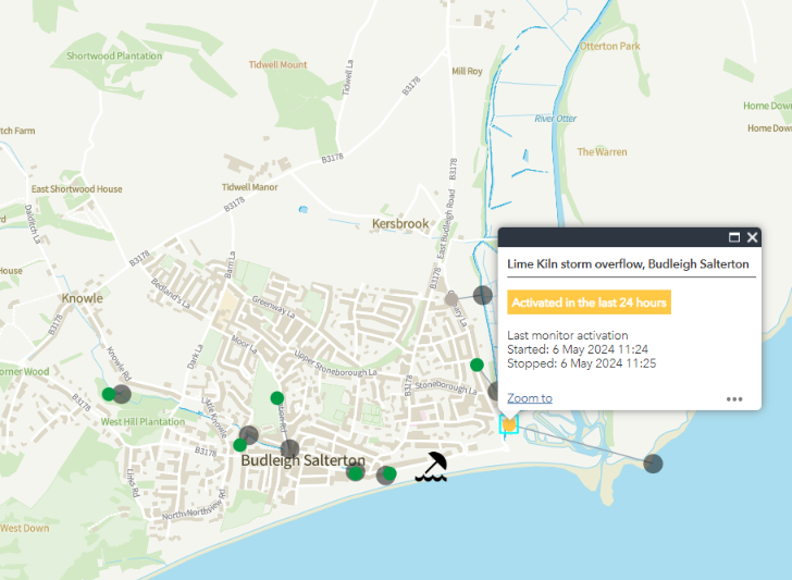
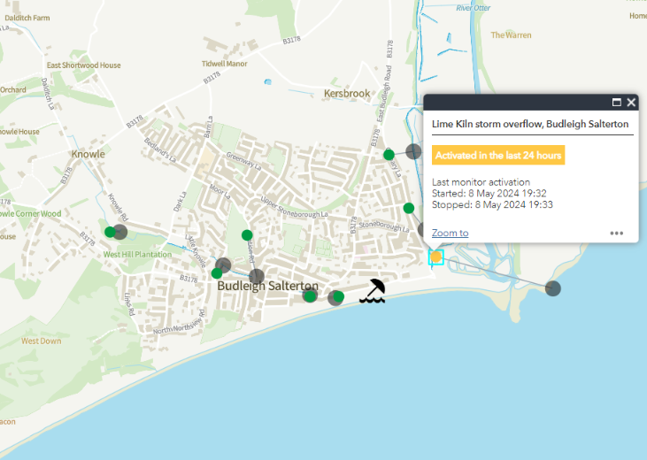
There have been recent “spills” at Fowey and Budleigh Salterton:
This evening’s WaterFit Live map is empty of orange pushpins once again:
What’s more the Environment Agency’s SwimInfo map only red flags beaches with permanent “advice against bathing” notices:

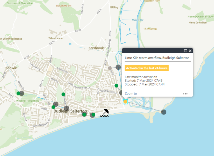
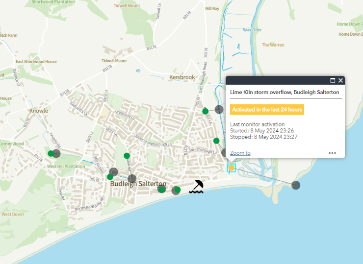
However at Budleigh Salterton the periodic 1-2 minute bursts of activity at the Lime Kiln CSO continue, without being visible on the overview map
This morning’s WaterFit Live map is clear once again, but the SwimInfo map shows a pollution risk warning for East Looe:
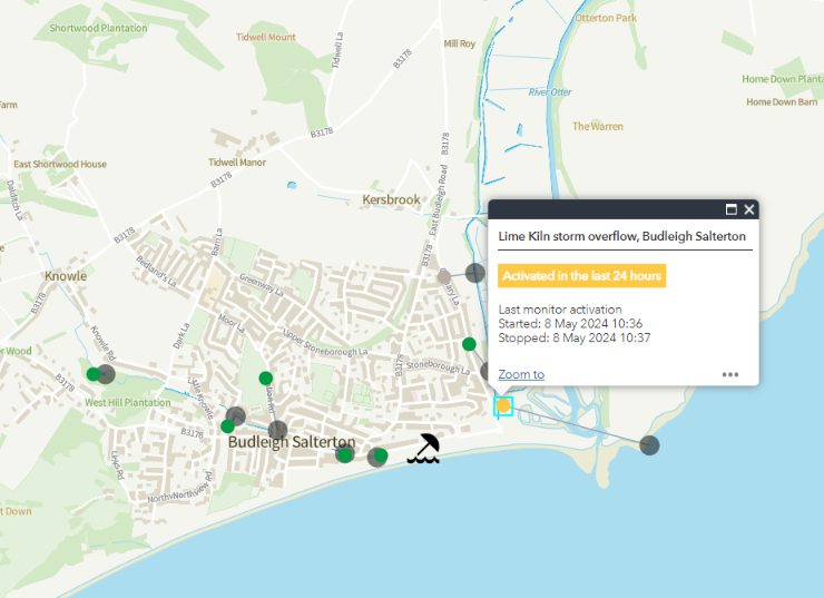
The periodic bursts of activity of the CSO monitor at Budleigh Salterton continue.
For the first time in a very long time there are no “pollution risk” or “sewage pollution” warnings on any of the South West Water, Environment Agency or Surfers Against Sewage maps:
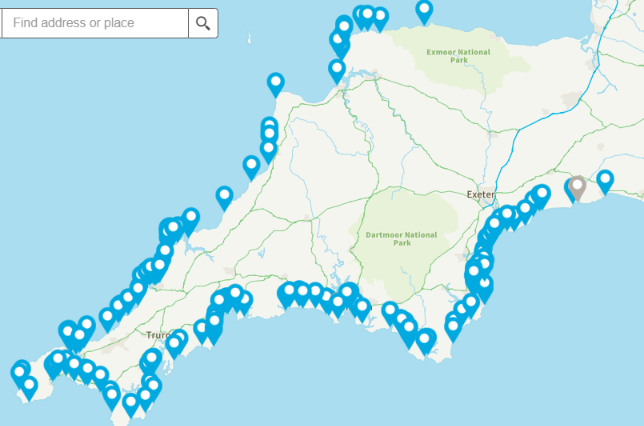
Apart from the permanent “advice against bathing” warnings at Wildersmouth, Instow and Porthluney:


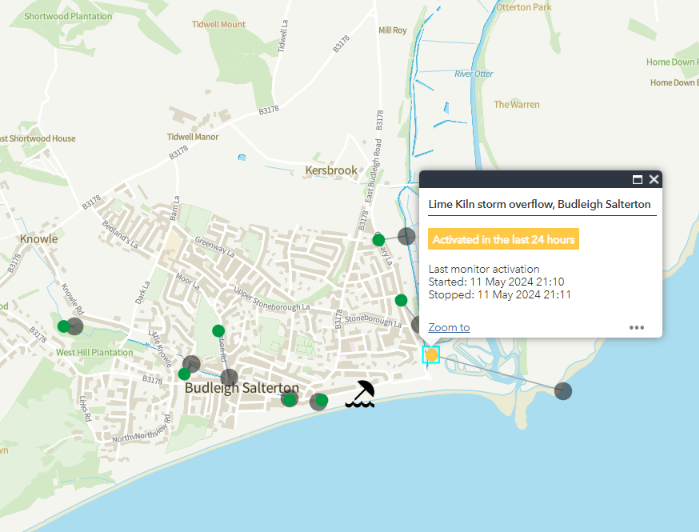
And the continuing brief CSO activations at Budleigh Salterton!
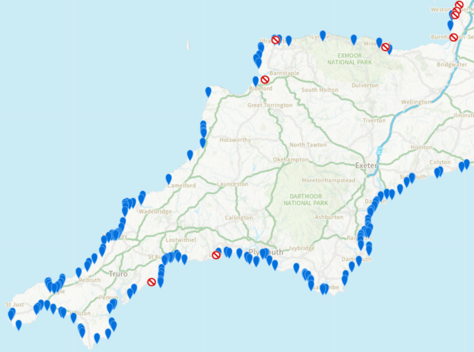
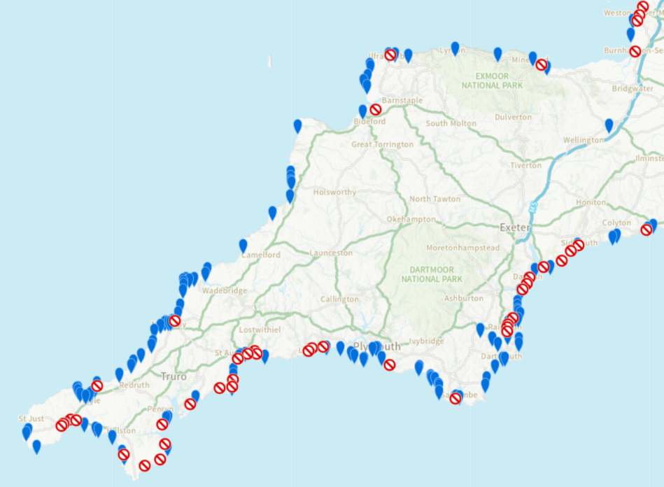
[Update – May 13th]The very brief sewage pollution hiatus was, of course, too good to last. There’s been some rain today:
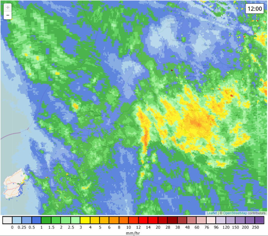
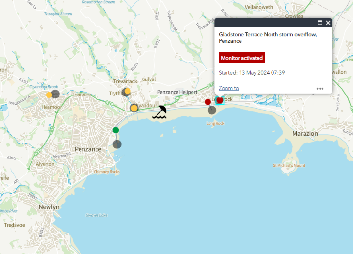
Consequently there are now pollution risk and sewage pollution warnings all along the south coast and on the north coast of West Cornwall:
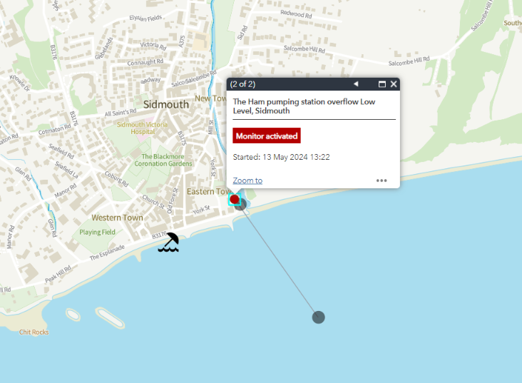
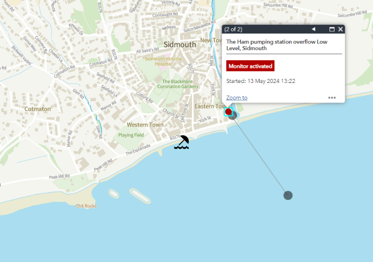
Starting with some of the usual suspects on the south coast of Devon, there are ongoing sewage pollution incidents at Sidmouth, Exmouth, Meadfoot beach in Torbay and Plymouth:


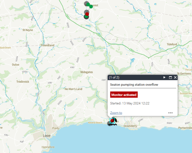
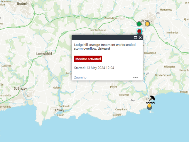
On the south coast of Cornwall there are ongoing sewage pollution incidents at Seaton, East Looe and Long Rock in Penzance. Plus a multi-hour “spill” at Pentewan that has recently finished:

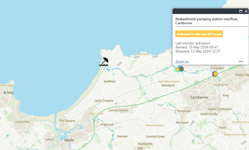
Heading around Lands End to the north coast of Cornwall there is an ongoing sewage pollution incident at Porthkidney beach near St. Ives, and multi-hour “spills” at Porthcurno, Godrevy/Gwithian and Portreath:


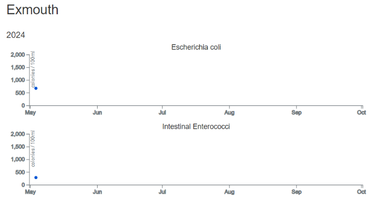
The Environment Agency has begun weekly water quality testing of bathing water samples from beaches around the West Country.
Elevated levels of Escherichia coli and intestinal enterococci have been found at Exmouth, Dawlish and Par Sands.


This morning there are still numerous beaches where the Environment Agency has issued an “advice against bathing” due to a “pollution risk”. Along the south coast there are also still several warnings due to sewage pollution during the last 12 hours.

There are currently ongoing sewage pollution incidents at Sidmouth and Seaton in East Devon:

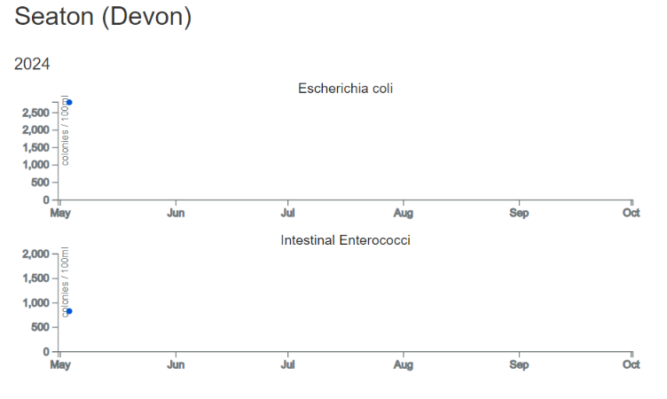
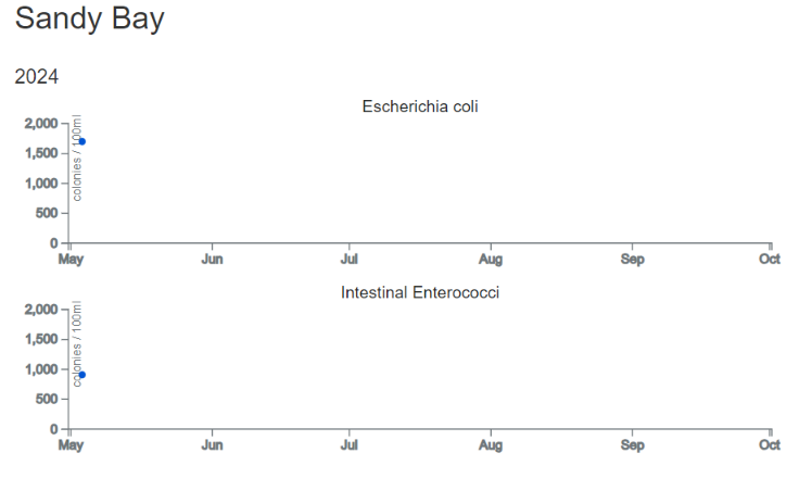
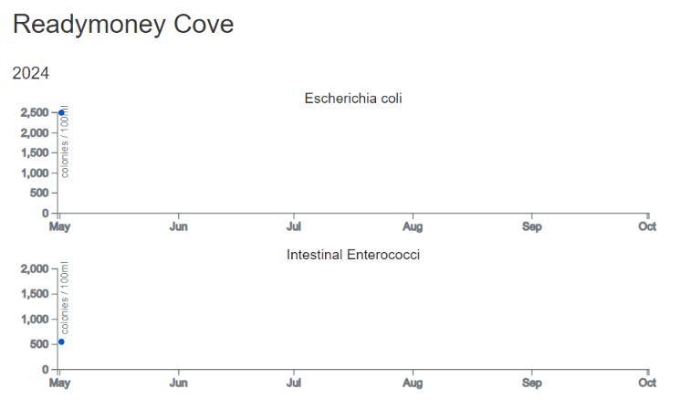
Here are a few more beaches where elevated levels of E. coli and intestinal enterococci were found in the first round of water quality tests in 2024:
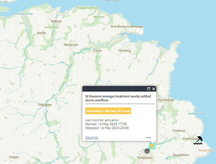
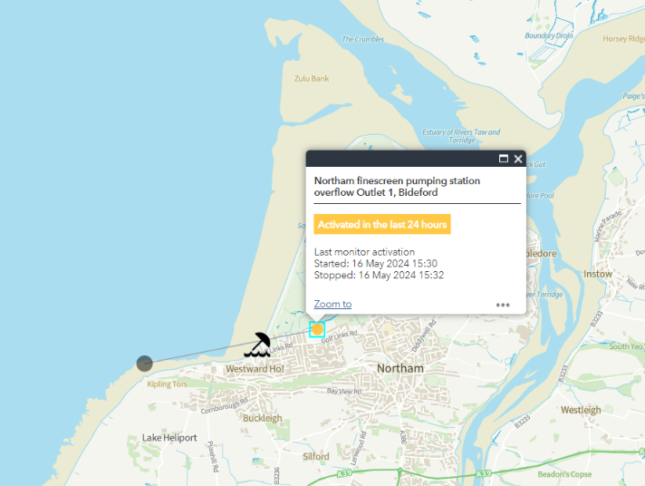
This evening a couple of sewage pollution “red flags” have popped up on the WaterFit Live map:


There’s been a multi-hour “spill” at Porthoustock, while Westward Ho! and Budleigh Salterton have been doing their 1-2 minute burst thing:

To be continued…
Regarding the ongoing events at Budleigh Salterton, South West Water inform me via XTwitter that: