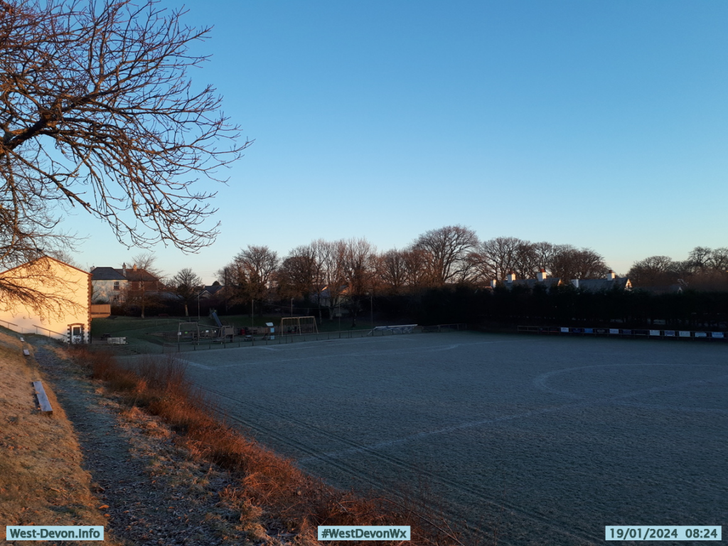
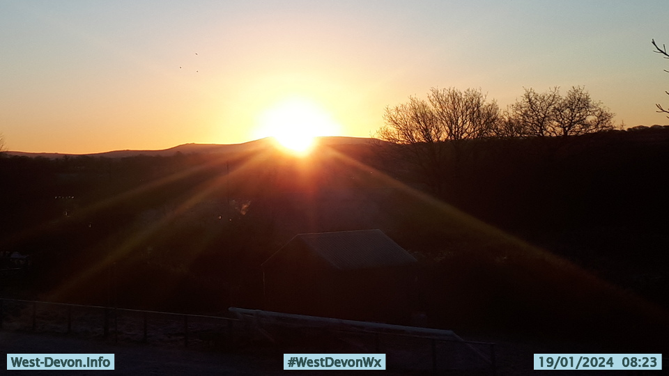
This morning dawned cold and clear once again, with another glorious sunrise:


However that is soon going to change, since later in the day the Met Office in Exeter announced in a press release that:
Storm Isha has been named by the Met Office, with strong winds for all from Sunday and heavy rain for some.
Cold Arctic air that has been dominating the UK in recent days is subsiding, replaced by an Atlantic influence which will bring a return to milder conditions, but also bring wet and windy weather across the UK on Sunday.
Amber and yellow severe weather warnings have been issued as Storm Isha approaches the UK on Sunday, in what will be a widely windy day for the UK. Many places are likely to see gusts of 50-60mph, even inland. Near coasts there will be widespread gusts of 60-70mph, possibly reaching 80 mph in a few places.
Chief Meteorologist, Dan Suri, said: “Storm Isha will bring strong winds to the whole of the UK through Sunday and into Monday. The areas of particular concern are reflected by a large Amber severe weather warning which covers Northern Ireland, central and southern Scotland, Wales, much of northern England as well as southwestern parts of England.
In these regions we could see gusts frequently between 50-60mph and even up to 80mph in exposed coastal locations.”
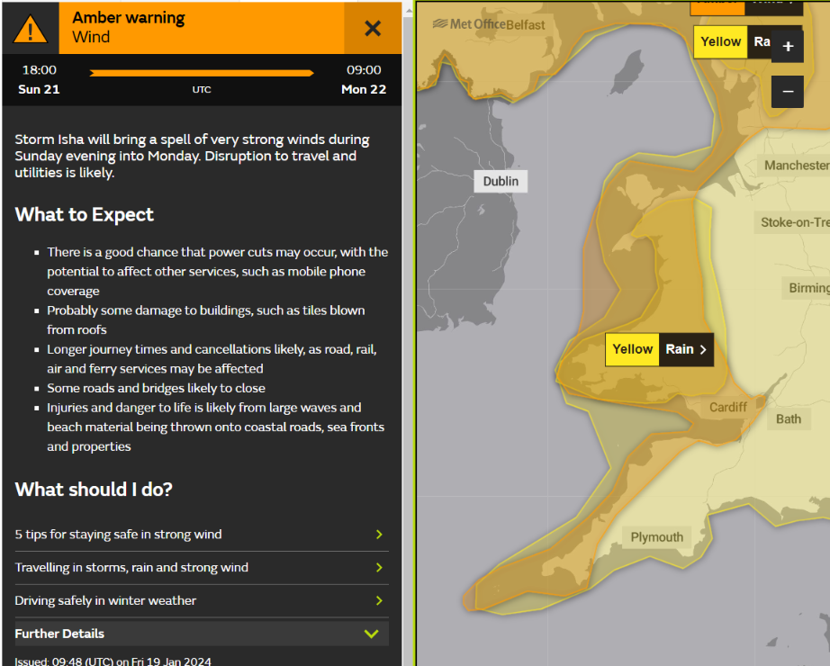
The yellow weather warning for heavy rain covers the whole of the South West, and the amber weather warning for strong winds includes the north coasts of both Devon and Cornwall.
The Met Office press release adds:
Warnings highlight the possibility of travel disruption, power cuts and dangerous conditions near the coast with high waves and flying debris. A spokesperson for Energy Networks Association, which represents Britain’s energy network operators, said: “An amber warning brings an increased risk of damage to homes and vital infrastructure. Energy network operators are preparing to deal with any damage quickly and safely.
Here is the Met Office’s current forecast for the highest wind gusts across the UK between now and Monday lunchtime:
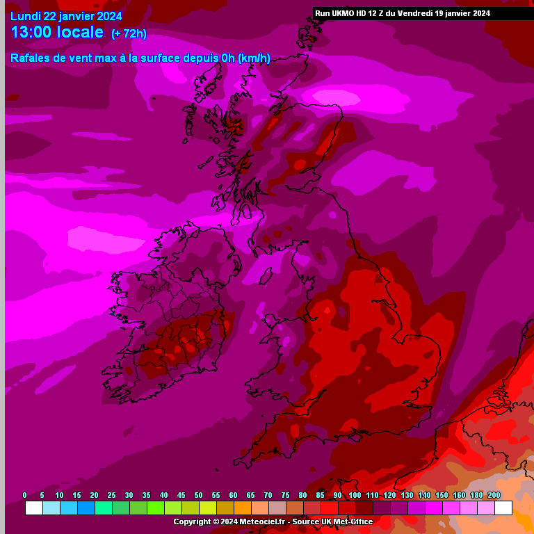
Note that the numbers above the legend are in km/h! Here too is the forecast for accumulated rainfall over the same period:
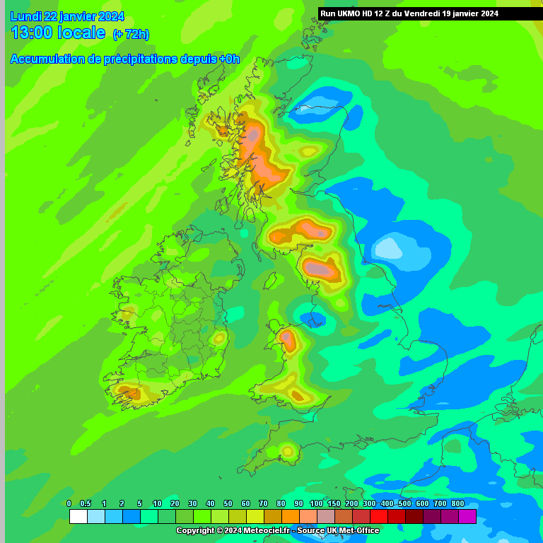
That shows between 1 and 2 inches of rain across Devon and Cornwall, with Dartmoor getting the worst of it.
[Update – January 20th]Here are a selection of today’s Met Office surface pressure charts for the next three days.
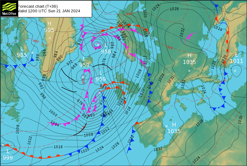
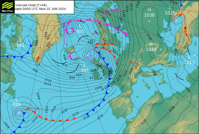
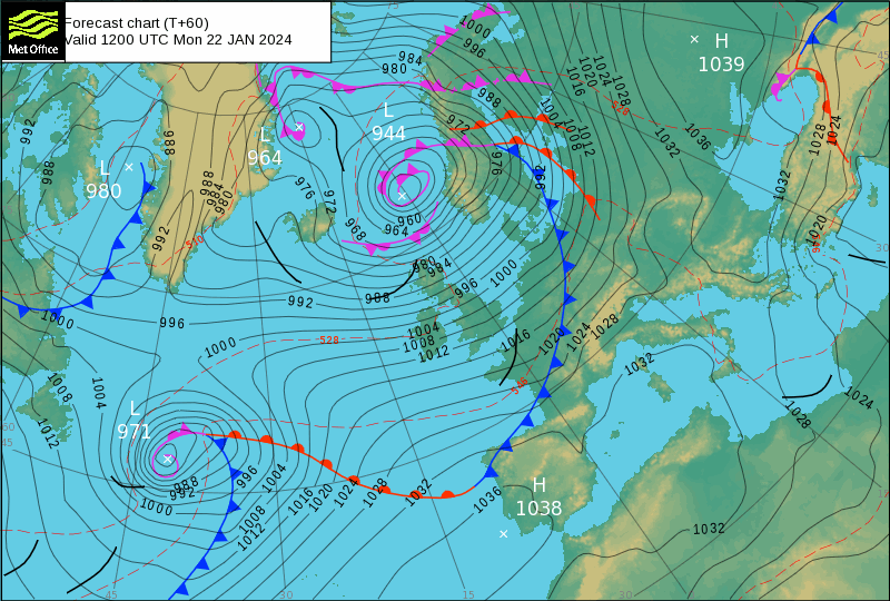
They show Storm Isha reaching a Mean Sea Level Pressure (MSLP) of 944 hPa north of Scotland by Monday lunchtime. By then there is also another storm heading our way from the other side of the North Atlantic!
[Update – January 21st]The Met Office’s amber wind warning for Storm Isha has been upgraded to include the whole of South West England:
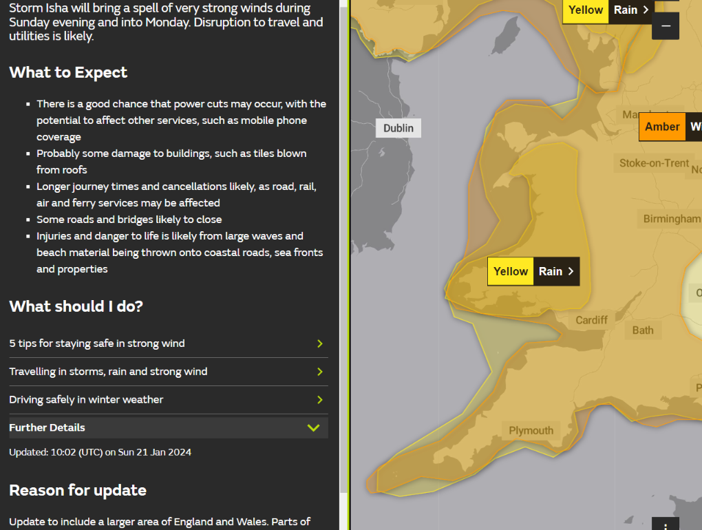
- There is a good chance that power cuts may occur, with the potential to affect other services, such as mobile phone coverage
- Probably some damage to buildings, such as tiles blown from roofs
- Longer journey times and cancellations likely, as road, rail, air and ferry services may be affected
- Some roads and bridges likely to close
- Injuries and danger to life is likely from large waves and beach material being thrown onto coastal roads, sea fronts and properties
To be continued…
This evening’s X update: